Roads of the Mid-South & West > Highways of the State of Arkansas > Interstate 30, Arkansas

Interstate 30 is a east-west highway in Central and Southwestern Arkansas. This highway starts in Little Rock and heads southwest toward Texarkana and Texas. There are several smaller metro areas along this route including Hope, Arkadelphia, Malvern, Benton, and Hot Springs, via U.S. Rt. 270.
While in Arkansas, I-30 is multi-plexed.
I-30 is multi-plexed with...
...U.S. Rt. 65, at Little Rock.
...U.S. Rt. 167, at Little Rock.
...U.S. Rt. 67, from Little Rock to near Benton.
...U.S. Rt. 70, from Little Rock to near Benton.
In Arkansas, Interstate 30 crosses the following interstates.
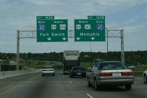
Interstate 40, at North Little Rock.

The first BGS on EB I-30.

A overhead sign on EB I-30.
EB I-30 near the I-40 split.
Interstate 630, at Little Rock.

The first BGS on EB I-30.

BGS on EB I-30.

EB I-30 at I-630.
Interstate 440, at Little Rock.
Interstate 530, at Little Rock.

WB I-30 near I-440/530.

Overhead sign on WB I-30.
Interstate 430, near Little Rock.

A guide marker on WB I-30.
Branches of I-30 in Arkansas.


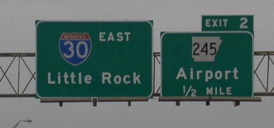
The first BGS on EB I-30 at the Texas/Arkansas State Line.

WB I-30 near the Texas State Line.

WB I-30 near Hope.

A set of guide markers on SB U.S. Rt. 270.

Junction marker on SB U.S. Rt. 270.

WB I-30 in a workzone near Little Rock. (Sept. 2003)

WB I-30 near a new overpass being constructed on the southwest side of Little Rock. (Sept. 2003)

WB I-30, west of the interchange with I-430.

HAZMAT warning sign on WB I-440.

EB I-30 at the stack interchange with I-630.

EB marker.

BGS on EB AR St Rt 10.

EB I-30 at the Arkansas River.

BGS on EB I-30 in North Little Rock. The I-40 shield is the control city.