Desierto de Atacama
Expedición
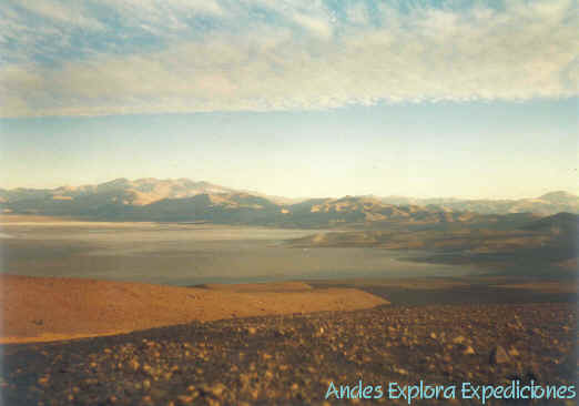
Volcán Ojos del Salado - Expedición
Nevado Tres Cruces
Volcán
Copiapó - Volcán Doña Inés
In the Atacama
Andean it stand out a solid mountain compound for a terrestrial relief of great span in
the beginning of the South American Altiplano that constitutes a great interest and
tourist attraction . . .
It´s the area with
bigger quantity of six thousand of the Chilean territory, fourteen mountains that surpass
the six thousand meters on the sea level, nevados and volcanos of amazing span and natural
attractiveness . . .
The established ones prevail in the such international
limit as the Nevado "San Francisco" ( 6.200 m/ 20.324 ft ), next to
the border step, toward the south and to about 15 kms the Nevado "Incahuasi" is
located ( 6.621 m/ 21.708 ft ), toward the west the Nevado "El Fraile" ( 6.061
m/ 19.872 ft ), it follows the Nevado "El Muerto ( 6.450 m/ 21.147 ft ) and then the
Nevado "Ojos del Salado" ( 6.893 m/ 22.600 ft ), which dominates the outlying
vision of the whole altiplanic environment that surrounds it, continuing toward the west
the Cerro "Solo" ( 6.213 m/ 22.370 ft ), and the Nevado "Tres Cruces"
( 6.753 m/ 22.140 ft ). The other six thounsand is located in national territory to both
sides of the international road in the proximities of "Murray" Camp ( 4.350 m/
14.262 ft ), which serves as center of operations and acclimatization place.

 
El Nevado Ojos del Salado are manifested reflecting an
imposing mountain located in an arid area and desertedly in Andes of Atacama on an
extensive plateau considered physically as the beginning of the South American
"Altiplano".
It is located in the
mountainous zone of Atacama, third region, to inside of the Copiapó city, Chile, in the
south end of one of the most arid deserts in the world, Atacama Desert, among those S 27º
06,45' y W 68º 32,629, surrounded of snowy of more than six thounsan meters of altitude,
the "Ojos del Salado" originate with their silhouette the most excellent summit
in whose Andean high landscape with 6.893 m.s.n.m., consenting him the
privilege of being the highest volcano in the world, the second
summit of America and the highest mountain of Chilean Andean.
The Snowy one
Possesses three summits on the six hundred thousand meters in the environment of the
volcanic complex, the north crater, the south and the west, the summit of the north or
main crater is that of more altitude ( 6.893 m/ 22.600 ft ), generally his crateric
fissure is covered with snow of moderate inclination. It descends gradually in east-west
direction their form in the higher part isn´t very defined, it possesses inside two
craterics hillsides, the east ( rocky formation of more volume in which summit is located
the Argentinean summit ), and the west ( great sharp turret, separated from the previous
one for the edge ( "canaleta" ), which harbors the Chilean summit ).
The Nevado Ojos del
Salado are of the volcanism Andesítico type, according to the emission
time the volcano would correspond to a recent, denominated Neovolcanism,
having carried out its main activity at the moment during the Plehistoceno-Holoceno
carries out a secondary volcanic activity, designated with the generic name of Fumarólic
. . .
TRIP ITINERATY 1: (VOS 01) 8 DAYS, 7 Nights
We meet during the morning in us office in Copiapó
to check the equipment and discut the Itinerary.
DAY 1: COPIAPO-LAGUNA SANTA ROSA
(3.650 m).
Begin the trip in the remind day, we`ll drive to
Laguna Santa Rosa a 3.650 m/11.500 ft. where set up camp. This Crystallin lagoon it´s
full of flamencos, who find refuge inside of the Maricunga salt flats.
DAY 2: LAGUNA SANTA ROSA-LAGUNA
VERDE (4.150 m.).
We will be here one day to do trekking in the Cerro
Mulas Muertas ( 5.800 m/ 19.016 ft ), and to be acclimatized to the altitude.
DAY 3: LAGUNA VERDE- REFUGIO
MURRAY (4.350 m).
We`ll trekking in the Cerro Barrancas Blncas and
ascend until the "farellones" to have a panoramic view of the area.
DAY 4: REFUGIO MURRAY-REFUGIO U.
DE ATACAMA
(CAMP 1 ).
We`ll drive to Universidad de Atacama Shelter to
5.200m/17.000 ft. where we will install camp 1.
DAY 5: CAMP 1- REFUGIO CESAR
TEJOS-CAMP 1.
We`ll acclimatize to the altitude while we walk
toward the Cesar Tejos Shelter to 5.750m/18.800 ft. and we will return to spend the night
in the Camp 1.
DAY 6: CAMP 1-CAMP 2 (REFUGIO
TEJOS).
We`ll ascend toward the "Tejos" shelter,
we will spend the night in the Camp 2.
DAY 7: CAMP 2-CUMBRE-CAMP 1.
We`ll climb toward the summit of Ojos del Salado
Volcano ( 6.893 m/22.600 ft ) in around 7 at 8 hours and we will return toward the Camp 2,
Camp 1.
DAY 8: CAMP 1 -COPIAPÓ.
We`ll travel toward Laguna verde, later on
a Copiapó to conclude the expedition.
TRIP ITINERATY 2: (VOS 02) 7 DAYS, 6 Nights
For Climbers who have had a previous escalade in
height ( 5000 m has more than enough ), it is probable that it can be a short period of
acclimatization, in this case, the itinerary could be:
During the morning we will know each other in
Copiapó to check the team and to fix the itinerary.
DAY 1 :
Copiapó-Laguna Verde (4.150 m) y/o Refugio Murray (4.350 m), making here two
acclimatization. days.
DAY 2 :
Aclimatization in Murray Shelter.
DAY 3 : We will drive from Murray Shelter toward the University of
Atacama Shelter (5.150 m)(BC);
DAY 4 : We`ll carry
some team from the BC until Cesar Tejos Refuge. We will return to the BC to spend the
night;
Day 5 : BC
until Tejos Shelter and spend the nigth.
Day 6 : Tejos Shelter
- Summit (6.893 m/ 22.600 ft)-Tejos S. - BC.
Day 7 : Universidad
de Atacama Shelter - Copiapó.
Go to Top of Page
 

El Nevado Tres Cruces find in the midle of the " Tres
Cruces" National Park whose importance resides in the existence, inside their limits,
of places of rest and refuge for a great number of species of birds and Andean fauna.
In this Park it´s
represented the Ecological Region denominated Steppe "Alto Andina" and the sub -
region of the Altiplano and of the Puna, the one that in turn would contain two vegetable
formations: The Desértic Steppe of the Andean Salt flats and the High Andean Desert of
the Ojos del Salado.
The Mountain have a
strong presence in the Area, product of the outlet of the River Lamas in this height
desert, constituted for Maricunga Salt Flat, and especially in the zone the Lagoon
Santa Rosa, place of Inca establishment. To obtain a privileged view from their
summit of 6.753 m.s.n.m. /22.140 ft is an excellent prize.
TRIP ITINERATY 1: (NTC 01) 7 DAYS, 6
Nights
During the morning
we will know each other in Copiapó to check the team and to fix the itinerary.
DAY 1: COPIAPÓ - LAGUNA
SANTA ROSA (3.650 m).
Begin the trip in the remind day, we`ll drive to Laguna
Santa Rosa a 3.650 m/11.500 ft. where set up camp. This Crystallin lagoon it´s full of
flamencos, who find refuge inside of the Maricunga salt flats.
DAY 2: LAGUNA SANTA
ROSA - TREKKING EN LA ZONA.
We´ll trekking in the area toward the Cerro Santa Rosa to
acclimatize us to the altitude and to obtain a panoramic view of this beautiful area.
DAY 3: LAGUNA SANTA ROSA
- CAMPAMENTO BASE (5.500 m).
We will drive in Vehicles 4 WD until the base of the Nevado
Tres Cruces until about 5.000 m/16.393 ft. for then to continue and install our base camp
BC ( 5.500 m / 18.032 ft ).
DAY 4: BC (5.500
m) - CAMPO ALTO (6.200 m).
We´ll ascend until the
"Collao" ( coliflor ) and install our High Camp CA (6.200
m/20.327 ft).
DAY 5: CA (6.200 m) -
CUMBRE (6.753 m) - CA.
From our High Camp after 6 at 8 hours of march will achieve
the Summit of the Nevado Tres Cruces ( 6.753 m / 22.140 ft ), we´ll back to spend the
night in our CA.
DAY 6: CA (6.200 m) - BC
(5.500 m) - LAGUNA VERDE (4.200 m) - COPIAPÓ (600 m).
We´ll walk down from the Collao
until the Base Camp ( 5.500 m / 22.140 ft ) and we´ll drive to Verde Lagoon ( 4.200
m/13.770 ft ). we´ll stay for the afternoon or over the night in this comfortable place
depending on that agreed previously.
DAY 7: LAGUNA VERDE -
COPIAPÓ.
We´ll back to Copiapó City, we will leave them in theirs
lodging or place that the client wants. This day it depends on that agreed previously.
Go to Top of Page


The "Copiapó" Volcano is located amid an arid
area, but that although arid, the Copiapó Valley has been enabled from the earliest times
because it is the first valley that has abundant water, grass, wood, and that it allowed a
wide agriculture after crossing 500 km of desert, from the North.
When the Inca
crossed the Copiapó Valley between 1470 and 1480, they already found it with livestock
and agriculture, they discovered that was a rich area in minerals deposit. They
established two Administration centers in the Copiapó Valley and mines worked in the
Region with an important mining center in "Viña del Cerro". The archaeological
investigations in the Region demonstrate that was of primary importance in the expansion
of the Inca Empire and was here where they consolidated bigger their authority.
The first current
knowledge, in their ascension to the "Copiapó" Volcano, was the Polish W.
Paryski and J. Szsepenski, they arrived to the summit at March 11 1937.
One of the more
important discoveries opposing was to the depth 131 cm. A statue of a woman's silver with
their complete dress in miniature and their garment for the hair, of feathers. Was buried
in a mixture of fine gravel and sand, with their face directly to the East. Was made in a
typical Inca style "Cuzqueño", similar statues have been in other places of
High summit;"Mercedario", "Las Tórtolas", "Gallán",
"Pichu Pichu", El Plomo", "Pili", "Llullaillaco".
To 164 cm of depth
was male's statuette made of "spondylus", with their gear in complete miniature
and a garment for the hair, their face directly to the E. they were 7 similar statuettes;
"Tarapacá", "Aconcagua", "Gallan", "Pili",
"Las Tórtolas". Was also a "Llama" statuette made
"spondylus".
The
"spondylus" shells were highly valued by the Inca ( warm water of the Ecuador,
outside of the "Humbolt" Current ), and the Inca believed that the
"spondylus" was the daughter of the ocean, the last origin of the water. For
that reason was indispensable in the rites to obtain rain. Their use in the
"llama" and male's statue has an association with fertility concepts.
The locations,
orientations and gear (hair of the statues was thought). the male's statue takes a hair of
black feathers, while that of the woman takes one of white feathers. The "llama"
was found among male's figures and woman guided to the East, and it is possible that with
the "llama" was likewise.
TRIP ITINERATY 1: (VC 01) 6 DAYS, 5 Nights
During the morning
we will know each other in Copiapó to check the team and to fix the itinerary.
DAY 1: COPIAPÓ -
LAGUNA SANTA ROSA (3.650 m/11.967 ft).
We`ll drive to Laguna Santa Rosa a 3.650 m/11.500 ft. where
set up camp. This Crystallin lagoon it´s full of flamencos, who find refuge inside of the
Maricunga salt flats.
DAY
2: ACLIMATATION IN LAGUNA SANTA ROSA.
We´ll trekking in the area toward the Cerro Santa Rosa to
acclimatize us to the altitude and to obtain a panoramic view of this beautiful area.
DAY 3:
SANTA ROSA - CAMPAMENTO BASE (4.200/ 13.770 ft).
We´ll go into in 4 WD Vehicles for the road that the Inca
traveled, in their Ritual procession toward the "Copiapó" Volcano (6.050 m /
19.836 ft), we´ll set up Base Camp, spending the night amid the Andean landscape.
DAY 4:
BASE CAMP - CAMPO ALTO (5.100
m/ 16.721 ft).
We´ll come closer until the base of the
"Copiapó" Volcano and we´ll install our Campo Alto CA, we´ll spend the night.
DAY 5: CAMPO ALTO - COPIAPÓ VOLCANO SUMMIT
( 6.050 m ) - CAMPO ALTO.
We´ll attack the "Copiapó" Volcano Summit (6.050
m / 19.836 ft), in around 6 at 8 hours. We´ll return to the Campo Alto to spend the
night.
DAY 6: CAMPO ALTO - COPIAPÓ ( 600 m/ 1.967 ft ).
We´ll back to the "Copiapó" City, being able to
go by Laguna San Francisco or Laguna Santa Rosa, previously agreed in our itinerary.
We´ll leave them in their hotel or residence place.
Go to Top of Page
  
The "Doña Inés", reaching the 5.070 m/16.623
ft., it´s the highest volcano near of Pedernales Salting, who together with the Atacama
Salting, they become the biggest in the Atacama Region.
In this area, the
Andes separate in two chains mountainous called Mountain range of Domeyko and Claudio Gay.
In any way, to climb it allows us to have a beautiful vision of the Region. From their
summit one can see the "Ojos del Salado" Volcano clearly (6.893 m), Pedernales
Salting and Incan rooms, vestiges of the Rites carried out in the Andean Region.
It´s not a
technical climb, being constituted a great mountain to be acclimatized to the height and
to see an interesting route: Inca Trail. Because this comes from San Pedro de Atacama
skirting when Atacama Salting and crossing toward Pedernales Salting, for finally to
arrive to the Copiapó Valley.
TRIP ITINERATY 1: (VDI 01) 3 DAYS, 2
Nights
During the morning we will know each other in
Copiapó to check the team and to fix the itinerary.
DAY 1: COPIAPÓ -
CAMPAMENTO BASE (4.300 m/14.098 ft).
We´ll drive to the Base Camp located in the
Pedernales Salt Flat base.
DAY 2: BC
(4.300 m/14.098 ft)- CUMBRE - BC.
We´ll climb until the summit of "Doña
Inés" (5.070 m/16.623 ft) in around 5 at 6 hours and then we´ll return toward the
B.C. Spending the night in the BC.
DAY 3: BC -
COPIAPÓ.
We´ll return us toward Copiapó for the east,
observing interesting geologic formations and carrying out eco-tourist pictures.
Go to Top of Page |

 Make on Expeditions