EARL and TENA'S RECUMBENT BIKE PAGE
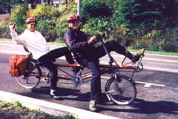
Click thumbnails to see pictures of our Rans Screamer.


Our Zzipper fairing fits on the Screamer, my Rans V-Rex and a Vision R-40. It takes only a minute or so to change it between bikes. Hose clamps and a few fittings made from aluminum tubing do the trick.
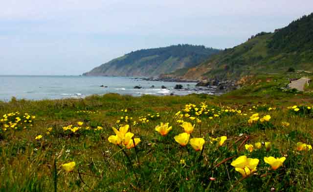
California Poppies at Westport Union State Beach
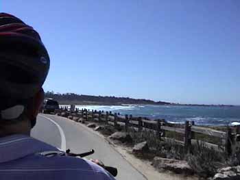
 Video California Coast bike ride, last section Muir Beach to Golden Gate.
Video coast bike ride from Pt Arena to Jenner along the rugged Mendocino coast.
Video N Cal coast ride from Leggett to Point Arena.
Video of our meeting with Johann who biked up from Tierra del Fuego.
Video of N Cal bike ride, the Redwoods, Eureka to Leggett.
Video first section of Cal Coast ride,Oregon border to Eureka.
Video first section of Cal Jenner to Bolinas Bay.
Video of Cal Coast ride, Stinson Beach to Muir Beach.
 Pictures from our California Coast Ride to San Francisco. First set
RVs and other monsters prowl the Oregon coast.
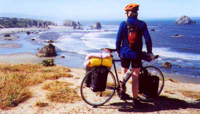
Pictures from my recumbent ride on the Oregon Coast.
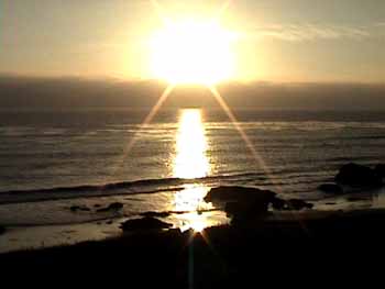
Sunset at San Simeon
Pictures from our ride on the Big Sur Coast.
More pictures from our ride on the Big Sur Coast.
Still more pictures from our ride on the Big Sur Coast.
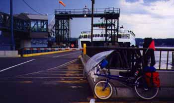
On the Washington coast trip ferries saved me a lot of miles of heavy traffic.
Pictures from my ride to the Washington Coast.
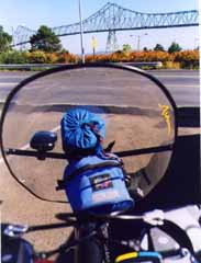
View from the cockpit of my V-Rex on the Oregon coast trip.The sleeping pad and tool kit obstructed my view of road hazards and were moved after hitting several chuck holes.
Is that a WEDGIE? Yep, Shawn still pounds his butt on one. Click the link below to see an ULTRA bike on the coast.
Pictures of coast ride to Santa Cruz, Ca. in 2000.

Kettle Valley RR trail. 18 trestles and 2 tunnels on this Canadian trail.
Pictures of Pictures of KVA RR trail ride.
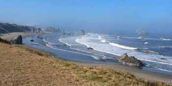
Bandon Beach, a highlight on our Oregon Coast Tour in 2002
Pictures From Our Tandem Recumbent Tour Of The Oregon Coast Bike Route 2002.
DIARY OF OUR RUCUMBENT RIDES
Starting a ride at Longbeach. Photo by my aunt Marie Outlaw2007, not as many bike rides this year. The highlights were rides on the Deschutes River in Eastern Oregon and along the Columbia on the Historic Gorge Scenic Highway.
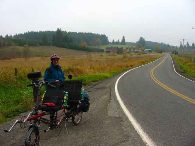
Oct 5, 2006, We take a short ride on the Olympic Discovery Trail from Robin Hill Park to Port Angele. It is cold, but views along the Strait of Juan de Fuca are a treat. We have a picnic in the sun at Port Angeles and a chance to warm up. 27 miles.
Oct 2, 2006, We got brave and rode a new route on the tandem. Started in Winlock and headed up the hill and northwest toward Lewis and Clark State Park, eventually reaching Onalaska where we had lunch and a potty stop. The roads are quiet, rural byways for the most part. A few short steep hills gave us a good work out on this 35.5 mile ride. We averaged only 10 mph, Max speed was 37. New gears work well for us, even on steep hills.
Sept 26, We rode the tandem to Chimacum from Port Ludlow. The new gear system and short cranks worked well for us. Had to replace it all when the 3x9 dual drive hub failed in Victoria. To get the low gears we need I had to go to mountain bike cranks. Also wanted shorter cranks which are hard to come by (165mm Captain and 160mm Stoker). DaVinci cranks had the goods. They are beautiful. This was the first real test and we are happy with them. The low gear is adequate and the short cranks are easier on the knees and allow a faster cadence.
Sept 12, we ride the tandem recumbent to Quilcene, a nice little 21 mile trip. Lots of fish were migrating up the Big Quilcene River. Enjoyed nice weather for an easy conditioning ride. July 29, we take the bike on the ferry to Seattle and ride to Alki Point and along the coast to Lincoln Park with lunch at the Alki Bakery. There is an arts and crafts fair at Alki and we spend an hour looking at the booths on our way back. This was a fun ride on a nice sunny weekend day.
July 20, 2006, We ride our tandem recumbent bike on the Olympic Discovery Trail. We have an new rear wheel sans 3X9 hub. This means our lowest gear is 30% higher than before. That's why we have chosen the relatively easy trail. Some short steep grades will give us an idea of how bad it is without the ultra low gear. We decide that lower gears are indeed needed. We will have to get new cranks with smaller chainrings to obtain lower gears. This is a nice ride and we go about 28 miles through Sequim, farmlands and deep woods in nice weather.
June 11-13, Visit Victoria, Canada by bike and ride the Galloping Goose Trail. We drive to Port Angeles, park the car and load up the bike with clothes and overnight gear. Bike riders board the ferry with foot passengers instead of on the car deck. The long ramps up to the deck have tight switchbacks that are a challenge to negotiate with our 8 foot long tandem recumbent, but we manage.
The voyage across the Strait of Juan de Fuca is dulled by dense fog. Just before reaching Vancouver Island the fog begins to clear and it is nice and sunny in Victoria. Our first destination is the Visitor center a short distance from the ferry terminal. We ride the streets in moderate traffic and do ok with the left turns at traffic signals. There are no maps of bike routes on Victoria streets, but we get a map of the Galloping Goose. We check into a condo on the waterfront and ride around the harbor and over the James St bridge to Spinnakers brew pub for dinner. It is a fine place and reasonably priced. The food is great.
Next day we ride downtown for breakfast at the Dutch Bakery, then head out on the Goose. It's a nice trail and we ride to Thetis Lake Park. Then down to 6 mile house for lunch. Return via Tillicum St and Gorge Rd. After a swim in the pool we ride to the Thrifty Mart to buy groceries, so we can fix our own dinner. It's steaks on the grill.
Next morning we walk to a restaurant for breakfast, then head out on the scenic drive along the Strait. We leave the shoreline drive for a climb up some hills to view picturesque gardens and quaint homes.
We have discovered that our 3X9 dual drive rear hub has suffered a breakdown. I try to adjust it and only make matters worse. I finally concede that it is cooked and resign to leaving it in low gear, so we can at least ride it.
Then head back to the scenic drive and out to Oak Bay. This is a pleasant old community with interesting shops and restaurants. We head for the touted White Heather Tea Room for an excellent lunch. This popular place is always crowded, but we are lucky and snag a table without waiting. After lunch we climb some easy hills for a look at local sights and lovely gardens. Then it's back to the condo to pick up the rest of our bags and down to the ferry for the trip back. The weather was lovely and so was the city.
June 7, Today we rode the Screamer from Miller-sylvania state park to the little town of Rainier. It's a nice easy ride with a few steep hills thrown in for variety. The sky was sunny and the weather cool for a nice ride. Not too many wildflowers, but we did see Sitka Columbine, Foxglove and Bleeding Heart. Took time to chat with other riders on the Chehalis Western Trail. 28 miles.
May 30, 2006, an "easy" bike ride. Steamboat Island turned out to have some short steep hills on the side roads of the return route. We got kind of burned on this easy ride. It was fun though.
May 10, We try a more difficult ride: Port Ludlow to Chimacum and return via West Valley Road. It's only 24.5 miles, but has lots of climbing, long and steep hills. We have lunch and pie at the Chimacome Cafe including delicious Raspberry-Rhubarb pie. We average only 8.5 mph, but are taking it easy to get back into shape.
May 4, We need a bike ride. An easy one. We choose Elma, McCleary, Malone, Porter loop. The weather is nice and we see a few wildflowers along the way. It's 37 miles and not too hilly. We average only about 9 mph, but we are out of shape.
Feb 12, So we got on the bike for the first time in 7 months yesterday. I thought we should do an easy ride of about 20 miles as we are not in shape and I'm still adjusting to my new seat (now it's a Rans lightweight). Tena says we can do more than that! I should have known better - I did know better - I went along anyway. We did the Black River ride, 31.5 miles with several short steep hills. At 1/3 through the ride I knew we should short cut it, but didn't bring it up. Too Bad. I was in severe pain and cramping by the time we finished, so I didn't really enjoy the fine weather like I should have. Still, I'm glad we finally had a ride and I'm getting the new seat dialed in.
July 30, 2005, We do a short bike ride on the Olympic Discovery Trail to test out a new seat. The seat didn't work very well, but it's a nice trail. Dale had recommended a Bacceta seat as being very comfortable and light, but its bendy shape doesn't fit the captain location on our screamer, so I can't get the tilt and peddle distance right.
JULY 7,2005, We return to Belfair for the Elfendahl Pass-Tahuya ride. Along Hood Canal we see an Osprey and Kingfishers. On the hill climbs Foxglove and Silvan Goatsbeard are blooming. At Menard Landing Park a lady is painting the benches. She is a volunteer working to save the park from short-sighted right wingers who want to sell the county owned property for tax revenue. We use this park for launching our canoe and for bicycle rest stops. We donate some money to help preserve the park. It is very popular and unique in that it has a launch ramp for hand carried boats. Good luck to those fighting to save this park.
June 29, 2005, Tena wants to do a strenuos ride to get in shape. Toledo - Toutle fills the bill. Rural valleys and forested ridges dominate this ride. We see lots of wildflowers and birds along the way and there are views of Mt St Helens and Rainier. From Toledo we ride country roads past farms and pastures, up and down hills for several miles. Then we climb a high ridge and enter the Toutle River valley. In a stump filled field next to a farmstead we laughed at a hand lettered sign that said, "FREE STUMPS, YOU PICK". We pass through Toutle and on to the Mt St Helens vistor center. More hills and a long descent bring us to the Toutle again. Another small ridge and we at riding along the Cowlitz River. Which brings us back to Toledo. 45+ miles, 1890 ft of elevation.
June 21, Winlock, L&C st pk ride. 28 miles. We find ourselves heading toward a thunder storm, complete with lightening and turn back early.
June 14, Bunker Creek bike ride. Same old Bunker Creek. That one hill has a grade that reaches 17%. No wonder it strains our legs and lungs. May 24, 2005, The Skookumchuck ride from Miller-Sylvania State Park to Tenino via Johnson Creek and the Skookumchuck River is our choice today. It's 39 miles with 1200 feet of climbing. Nice cool weather with sun and a little wind. We see Solomon Seal, Fringecup, Foxglove, Lupine, Columbine and a few Camus. We saw some hawks and lots of swallows, an eagle and a few vultures. It was a good ride, but we weren't as strong as we thought we were.
May 12, It's a nice Spring day, so we drive to Shaffer State Park on the Satsop River for a bike ride. The road to Buck's Prarie heads up a pretty valley with large over-arching Maple trees that are hung with green moss. The edge of the road is covered with Fringecup flowers and Bleeding hearts. We also see the twin flowered Solomon Seal and Foxgloves are begining to grow, but not blooming. The open meadows of the prairie are carpeted with blue Camas flowers. From Buck's Prairie we head over Highland Rd to the Shelton Matlock road. Here we have lots of log truck traffic, but there is a narrow shoulder. At Lake Nawatzel we stop at the fishing access for lunch and a chat with fishermen. It's another 7 miles to Matlock where we shop at the little store for snacks and to use the restroom. We expect to find lowland Beargrass in the fields on the last stretch of the route, but see only one small clump. Maybe we are a little early. The ride is 39+ miles and we average 10.7 mph. Not impressive, but we seem to be slowing down and are lucky to get that much speed.
05/05/05, It's the fifth day of the fifth month of the fifth year of the century and we decide to do something about it. A bike ride. It's been a while. We should have taken it easy, but decide on the Elma, McCleary, Malone, Porter, Oakville loop ride of 48 miles. Pollens are dragging us down, so we are lethargic at best. About half way through I start having pain in the groin and abdomen from a kidney stone. Luckily it is a small one and the pain isn't "the worst pain I ever felt" as many people say of kidney stones, but it was an ordeal to finish the ride. The upside is that we saw lots of Camus blooming - whole fields of it. There were Bleeding hearts and Fringecups too. Two large hawks spiraled up in a thermal as we passed under. We saw 3 Osprey nests; one with a bird on it and a guard nearby. An Osprey winged by one of the other nests. It was an ok ride, all considered, 48 miles, 10.5 mph, but I guess 05/05/05 is not our lucky number. We'll just stay home the next time it rolls around. April 4, We need a bike ride and this looks like the only day of the week with a chance of staying dry. We drive to Belfair State Park and ride the Tandem up Elfendahl Pass Rd and wind our way to Tahuya and Menard Landing near The Big Bend on Hood Canal. We see Trillium blooming and Salmonberry, Oregon Grape, Wild Current, Manzanita and Coltsfoot. We also saw some Hairy Woodpeckers, a Redtail Hawk, Grebes, Herons and a Hummingbird building a nest. The nest was well protected, though only a few feet from the road. It hung on a Blackberry Blackberry vine that drooped over the edge of a cut bank. It was almost impossible to see, but the Hummingbird caught Tena's eye as it flew to the nest. I tried to get a picture as it was only about 15 feet from us, but it was so tiny and hidden so well that it didn't show up in the photo. We got caught in a shower on the ride back, but by the time we stopped and put on our rain gear the downpour stopped. It was a 35 mile ride with 1,200 feet of elevation and we averaged a mere 10 mph.
March 24, We are both suffering from allergies, but the weather is decent and we need some exercise, so we choose an easy bike ride. Starting in Rochester we ride along the Black River to Gate, then Northward to Mima Mounds Natural Area. We see some Kestrels and Scrub Jays along the way. At Mima Mounds a few Buttercups and Trillium are blooming. Dense clouds and rain threaten from the South, but our only problem is a light headwind the leads us around all day. From Mima Mounds we continue North through Capitol Forest, then head South in the Black River valley. At Littlerock we stop for a snack. The last 8 miles are along the Black River with an increasing headwind. 31.5 miles total, 10 mph average speed. 950 ft of elevation, 36mph max. speed.
Feb 22, 2005, On the Port Ludlow to Chimacum ride we see large white birds in a field. They are not close enought to know for sure, but they seem larger than geese and appear to have long necks - Swans. At the Chimacum Cafe we have a nice lunch and I finish with hot out of the oven raspberry/rhubarb pie. Great. On the return ride we see a Fox cross the road and lope across a field. Later we see and Eagle and hear the cries of two. 24 miles +, 9 mph + average speed, 37 mph max.
Feb 10, 2005, Castle Rock/Longview loop is hilly, has some narrow roads with traffic and goes on busy city streets in two towns, but we haven't done it in 10 or 15 years (guess why) and we are desperate to find some sunshine on this cold, foggy winter day. It's a long drive to Castle Rock, but it's where we find some sun breaking through the fog. After checking out the museum (bathrooms) we move the car to their parking lot and load up. There is more to Castle Rock than we knew as we ride side streets towards the bridge over the Cowlitz River. Plenty of restaurants, shops, groceries and hardware and a nice riverfront trail. We wind our way to the Delameter Valley and enjoy a lovely farmland ride with light traffic. The air is sharp and cold in spite of the sunshine. At the head of the valley we climb over a steep hill (1.5 miles, 5, 6 and 7% grades). Then we drop down to Coal Creek and ride along this interesting river with small canyon and rapids. A stop at the Coal Creek Store for restroom and snacks, then on to Longview and Kelso. These town are traversed partly on side roads and partly in heavy traffic. We stop at the Cowlitz County Museum in Kelso for help finding the Pacific Hwy back to Castle Rock. The Museum Director rides to work on his bike and offers to show us the way. He's too fast for us, but we appreciate the help. Plenty of hills on the way back as the road goes alongside the Cowlitz and crosses the freeway back and forth. The last mile is on the Riverside Trail. It's 33.8 miles with 1,300 feet of elevation gain. Average speed is just 8.5 mph.
Feb 1, 2005, It's another nice day in the ski-less winter, so we are doing another bike ride. From Onalaska SE of Olympia we head for Cinebar on a gently climbing highway with light to moderate traffic. The countryside is farmland in the broad Shoestring Valley with wooded ridges on either side. We see several small hawks on the way, probably Kestrels or Prairie Falcans, also what was probably a Sharpshined. We have a glimpse of Mt St Helens too, but the best view of our active volcano comes several miles down the Cinebar road when we crest a hill and look into the crater with a small pume of smoke rising. We drop down a steep hill to Mayfield lake and cross a bridge to the State Park where we eat lunch at a sunny picnic table and use the restroom. It's a steep climb up from the lake and mostly uphill back to the highway, then we fly down the grade to Onalaska. There were aid cars at a 2 car wreck on the edge of town. People were not too seriously injured compared to the cars. Half a block from our car the fire department was cleaning up after putting out a fire that destroyed an RV and a car in a plastic and metal framed shelter. This was a 34 mile ride with a little over 1,000 ft of climing. We averaged 10.3 mph, max was 38.
Jan 25, This bike route goes from Winlock to Castle Rock and back. It would be about 43 miles if we did it all, but at a little over 17 miles we had to turn around in order to get back to the car before dark. We were hampered by several delays. It's a long drive to Winclock, we had a hard time finding a store with a battery for our bike computer and it took longer than it should have to install the battery and set up the computer. Oh well, we enjoyed it anyway. This farmland ride has lots of small hills and a few larger ones. There were lots of hawks and a few Eagles. We saw Cormorants and American Merganzers on a lake where we had lunch at the County Park. It was foggy most of the day and cool. In the afternoon drizzle started and briefly turned to rain. We'll try this again later in the year. The full loop route would be 43 miles with 1500 ft of elevation gain.
January 21, 2005, There is a break in the weather (rain, rain, rain), so we make a quick decision to do a bike ride. The fog is thick, so we head south in the car looking for a little clearing. We choose Rochester as the most likely place to start as other options seemed to be still fogged in. This is a 3 county ride: Lewis, Grays Harbor and Thurston. We start in sunshine, but the route heads toward the fog. Down to Independence Valley we are in for for about half an hour, then the sky clears. The Chehalis River is very high from all the rain and a crew is repairing a breach in the bank where the river runs close to the road. It is a beautiful rural valley with old farms and a few new houses. We see several hawks, Kestrels, a Merlin and Red Tails. At the head of the valley we turn up Garrard Creek Rd and over the ridge to Garrard Valley, another picturesque area. More farms and hawks, some cattle and lots of dogs. Soon we cross the Chehalis again and head into Oakville. At the Old Mill Cafe we have lunch and talk to the locals about the recent flooding. Click the link below to see how one kid took advantage of the flooding. They advise us to alter our route a little to avoid water over the roadway. On the return to Rochester we have nice views of Mt Rainier with fresh snow gleaming brightly in the sunshine. This was a very pleasant ride on 31.5 miles. We averaged a little over 10 mph with a max of 29 (held the speed down on the curvey decent due to wet pavement).
Pictures from Independence Valley/Garrard Creek ride.
December 28, 2004, It's a cold day, but sunny day and we need a bike ride. On the drive to Port Ludlow we pass from fog and low clouds to sunshine and blue skies. It is almost warm in the sunshine (mid 40s), but most of the route is shaded by trees and there is frost in the grass beside the road. We are dressed warmly and we need it, especially on the downhills where the wind chill bites. At Chimacum Cafe we have lunch and pie, the head back via the quiet, West Valley Road. A relief from the heavy traffic on most roads today. People must be on vacation as these roads are usually quite peaceful. It's only a 25 mile ride, but we haven't ridden for a month and we are out of shape, so our average is less than 10 mph. It was fun, glad we did it.
November 11, It has been a long time since we did the Lincoln Valley/Independence Valley ride, so we head South to Centralia. We start at Fort Borst Park and ride past the state game pheasant hatchery to Galvin and Lincoln Creek valley. It's a nice day with no wind, but kind of cold. At the head of the valley we ride over the steep ridge to Independence Valley. Soon we are riding beside the Chehalis River. We pass the turn off to Michigan Hill in order to go into Rochester to find a restaurant where we can get out of the cold and have something warm to drink. The only place we find is a little old drive-in with a small dining area. It works though and we are warmed up when we return to the ride. It's back to the Michigan Hill road and up Lundeen road to the top of the hill; very steep and we have to get off and walk the bike for a short way. The top of Michigan Hill is a nice long ridge ride. Then we descend to the Chehalis River and head back to Centralia on old highway 99. The ride was 39.4 miles. We averaged 10.29 mph and our maximum speed was 40.5 going down the hill into Independence valley.
In Lincoln Valley
November 4, We rode the Screamer on a loop through Elma McCleary, Malone and Porter. At Porter we went into the little store/restaurant and were pleasantly surprised by the Asian decore of the small cafe. We had coffee and tea and some sweets. 50 cents for coffee. It was very cold (34 degrees at the start). In McCleary we stopped at the Subway for sandwiches. It was so hot in there we were uncomfortable after the cold ride. A local guy came in to talk about bike riding for a few minutes. Later another local dropped in to talk cycling - it must be a bike-friendly town. We rode 31.6 miles at 11 mph average speed.
Oct 27, From Miller-Sylvania State Park we rode the Screamer to Rainier, Wa. It was a cool day, but mostly sunny. After lunch and ice cream in Rainier we went West to MacIntosh lake and back to the park. It was 33 miles and we averaged 10.6 mph. Nice ride. On the a log restroom built by the CCC in the '30s we saw this big moth
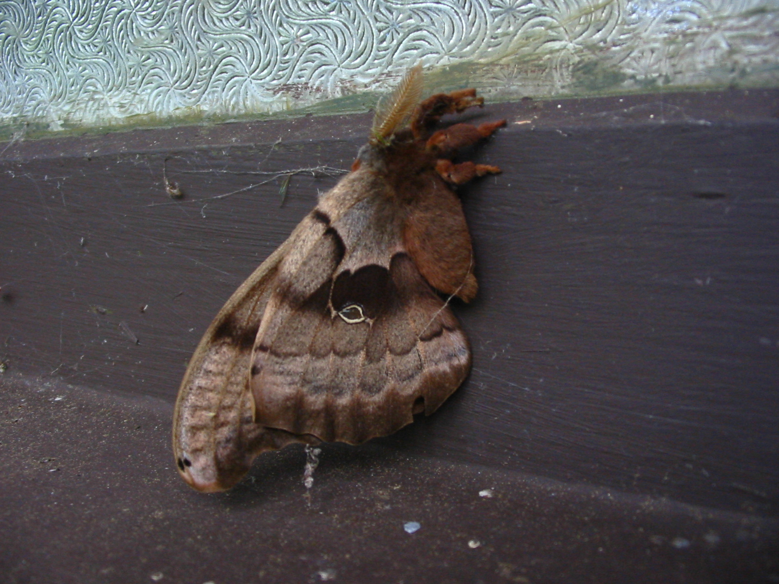
large moth, about 3 inches longOct 3, We rode the Screamer from Belfair State Park to Tahuya and Menard Landing. 35 miles, 10.2 ave speed, 38 max. Beautiful warm fall day. Saw lots of Loons on Hood Canal. A few Rhododendrons were re-blooming after the draught and recent rain. Part of the road was closed due to a dangerous washout, but we found we could get by with the bike.
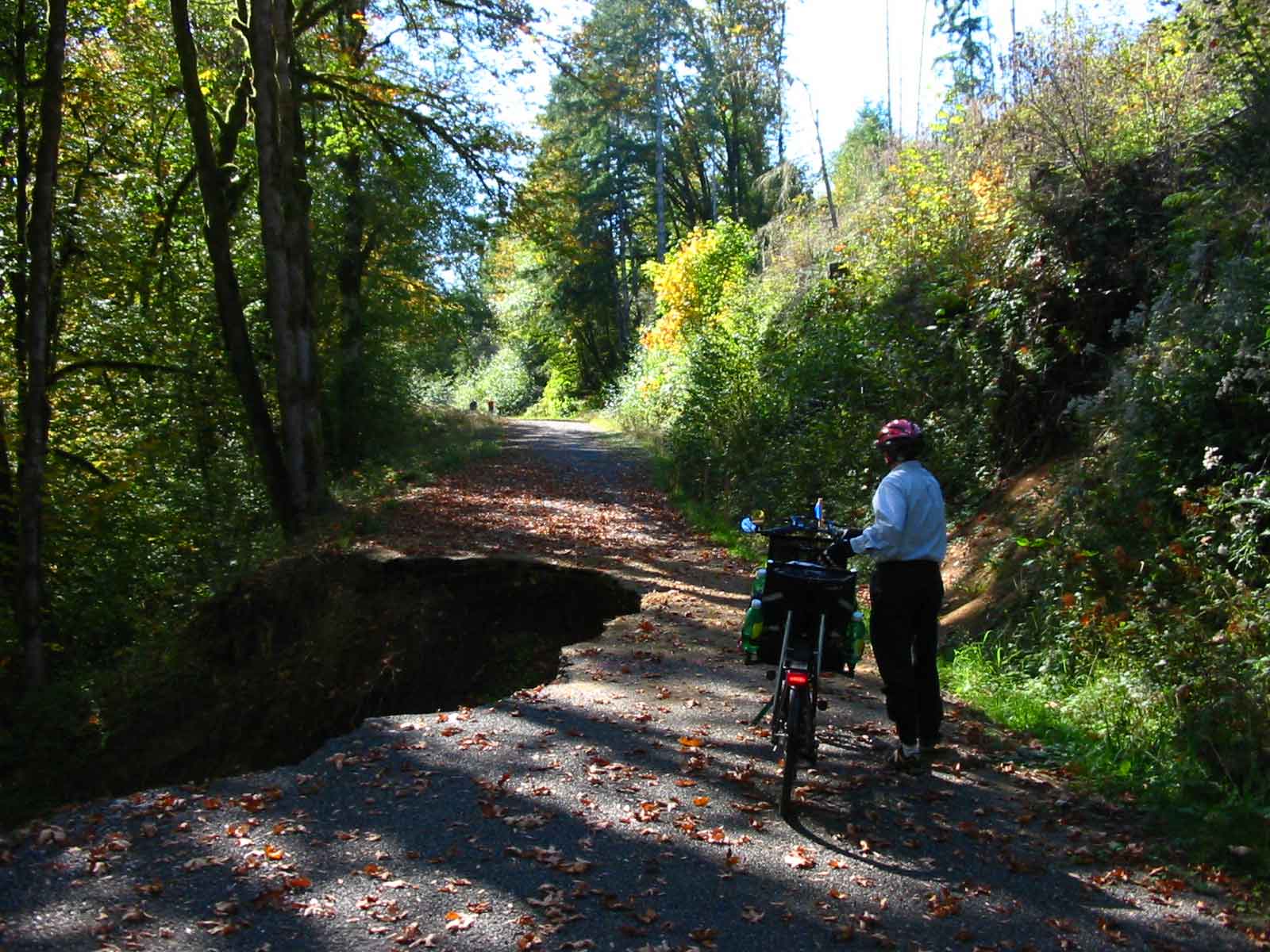
The slide dropped very steeply to the river far below
Oct 14, 2004, The Chehalis to Lewis and Clark State Park ride is one we haven't done for several years. It's 36 miles of mostly easy riding in the Neawakum River Valley. The rural route takes us past many pretty flower gardens at well kept homes. We see a Northern Harrier and hear a Redtailed Hawk. We see lots of Flickers too. We stop in Napavine for a piece of Grandma's home made pie. This is a busy little town with a lot of traffic. We have a head wind for more than half of the ride, but average 10.1 mph.
Oct 3, We rode the Screamer from Belfair State Park to Tahuya and Menard Landing. 35 miles, 10.2 ave speed, 38 max. Beautiful warm fall day. Saw lots of Loons on Hood Canal. A few Rhododendrons were re-blooming after the draught and recent rain.
Sept 1, We transport the bike to Miller-Sylvania State Park for a ride, but road construction interfers, so we detour to Tenino and do the Skookumchuck ride in reverse, except we don't go to M-S park. 30.5 miles, 11 mph.
August 27, 2004, We take an easy bike ride to Chimacum and have lunch and homemade pie at the Chimacum Cafe. 24 miles, 1200 ft, ll mph.
Aug 12, It's going to be a scorcher in Western Washington. Tena's knee and foot have not recovered from the hike to Summerland, so we decide to do a bike ride instead of another hike. Sequim, on the Strait of Juan de Fuca is supposed to have a high of only 79 degrees, so that is where we go. The Olympic Discovery Trail is completed from Sequim to Port Angeles and we have not ridden some of the middle part, so this is our route. Most of the trail is on dedicated pathways and most is paved. Parts of the route are on city streets and some of the trail is on gravel. We pass through 3 parks on the way and there are sani-cans and picnic tables in places too. Three large RR trestles are crossed as well as lesser trail bridges where you drop steeply down to the stream and climb steeply back up. The hills are all short, but many are very steep and we have to walk the bike up a few of them. We rode as far as the public warf in Port Angeles. It was 23.3 miles one way. We averaged less than 9 mph. It was foggy on the water and a steady wind blew all day, so it never warmed to anything like 79 degrees. It felt more like 59 in PA. In Port Angeles we ate lunch and got ice cream at the Dairy Queen. It was an interesting ride, but we were beat by the time it was over.
Aug ?, We decide to do the strenuous Adna/Vader ride, even though it has been a while since we have been on the bike. This is a 47 mile ride with some long steep hills. There is mist in the air as we start in Adna and it comes and goes all day, sometimes increasing to a light rain and even a harder rain for a few minutes when we get to Winlock, 3/4 of the way through the route. There is a tough hill at about the 1/2 way point that always seems harder than it looks. It turns out to have a 10% grade - hard indeed! The 10% grade sign is at the top of the hill, but faces away from us as we climb, so we hadn't noticed it before. On the long descent we hit 46.5 mph, our top speed. At Vader we stopped at the cafe for a snack. In Winlock we used the bathroom at the Senior Center and got candy at the convenience store. There is a long steep hill out of Winlock as the Tennessee Road climbs toward Pleasant Valley. This hill goes up in steps and the last one is very steep indeed. I tried to shift too fast and lost the chain. We put it back and started up again in the middle of the steep part. We averaged 10.8 mph for the ride.
July 27, We ride the Screamer from Belfair State Park on Hood Canal up Elfendahl Pass Road, to Seven Devels hills, down the the Canal and on to Menard landing. After lunch in the shade of the gazebo and a walk to the beach we face the near 90 degree heat again and ride the last 15 miles back to the park. It was a 34 mile ride with about 1,200 feet of climbing and we averaged 10.5 mph with a max of 37 mph.
July 13, It's been a long time since we have ridden the Sequim loop route. We start at the Marina in calm sunny weather. Up a long easy hill, then down to sea level and up a short steep steeeep hill. Soon we are riding along the Strait of Juan de Fuca; then back inland. We cross the Dungeness river, then along Dungeness bay on a high bluff. After a visit to Dungeness Spit Park the route takes us East of hwy 101 and through farmland. Soon we find the old railroad trail and cross the river again on a long old RR bridge. The Audubon Center in the bridge park has an impressive collection of stuffed birds and mammals. The day has turned hot and windy. The trail picks up on the South side of town and crosses another interesting trestle, 210 feet long and 87 feet high. It's a 35 mile ride and we average only 9 mph.
June 30. It's been too long since we've ridden the bike. We drive to Centralia and head out for Claquato, Adna, Bunker Creek and Lincoln Creek. It's a nice ride, not too strenuous, with one longish, steep climb. Wildflowers are mostly Foxglove and Daiseys. A few Columbine show themselves. We see a small hawk and some Scrub Jays. Nice ride at 38.3 miles with a 10.8 mph average.
June 10, 2004, The ride from Shaffer State Park, to Buck Prairie, to Lake Nahwatzle, to Matlock, to Shaffer is 40 miles with about 1,000 ft of elevation gained. We had a 10 mph and upwards headwind for about 2/3 of the way. Wildflowers were blooming, Foxglove, Columbine etc. We got a few sprinkles, but didn't get wet. It was a nice ride and we averaged 10.7 mph in spite of the wind.
May 25, 2004, 47 miles and 2000 feet of elevation: that's the Toledo - Toutle ride near Mt St Helens. We average 9.7 mph which is slow, even for us. We just can't get the bike moving and I think it is the heavier and wider tires and heavy front tube. It's pathetic that we can't get the average over 10 mph on any long ride. Well, before conceding that we are out of shape, I'm going to try a lighter front tire with less rolling resistance. This was a good ride though. We saw lots of wildflowers and birds. Mt Saint Helens showed from all the hill tops. We had a view of Goat Rocks and a glimpse of Mt Rainier. It was sunny and warm to begin with. Later clouds came in and it cooled off. Finally it started to sprinkle and then to rain as we ended the ride. The drive home was in a downpour.
May 20, The Onalaska ride starts at Lewis and Clark State Park with an easy climb. The hills get steeper and longer as the ride climbs over ridges to green valleys, then descends to the Cowlitz River and finally climbs to the Cowlitz Plateau where the hills are steep, but not so long. We see Columbine, Lupine, Camas, Solomon Seal, Fairy Bells and lots of wild Iris. We also see some Scrub Jays and several Ospreys and their nests. This is a 40 mile ride and quite strenuous for us. I left the computers home after readjusting them, so I don't know our average speed. Nice ride in cool, but comfortable weather.
At the little store in Onalaska
May 17, 2004, We are in Leavenworth, the Bavarian Capitol of the Cascade Mountains enjoying a few days with my mother and aunt. Leavenworth is on one of our favorite rides, so of course we have our bike along. However, in the morning it is raining hard. We expect it to clear by 9:30 or 10, but no luck, so we go for a drive up Icicle Canyon with mom and Marie and find lot of wildflowers blooming, Paintbrush, Lupine, Penstimon, Delphinium and others. By 12 am the rain has turned to light showers, so Tena and I get on the bike and head up Chumstick Canyon Road toward Lake Wenatchee. It is cool and we have the occasional light shower, but we don't get seriously wet. Wildflowers are blooming here too. We see Solomon Seal, Scarlet Gilia and Mariposa Lilies. We also see Ospreys, Redtailed Hawk and a couple of Blackheaded Grossbeaks. At Highway 2 we hit a headwind, but not too strong. We reach Leavenworth in sunshine after a scenic ride down Tumwater Canyon with its cliffs, waterfalls and raging Wenatchee river. It was 39 miles with about 1,700 feet of elevation gained. We averaged over 10 mph.
May 13, We need a longer ride to get in shape for our California trip, so we head for Elma and ride to McCleary and Oakville. It's 48 miles with a few easy hills. We have a headwind on the way back that develops into real challenge. We are tired before it is over. We saw fields of wild Camas and lots of bleeding hearts. The average was 10.5 mph, that's somewhat better. I think the computer needs to be adjusted for our new tire.
May 6, we ride from Miller-Sylvania State Park to Rainier. Tena is not feeling well, so we cut the ride short. Nice weather and fields of Camas are seen blooming along the way. 33 miles, 9.6 average.
May 2, The Belfair - Tahuya ride should help get us in shape. We are still not in condition as we should be and average only 9.8 mph.It's a good ride though with cool, clear weather. We see False Solomonseal, Bleeding heart and Beargrass blooming along the way. Part of the Tahuya River Rd is closed and the detour shortens the ride by about 2 miles.
April 28, 2004, Wildflowers are blooming and we are out of shape for bike riding. The Black River ride will give us a good workout and the promise of Camas and other wildflowers along the way will be the incentive. The weather is perfect, except for a moderate headwind on the last half of the ride. Wildflowers lighting the way are Camas, Bleeding Heart, False Solomonseal, Columbine and Buttercups. At Mima Mounds we see a Chocolate Lily and Violets. 30 miles. Our average is only 9.7. Blame it on headwind, wider tires and out of shape.
April 13, 2004, The Chimacum ride from Port Ludlow goes a little slow. I don't know if it is because we are out of shape from our winter lay over or is it the new wider tires on the bike? Our coasting speed seems a little slow. 25 miles, Average speed 9 mph.
April 9, We did a bike ride on the Historic Columbia Gorge Highway. We rode from The Dalles Oregon to Rowena Crest and Memaloose Overlook. The old highway is one of the most scenic in the world. The Rowena Loops wind up between basalt cliffs to a promontory with a magnificent view of the River and Gorge. The hills are green this time of year and wildflowers are profuse. For pictures click HERE.
April 5, 2004, We do the Quilcene ride on the Olympic Penninsula. Just 20 miles and no significant hills, but it's our first real ride in many months and we enjoy it and feel the work in our legs.
April 2 we tried out our modified tandem recumbent. It has been cut apart with couplers added, so it can be taken apart for shipping. It now has disc brakes front and back. Rode it to Point White from the house for a test run. Needed some adjustments.
Oct 26 - 27, 2003, From Longbeach we drive South to Newport, Or. to see the aquarium and enjoy a bike ride up the Yaquina River. The aquarium is fabulous. The Sea Dragons and small colorful fish are fascinating. We spend 2 hours admiring the displays. On Monday we ride from Old Town Newport to Elk City. It's 48 miles of easy scenic riding along Yaquina bay and River. We see lots of Herons, Egrets, Cormorants, Kingfishers, gulls and ducks. We even see a couple of River Otters. We have lunch at the Canyon Quarry County Park and get back to Newport at 4pm. A very enjoyable ride. BR>
Oct 13, 2003, It looks like rain all week except today, so we put the bike on the car and head for Elma. It is cloudy and threatens rain all day, but we only get a light sprinkle. The ride goes to McCleary, Malone, Porter, Oakville (lunch at Jag's) and back to Elma. 47.7 miles and less than 1,000 ft of elevation. We average 11.4 mph. We needed the exercise to keep our weight down.
Sept 22 - 25, 2003, On my 65th birthday we head for Oregon and the Columbia River Gorge for some bike rides on the Historic Columbia Gorge Highway. Tuesday we ride from Troutdale to Multnomah Falls and back on the old highway. It's 19 miles with about 900 ft of elevation each way. We see waterfalls, historic bridges, views of the gorge, cliffs, mountains, the river. The old stonework guard rails are moss covered gardens. On Wednesday we ride a restored portion of the historic highway reserved for bikes and pedestrians only. At Tooth Rock we are over the freeway tunnel on roadway cut into the steep cliff or supported on via duct. A long, steep set of stairs stops us. Our 8 foot long tandem can't clear the edge where the stairs drop at each of 5 or 6 landing. We turn around and head back to Bonneville Dam and the Moffett Creek Trail. Then drive to Eagl Creek and continue on the bike path to Cascade Locks.
Pictures from our rides on the Historic Columbia Gorge Highway.
Sept 15, We repeat the Skookumchuck bike ride. The rail trail that the route crosses has been extended another 2+ miles to connect with the Rainier-Yelm trail and we ride on part of this. It takes us past a Sculpture garden where we tour the grounds and talk to Tom Yoda, a wood carver. There are many very nice pieces on display and some really funky ones. The route continues past McIntosh Lake to Johnson Creek Rd and past the winery to the Skookumchuck River. Then we head for Tenino and back to our car at Miller-Sylania State Park. Nice ride, about 37 miles, 1100 ft of elevation, 10.5 mph ave.
Sept 4, The Lake Quinault loop ride, one of our favorites, turns out to be a bust. First, a few miles of the dirt surface part of the North Shore road was being graded and had soft gravel instead of a hard surface. We had to walk several short stretches. Second, the dirst section of the South Shore road was extremely rough with washboards and our idler chain kept coming off. We had to stop several times to replace it. This shouldn't happen, but I can't get the tension adjusted right. Rans needs to address this problem because I know others are having it too from email I have received. Dale at Angle Lake Cyclery doesn't know how to fix it either. The Lake Quinault loop is 30 miles with about 1,000 ft of climbing.
Aug 21, I want an easy bike ride, like Elma, McCleary, Oakville; Tena says we can do a harder ride. I cave in and we choose Adna, Curtis, Vader, Winlock - via the steep Curtis Hill Rd yet. Expecting 80 degree weather (our upper limit for a tough ride temp wise) we find ourselves wilting in 90 degree heat. We consume 7 litres of water and soda on the ride and we are beat at the end. 46 miles, ave just over 10 mph, around 1700 feet of climbing. I need a rest.
Aug 13, since we are in Centralia after our rare seed gathering, and have our bike with us as well as canoe, we will do a local bike ride. We try something new, Rainier to head of Deschutes Valley. It turns out most of our route would be on a private logging road that is closed due to fire danger, so we ride to Lawrence Lake and back to Rainier. Short ride, 18.8 miles. It's nice to take it easy for once.
Aug 3, 2003, We haven't ridden our bike since I fell and hurt my butt. My tail bone still hurts and the right cheek is still tender, but we are itching for a ride. The Wishkah/Wynoochie ride would be easy, but we think it over and settle on the tougher Toledo/Toutle ride. My sore butt soon tells me this was not the best choice, but a little pain killer helps me get through. Its a beautiful day, cool and sunny. We see several Osprey on nests and hovering above the Cowlitz River, looking for fish. We also see Scrub Jays and small hawks like Kestrels or Prairie Falscons. The wildflowers are mostly gone, but we see some Foxglove and a few others. The route takes us from Toledo on the Toutle River up a couple of rural valleys, over a ridge or two and back to the Toutle at the town of Toutle. Then we proceed down the valley to Silver Lake the the Mt. St. Helens visitor center. Side roads get us most of the way down to the lower Toutle R and over to the Cowlitz. It's a 46 mile ride with over 1,500 ft of elevation gained.
July 17, Strenuous describes the ride from Adna to Winlock and Lewis and Clark State Park. Curtis Hill is very steep and kinda long, but the King Road goes over a steep hill that is even longer. King Rd has banked curves that have to help the cars stay on the road, but our bike slips sideways on the loose gravel, so we get off and walk these banked curves. However, we didn�t get off soon enough on two of them. I got a heck of a bruise on my butt on the second fall. It made the rest of the ride painful. Ibuprofen helped. Fortunately the rest of the ride was easier and we rode back to the car instead of hitching a ride with someone. We did cut out the loop from Winlock to the state park though. We climbed 1980 feet, traveled 32 miles and had a maximum speed of 46.2 mph (a record for us, I believe). Don�t know if we�ll try this ride again.
July 2, Castle Rock - Toutle. We've avoided this ride for a long time because of the strenuous hills, the first one climbs 1000 ft. The ride ends with several very steep grades. We needed to stop and rest on the last 3 steep ones in order to make it to the top. Beautiful scenery, lovely countryside, views of Mt St Helens and Mt Rainier, Silver Lake, Toutle and Cowlitz Rivers. 37 miles, 9.5 mph average speed, 42 mph maximum speed, 2440 feet of elevation gained. We saw lots of Foxglove and Ocean Spray, Fireweed, a variety of flox and other flowers. Also saw a Pileated Woodpecker, Osprey, Eagle, GB Heron and Goldfinch. We were tired by the end. Treated to a good dinner at a nice little roadside restaurant on Jackson Highway.
June 25, to stay in shape after our big ride on the coast we decide on a strenuous ride. Dewatto loop via Elfendahl Pass fills the bill. It is going to be a hot day, 80 degrees, so we dress light. The first hill climbs 300 ft in 1/2 mile, then keeps climbing to 500 ft. We see lots of Foxglove, Ocean Spray and Sylvan Goatsbeard. We also see a Hairy Woodpecker and a Downy Woodpecker. About 3/4 of the way into the ride I begin to fade from the heat and all the hills. It�s a 39 mile ride with 2160 ft of elevation. We average 9.7 mph with a maximum of 40. On one of the steep descents we hit a rock in a curve, but managed to recover without going over - good thing too.
BR>
June 18, A bike ride on the Olympic Penninsula between Quilcene and Chimacum. We see Cedar Waxwings in Alders beside the road and lots of wildflowers. The Foxglove is blooming and Oceanspray is coming out. We also see Horsenettle and Twinflower and Solomonseal. This is a 32 mile ride with 1600 ft of climbing, mostly on the Center Rd. We average 10.6 mph with a 39 mph max. A nice ride in cool weather with lunch and pie at the Chimacum Cafe.
June 10, Bunker Creek and Lincoln Creek valleys call us for an easy ride. We start in Centralia and ride in traffic for a mile or so to Schauber Rd, then it's rural rolling roadway for several miles to Bunker Creek. We see lots of wildflowers, Bug Bain, Columbine, Solomon Seal, Goatsbeard and Foxglove, and birds a Kestrel, Redtail Hawk, Osprey, Scrub Jay and lots of Goldfinches. It's 38.4 miles, only 890 ft of climbing, we average ll.4 mph. Nice weather for a good ride.
June 3, 2003, We want to stay in shape, so we take the bike to Schaffer State Park near Elma and do the Highland Rd loop. The skies are sunny and the temperature is just right. We see a few wildflowers, Fringecup, Foxglove etc, but not many. We have slight headwinds for most of the ride, but still average 11.6 mph. Elevation gained was 1,170 ft. Nice ride.
May 29, We ride the Belfair - Tahuya route to see if we are still in shape after 11 days of sitting around. It seems we are in pretty good shape yet, but have already lost our edge. The hills are easier on this route now, but our average isn't any record.
May 5 - 19, 2003, We toured the Northern California coast on our Tandem Recumbent, riding from Brookings, Oregon to San Francisco. Cool weather greeted us and the constant threat of rain, so after three days of not using our camping gear we shipped it home and settled for Yuppie camping (hotels and restaurants). The coast has spectacular scenery in N Cal, especially when the wind is pumping up the waves. The Redwoods are magnificent and awsome to visit on a recumbent as you sit back and gaze up at their towering height from your comfortable chair while slowly and respectfully passing through this forest cathedral. Traveling ing May we had light traffic except in the cities. The weather was cool with one day of rain (downpour). We followed hwy 101 to Leggett using side roads whenever possible as shown in Adventure Travel Maps and BICYCLING THE PACIFIC COAST. From Leggett to San Fran we followed Hwy 1 and or side roads except that at Jenner we detoured to Occidental to avoid weekend traffic on the narrow road to Bodega Bay. We missed a scenic piece of the coast, but the trip to Occidental was fun too, so was the town and so was the ride to Valley Ford the next day. In fact, having done it both ways, I'm hard pressed to decide which is best. Most bike riders leave Hwy 1 at Olema and take the urban route into Sausalito. I hated this route while I found Hwy 1 through Stinson Beach and Muir Beach to be very pleasant. This route would probably be too busy on a weekend and you need to get an early start to avoid heavy traffic on the narrow, steep and curvey road.
May 1, More conditioning is needed, but my legs are still sore from cramping on the Onalaska ride. We choose the Skookumchuck which is only 41 miles and 1,100 feet of elevation. Good choice. We see Trillium and Bleeding heart and whole fields of Camas. At one place a whole meadow was bright blue with Camas. Tena saw a Western Bluebird and we saw a Scrub Jay as well as Ospreys and a couple of common Mergansers. 41 miles, 11 mph average. Nice ride.
April 27, 2003, We want a conditioning ride for our upcoming tour of the N. California coast, so we head South for the Onalaska ride. It's 44 miles with over 1,500 feet of climbing. The weather is perfect as we head out from Lewis and Clark State Park and head over a small ridge to the Neawakum River Valley. We see lots of birds and wildflowers along the river. After climbing a big ridge we drop into Onalaska. Fred's restaurant is closed for repairs, so we eat our lunch at the little general store. Another steep climb and fast descent and we are in Salkum in the Cowlitz River valley. The remaining hills are short, but steep and my legs cramp up on them. We average 9.9 mph.
April 15, 2003, We ride the Black River loop near Olympia. It's a cloudy day with showers all around us, but only a few sprinkles hit us until the end of the ride. Started at the North end to have a tailwind on the home stretch. Saw a Scrub Jay. Heard a Pheasant and a Quail. Saw many varieties of wildflowers, but not a huge number. There were Bleeding Hearts, Camas, Avalanche or Fawn Lily, Trillium, Coltsfoot and others growing beside the road and at the Mima Mounds park. 31.5 miles, 950 ft, Ave speed 11.6 mph. Good ride.
April 8, We need a bike ride because we have to get in shape for a tour on the N. California coast next month. We ride out to Point White and over the hill, then on to South Beach and back. It's only 11 miles, but the hill is steep and long, just what we need to get us ready for Crescent City hills.
March 1, It's a nice sunny day and we decide to do the Belfair, Elfendahl Pass, Tahuya, Maynard landing ride. It's 35 miles, 1200 ft of climbing on the inside of the Big Bend of Hood Canal. Lovely day, cold when riding, but warm when standing. Coltsfoot was blooming as well as Dandelions and some late Indian Plum. We saw lots of ducks on the canal and some loons. Everyone was out walking or riding or driving and seeing the scenery.
Feb 12, 2003, We drive South of Olympia to get away from the dense fog. At Miller-Sylvania State Park we mount up and head for the town of Rainier. Soon it turns into a beautiful, sunny day with bright blue sky. We catch excellent views of Mt Rainier. Passing one of the old railroad grades we see that the rail/trail has been extended this far (we have ridden a part of it between here and Olympia). Soon we find another section of rail trail and ride it for about 1/2 mile to a gate. It seems likely that it will hook up with the Yelm-Tenino trail, but not knowing the condition of the trestle ahead we opt to continue to Rainier on the road. At Rainier we meet a walker on the trail and ask him about how far it goes. He turns out to be a former Engineer on this RR, who is retired and now walks the route he used to pull trains on. He tells us the trail can be ridden back to the gate where we exited. The trestle is passable, but you have to walk on the ties and there are no railings. We go back this way and ride a few extra miles toward Olympia on it. The rail/trail extends 15 miles out of Olympia. This year the Yelm trail will be finished into Tenino. We rode 31.5 miles, Ave. Sp 10.7, Max Sp 37.
Dec 7, We haven't had a December bike ride in several years. Getting too old to face the cold, but we decided to go for it and try to keep a little bit in shape. Did the Chimacum ride, 24 miles + with 2 long hills and a few shorter ones. Of course the Chimacum Cafe was where we warmed up half way through the ride. Soup and Pecan pie. Delicious. Donned foot covers after that until the feet warmed up. Had to keep taking off and putting on sweaters, gloves, hats as we would sweat going up the hills and chill out in the cold blast on the fast descent. Averaged just over 10 mph. Good ride.
Nov 20, Big Hannaford Valley on a sunny, warm day in Nov? Sounds good, but thick fog is everywhere. By 11am the fog is thinning, but the sun isn't getting through. Oh well, we go for it. There are many valleys to travers and many hills to climb on this ride - the steepest hills come late in the ride. Oh well. We finally get some sun around 1:30. It's still a beautiful ride. We see Jays, hawks, a Prarie Falcon, Juncoes, Flickers, Jungle Fowl, a turkey and a Peacock. Horses, goats, cows, donkeys, Lamas and sheep are in the meadows. Strip mining in Big Hannaford Valley is ugly and the re-landscaping isn't great. Nice ride, 38.9 miles, 10.8 mph average, over 1000 ft of elevation, 40mph+ max speed.
Nov. 12, 2002, We need a bike ride, but don't want a long drive, so we ride from home to Eagledale and circle back by Old Mill Rd. 11.5 miles and 1040 feet of elevation. A good short, strenuous ride.
Oct, 22, 2002, We ride the Skookumchuk route from Miller-Sylvania Park to Skookumchuk Dam to Tenino and back to the park. It's a beautiful day with brilliant Fall colors. We stop at Johnson Creek Winery for a rest and lunch. Pick up a brochure about their farmhouse dinners. Will have to try it sometime. Average 11.4 mph, max 38 mph, Elevation 1,400 ft. Good ride.
Oct 17, We drive across the Hood Canal Bridge and ride from Port Ludlow, past Mats Mats Bay and Oak Bay to Indian Island and Marrowstone Island to Mystery Bay. It's a warm, sunny, beautiful day. At Oak Bay, birders with spotting scopes are scoping out the avian population. We peek too. A Golden Plover, a Mew Gull and a California Gull are shown to us. There is a Yellow Legs, a lot of Black Bellied Plovers, Killdeer, Pintails, Buffelheads, a Redtail Hawk, Crows and Glaucus Wing Gulls. We learn a lot from the experts, then move on to the Islands for lunch at Mystery Bay. We return via Chimacum with a stop at the Chimacum Cafe for some of their famous pie. Wild Blackberry for me, Boysenberry for Tena. We spin up the long hill to Beaver Valley at 65 to 80 rpm, mostly 68 to 70. Tena needs the rpms for her sore knee, but this is far higher than we have ever done it before. My legs are starting to burn, but we stick it out and I'm glad we did. Hope we can do it again. Distance, 36.8 miles, Ave 10.5, Max 38.5, Elevation, 2,000 ft.
Pictures From the Pt Ludlow ride.
Oct 14, 2002, Warm weather returns. We want a longer ride, so head South for the Vader, Adna, Curtis loop via 4 valleys. Tere is just enough daylight this time of year to drive down there and complete the ride before dark. It's a beautiful day with views of Rainier and St Helens. Fall colors are bright. Traffic is light to moderate, depending on which roads we are on. Mostly it's quiet in these peaceful, rural valleys. At one point we pause to let the cows cross the road to the barn for milking. In Winlock we photograph the big egg which is showing its patriotic colors. 48.75 miles, Ave 11.5, Max speed 45.3, Elevation 1,650 ft. Good ride.
Pictures From the Vader etc ride.
Oct 10, We ride the Olympic Discovery Trail in Sequim. It's a steep climb up from the marina to start of trail. First off we cross a high trestle over a little creek. This is the Old Milwaukee RR grade. The trail leaves the RR and undulates near the highway, then turns into town, finds a couple of parks and eventually regoins the RR grade at long bridge over the Dungeness River. A few miles of RR grade and street riding and we end at the 10.7 mile mark. The ride back is warmer as the chill wind is now behind us. A nice ride of almost 22 miles. We average just under 10 mph with a max of 39 (that steep hill near the marina). Over 800 ft of elevation if I can trust my altimeter.
Oct 7, The Belfair - Tahuya ride, always beautiful, always interesting, it's our favorite ride. Last time we tried it the most challenging part - 7 Devils Hill - was closed for construction. They were widening the road and straightening it some. We want to see the improvements. The 7 Devils have been reduced to 3 imps, but the hill is higher now. That's ok - the road is wider, some shoulder in places and not as steep. We push hard and equal record time for this ride of 11.7 mph. We hit 40.4 mph on a long descent. Probably a record too. 34+ miles. Cold and misty at first, it finally warms up and clears later in the day.
Oct 1, 2002, We ride the Toledo-Toutle route for views of Mt. St. Helens. We see only the bottom of the mountain. Most of it is obscured by clouds. We catch a glimpse of Mt Rainier early on and a full view late in the day, but St Helens hides all day. We see a woodpecker, hawk and Scrub Jay. We have replaced our rear wheel that had a 3x7 speed hub with the new 3x9 speed hub as the old one was wearing out. We found the hills easier to climb, as least for the first half of the ride. We averaged 5% faster speed than last time, and this was after 3 weeks of not riding. The shifting on the new system is very smooth and the hub can be shifted while peddeling lightly. We rode 46.2 miles, averaged 10.8 mph and were quite tired at the end, but no worse than last time when we were actually in better shape.
Freedom Ride, on the beach at Moclips
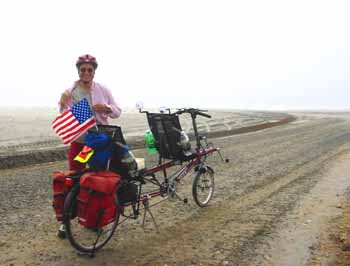
9/11/02, a day for remembrance. We plan a Freedom Ride to celebrate the rights and freedoms we enjoy in the United States. Freedom: Americans are free to do what they want and go where they want without hinderance or oversight by government or religious authorities. The Right this ride celebrates is the right of pursuit of happiness. Exercising the rights and freedoms that terrorists would deprive us of is our way of honoring the victims of 9/11/01. At the Forest Service R.S. we learn that the Lake Quinalt Loop Rd is closed for construction. We decide to ride from Hwy 101 to Moclips and have a look at the ocean. We have our American Flag flying high and handsome above the back seat of our tandem. It's a 45.2 mile ride through second growth forests and some areas of Pygmey Forests (where wet, nutrient poor soil inhibits tree growth). There are also small patches of clearcut. Most of this ride is on the Quinalt Indian Reservation. We see a Woodpecker, Vultures, Ravens, Crows, Goldfinches, Chickadees and Gulls. At the Ocean beach at Moclips the Gulls are all hunkered down in the sand as if a storm is expected. Not many flowers are blooming this late in the year, but we do see some Foxglove and a lot of Gentian. We average 11.5 mph with a max of 35.7 mph. We climbed 1510 ft. It was a warm, sunny day with a cold breeze at the beach.
Sept 4, 2002, This ride starts at sea level in Shelton and climbs steeply to Isabella lake. The narrow road twists and undulates through forests eventually emerging on a level plateau at 550 ft. Past Arrowhead Lake the road winds along a little creek and eventually runs beside the Satsop River. Shaffer State Park waits at the 23 mile mark. After a leisurely lunch and a chat with a surfer/ex-bike racer we head for Matlock. It's a 300 ft plus climb over 11 miles. We treat ourselves to ice cream and restrooms at the Matlock store, then head out for Lake Nahwaztel and the little cafe where we have a coke and use the restroom. Lots of log truck have been passing us on this stretch of road and some of the auto drivers are speeding road hogs. It's 12 fairly easy miles to Shelton and we lose most of the log trucks at the Simpson sorting yard a couple of miles from Nahwatzel. The last two miles into Shelton are a downhill coast and we finish at 5:00. Total distance, 52.5 miles, Total elevation: 1970 ft. ave speed 11 mph, not bad for this ride. The last time we rode this loop I was so tired and my muscles so sore for the next few days that I swore off of longer rides. Things are looking up. Today my muscles feel good, not sore. The difference is eating and drinking properly. You need water, fuel and electrolytes. We are in shape now, but the other time we were in shape too, but I didn't eat properly for all day hard exercise.
Aug, 26, 2002, It's our 42nd anniversary. We celebrate with a bike ride near Mt. St. Helens. From Toledo we in the Cowlitz River valley, then over to the Toutle River, then to Silver Lake and the Mt.St.Helens Visitor Center where we watch a movie about the eruption and look at the displays. Very interesting and impressive. Ospreys are nesting right above the V.C. and we see them adding to their nest. It's a 47 mile ride with 1980 ft of climbing. We average 10.2 mph with a max of 40.9 mph. Cool and cloudy, so we don't see the mountain. Afterwards we have an anniversary dinner at Falls Terrace Restaurant in Olympia.
Aug 1, 2002, We ride the Screamer from Port Ludlow to Marrowstone Island with a stop at Oak Bay Park with its fabulous view.
Lunch was at the little park at Mystery Bay. Sailing yachts in the foreground and the Olympic Mountains in the background for a wonderful scene.
Between Indian Island and Marrowstone Island
Mystery Bay
Then on to Chimacum Cafe for some of their excellent pie. Finally, it up the West Valley Road and over the hill to Pt Ludlow. We saw a Pilleated Woodpecker feasting in an apple tree. This was only 37 miles, but hilly - we climbed 2,270ft. Average speed was ok at 10mph. The weather was just cool enough to keep things pleasant. I closed the angle on my seat back for more power on the hills and it worked better than expected. In the less laid back position I felt stronger on the hills, even at the end of the day.
July 28, A new ride in the Newaukum and Cowlitz River vallies starts at Lewis and Clark State Park. We ride past the Middle Fork Newaukum and head up the North Fork valley where we are greeted with drizzle that grows to light rain. Then a steep hill takes us over to Onalaska. We are getting pretty wet by now, but all the restaurants are closed on Sunday, so we eat at the little grocery store. Drizzle continues as we climb a long steep hill, but tapers off as we cruise along the ridge. Dropping down to the Cowlitz we are out of the wet and it starts to warm up. We see an Osprey on the nest near the river, another one farther along by the boat launch and a third one beside the road a few miles farther along. Three nests and four Ospreys in one day. That's a record. This was a 43 mile ride with well over 1500 feet of climbing. We averaged just under 10 mph.
July 21, 2002, A hot day calls for a ride at Aberdeen where the ocean breezes blow. We decide on a new ride up the Wishkah Valley, over the ridge and down the Wynoochee, over to Friends Landing and back to Aberdeen. The cool breezes seem to have gone South and we sweat a lot in the heat. The climb over the ridge in oven temperatures stops us short of the summit to cool down. The decent is a scarry matter in lose gravel. The road is steep with sharp turns and highly banked curves. We had to walk part of this section to control the bike. We rested in the cool shade along the Chehalis River at Friends Landing. Then climbed a few more hills back to Aberdeen. I sweated so much my legs cramped in spite of drinking most of a quart of Gator Aid and eating every half hour. I finished the quart and the cramps ended. We saw Cedar Waxwings in a couple of places on the ride.
July 2, The Capitol Forest South of Olympia beckons us to a new ride. From the Black River to Mills Creek, over a pass to Stevens Valley and Cedar Creek, up a hill and down to the Chehalis Valley, it's a varied and interesting ride. We see wild Columbine, Foxglove, Mimulus, St Johnswort, Carpet Bugle, Twinflower and others including a Lily we don't recognize. Scrub Jays showed themselves and we saw an Osprey and a couple of Horned Larks. This ride was 35.8 miles the way we did it with a long detour. We climbed 1730 feet and averaged 10.3 mph with a max of 38.7.
June 26, 2002, It's the Port Ludlow to Chimacum ride again. 24.5 miles, 1250 ft of climbing, pie and ice cream at Chimacum Cafe, 10.5 mph average. Hot day, but a good ride. Saw a Western Tanager and a Cedar Waxwing., not many wildflowers.
May 30, 2002, Michigan Hill, Lincoln Creek, Rochester. Starting at Centralia we ride up Lincoln Creek, then over the ridge to Independence Creek. Stop in Rochester for snacks, then Head up the long and steep Michigan Hill. I've lost the details of the ride, but it was about 30-35 miles with about 1200ft of climbing.
May 23, Winthrop, Eastern Washington again. We ride up the Chewach River valley through pine forests carpeted with wildflowers: Delphinium, Death Camas and Balsam Root. We see some Indian Paintbrush too and a small patch of Cat's Ear Mariposa Lily. Tena finds some Eligant Brodilia and we see one clump of Penstimon. There are lots of birds singing in the trees, but most are hard to identify. We do see a Bullock's Oriole, some Flycatchers, Western Bluebirds and a Lazuli Bunting. This is a 37 mile ride to Camp 4 with 1,600 feet of climbing. We average just over 10 mph. The weather was cool and nice for riding.
May 16, We ride the Screamer from Belfair State Park to Tahuya again, but a detour due to road construction added some miles and elevation. The new road will probably smooth out the Seven Devils hill and it'll probably be less steep. We'll find out in September. We had good weather and rode up all the hills, even the two steepest which we usually walk. The first one is short, but incredibly steep, the second is long and very steep, we stopped for a rest half way up. Weather was cool, but nice. We rode 35.8 miles, climbed 1700 ft and averaged 11 mph. Few wildflowers were blooming, but we did see the lowland Beargrass.
May 11, 2002, Schaffer State Park near Elma is the start of one of our favorite rides. The route leads up Cloquallam Creek to Highland Road, over the low pass to Matlock road. We stop at Nawatzel Lake for lunch in the little restaurant. Then on to the Matlock Brady Road and return to the park. 39 miles, 1200 ft, at 12 mph average. A nice ride in good weather, but no birds nor flowers to speak of.
May 8, We toured valleys SE of Olympia on the Screamer. Cold weather kept us in warm clothes, even going up the hills. It's been very cold and rainy for a few weeks and we saw snow on some of the low hills around our route. Trees are just starting to leaf out. Few wildflowers are blooming, but we did see a lot of Camas Lilys and Bleedinghearts. From Deep Lake we rode over to the Deschutes Valley, then over the hill to Johnson Creek. Rode up the Skookumchuck to the dam, then down to Tenino and returned to Deep Lake. We saw a couple of hawks, a Vulture, a red headed Sapsucker and a Scrub Jay. It was 41.8 miles with 1,250 feet of climbing. Ave 11 mph, max 37.7 mph. A nice ride with only slight headwind most of the way around the circuit.
April 30, 2002, Cruised the Burke-Gilman trial on the Screamer. Beautiful day, blue sky, white clouds, comfortable temperature. Rode 43 miles from near the University to Marymoore Park. Saw some hawks, ducks, songbirds. There have been some improvements to the trail since our last ride, like a new bridge and a new bridge access. An easy and enjoyable ride.
April 28, We did the Black River bike ride South of Olympia. 31.5 miles, 900 ft elevation gain, 11.8 mph ave. speed. Beautiful day, sunny, but cool. A few wildflowers are blooming, most notably the Blue Camas Lillys. Saw a Scrub Jay near town of Gate. The rivers are high and beautiful.
April 18, Today we get a break in the clouds afters about 10 days of rain and cold. We need to un-hibernate, so we head for Elma and an easy bike ride along three gentle river valleys. First we head up Wildcat Creek to McCleary. Next it's down Mox Chehalis Creek to Malone. In this valley we saw a large herd of Elk gazzing in a meadow across the road. Then up the Chehlis River Valley on busy hwy 12 to our river crossing at Porter and finally down the valley on the quiet country road on the South Bank of the Chehalis River. It's too early for many wildflowers, saw a few Bleeding Hearts, most trees haven't even leaved out. We saw some hawks, an Osprey on a nest and lots of Evening Grossbeaks at a feeder. Even saw some Hummingbirds. We covered 29 miles, climbed just 600 plus feet and averaged 11 mph.
April 8, Saw the Dr in Seattle and while over there visited the Conservatory at Volunteer Park. Lots of Orchids were blooming - fascinating. Also saw some great Cactus blossoms and unusual Bromiliad blooms. Then we headed to the Duwamish Trail for a 23 mile bike ride - our longest since last November. It was a beautiful sunny day. We saw some bunnies along the trail. The highlight was meeting a couple with a home-made tandem recumbent. A neat bike with Rotator type gearing and seats and a lonngggg wheel base (111 inches). The head tube angle is so low he had a return spring on the front fork to help overcome tiller effect. A beautiful, well made bike. Our ride took us 23.5 miles and we averaged 11 mph. Baby back ribs and dessert at Winners afterward. Now it's time to diet.
Nov 9, We must be dreaming, or is it a nightmare: we head for Leavenworth expecting a fun ride up Chumstick Canyon and down Tumwater Canyon. Well, in the mountains of Eastern Washington it is already winter. The temperature does not rise above freezing and we are in the shade of the canyons most of the day. We wear layers of polypro and pile and windbreakers, but still feel the chill of the cold air. It's a beautiful ride in other seasons, but November is too late. Now we know. We'll return in the spring when flowers are blooming, the rivers are raging and the air is pleasantly warm. This is a 39 mile ride. We averaged 11.3 mph and climbed 1750 feet.
Nov 3, A new ride for us: Skookumchuck Valley via Miller-Sylvania State Park, Deschutes River, Johnson Creek Valley and Tenino. The weather was cool, with lots of fog, clouds, sun and wind at one time or another. We saw a Kestrel and a Northern Harrier, heard a Flicker and a Red Tailed Hawk. It was a beautiful ride with a few flowers still blooming: Lupine, Fox Glove, Daiseys, clover and Sweetpea. Will have to do this one again in the spring. 38 miles, 1,150 feet of elevation gained, Ave speed: 1l.5 mph.
Oct 18, 2001, Three beautiful valleys and one ugly one, up hill and down dale, quiet farmland and busy city streets made up our ride on this cool fall day. From Centralia we rode to Lincoln Creek, up the ridge and down a 14% grade back to town, out beautiful Salzer Valley, climb over the ridge to scarred Hannaford valley with its strip mining and steam plant, then over another ridge and drop down to Buccoda and the Skookumchuck River valley and return to the city. Got lost twice and climbed an extra hill that was very steep, but enjoyed this ride very much. 38 miles, 1,300 feet, average speed 11 mph, max 39.
Oct 14, Why not do an easy ride? Chimacum comes to mind. Only 24 miles with over 1000 feet of climbing and the Chimacum Cafe' with pie. We get Boysenberry and Dutch Peach. Yummie.
Sept 30 - Oct 5, A tour of the Big Sur Coast from Monterey to San Luis Obispo. We rode 198 miles including the 38 mile tour from Monterey to Carmel Mission and back. Staying in motels and eating in restaurants we enjoyed what we call Yuppie camping along the way.
On Sunday Sept 30, we rode from Dennis The Menace Park in Monterey along the waterfront to 17 mile drive and Carmel. We passed Fisherman�s Wharf dodging pedestrians and 4 seater pedicars. The trail followed an abandoned railway route past Cannery Row, Doc�s laboratory and the Monterey Aquarium. We passed the place where Doc Ricketts was killed by the train long ago. To Steinbeck fans this is sacred ground. Cormorants, Seals and Pelicans sunned themselves on offshore rocks along the way. Sea Otters preened on their backs in the water. At Lover�s Point the bike trail ends and the route follows the street along the coast through Pacific Grove to 17 mile drive.
Pictures from our ride on the Big Sur Coast.
We passed the Beachcomber Motel in Pacific Grove and saw their sunday rate of only $79. Tena said they might be willing to keep our car for a week if we stayed stayed there. Seventeen mile drive was beautiful. The Cypress trees arching overhead and reaching toward the water framed the rugged coast perfectly. At Carmel-By-The-Sea we gawked at all the quaint houses that each have an elegant privacy and uniqueness. We visited the historic Carmel Mission before heading back. On the return to Monterey we stopped at the Beachcomber and they said it would be ok to leave the car, so we took a room. This cut 5 miles or so off our next day�s ride and solved our parking problem.
We enjoyed this day's ride almost as much as the Big Sur Coast. In fact, the weather was sunnier than on Big Sur where we had some fog. But the mist added a mysteriots quality to the terrain. Sometimes we were above it, sometimes under it or in it. Usually it stood off far enough to give us a peek-a-boo view of the water, cliffs and shoreline below.
Starting at the Beachcomber we retraced our route of the day before, but this time we the sun streaked down through fog. First, a detailed tour of the Carmel Mission, then on to explore Point Lobos Reserve with it�s beautiful shorline and wonderful Monterey Cypress forest.
More pictures from our ride on the Big Sur Coast.
Nearing the top of a hill a few miles from Point Lobos a loud bang announced a rear tire blow-out; a long way from the nearest bike shop and I didn't have a spare. I was considering whether to use a boot or take the bus back to Pacific Grove for a new tire when a guy in a pickup offered to help. He took me to the bike shop and brought me back with a new tire (and a spare). Then 3 cyclists stopped and one of them looked at the new tire said "Is that an armadillo tire.� Yes it was. �They've been recalled - defective." Duh! Well, then he said the defective ones had probably been replaced by now. Duh-uh? So we rode on with dubious confidence on dubious tires. Luckily, some gear shifting trouble (from mis-aligning rear the wheel) took my mind off the questionable tires (no further tire trouble, by the way).
Fog made this ride interesting. Bixby Bridge looks even higher and more remote in the fog than in sunlight. We saw a Condor gliding overhead near Andrew Molera State Park. The Glen Oaks motel in Big Sur had our room reserved. We had planned an extra day here for hiking and relaxing.
Next morning I fixed the gear problem, then we relaxed on the deck and read in the sun. Later we rode to the park for a hike and dinner afterward. The Redwood forests gave way to Oak groves as we climbed the hillside trail in Pfeifer-Big Sur State Park. The trail ended on a bluff with a fine view of the entire Big Sur Valley, from the foggy coast up North, to where the road climbs over the ridge to the South. Meals in this town are pricey, but good. The restaurant in the park lodge is very nice, with a view of the Big Sur River and a cozy fireplace.
My son Shawn said he only remembered one hill on the Big Sur coast. Well, he may be getting premature senile dementia. I've already straitened him out regarding the hills: many, long and steep. Actually, the hills were fun, especially coasting down, dipping into the steep gullies and sailing around the points above the high cliffs. Wednesday�s ride started with a steep 3 mile climb out of the valley. After a fast descent we traversed miles of steep hillsides and cliffs with easy grades. This was a great ride with both sun and fog, occasional views of the ocean and intregueing glimpses of cliffs in fog-bound obscurity. The night was spend at Gorda Springs where we had a nice room with a view of the ocean, a fireplace and Jacuzzi tub. This was a fun place to stay, but very expensive, breakfast was $25!
Still more pictures from our ride on the Big Sur Coast.
The next day�s ride featured two long steep climbs along spectacular terrain with outstanding views of the ocean and cliffs. We got to San Simeon in time for a tour of Hearst Castle and the last movie. Then on to El Ray Garden motel where I shared the hot tub with the biggest woman I have ever seen. There wasn't room for anyone else in the tub. Surprisingly, she used to bike and jog and keep in shape. Now she just does fat and arthritis. She was interesting and fun to talk to, but it's sad to think she'll never be able to join a hot tub party.
The last day was different, cruising through the quaint town of Cambria, lunching on the beach at Cayucos and tollerating the freeway into Morro Bay on the way to San Luis Obispo (that's "San Louie Bizbo"). The terrain changed to low rolling hills giving way to colorful farmland when we left the coast. Tena saw a rocket streaking up from the Pacific Missile Range at Vandenberg Air Base to the South. Several minutes later we heard the roar of its motor. It was a little scary. The Adobe Inn, a nice Bed and Breakfast in the historic part of San Louie Bizbo, didn't have our reservation, but we lucked out and got the last room. Enjoyed their afternoon cookies on the patio and the gourmet breakfast in their tiny dinning room.
After breakfast I took the bus to the airport and rented a car. We drove it back to Pacific Grove to pick up our own car at the Beach Comber. On the way back to Washington we visited the Monterey Aquarium, Yosemite and Lassen National Park. Loved every minute and every view. Walked to Cold Boiling Lake in Lassen. Very pretty.
On the Monterey - Carmel ride we traveled 38.5 miles, averaged 9.5 mph, and climbed about 1,400 feet.
From Pacific Grove to Big Sur we rode 38.9 miles, averaged 9.4 mph and climbed 2,680 feet. Max speed was 33.5 mph
Second day at Big Sur we rode 4.5 miles and climbed 370 ft.
From Big Sur to Gorda Springs we rode 38.9 miles, averaged 8.4 mph and climbed 3,520 feet. Max speed was 36.6 mph.
From Gorda to San Simeon we rode 30 miles, averaged 10.9 mph. We climbed 1,940 this day. Max speed was 37.4 mph.
From San Simeon to San Luis Obispo we rode 47 miles, averaged 9.9 mph and climbed 1,600 feet. Max speed was 38.2 mph.
Total elevation climbed was 11,510 feet. Overall average was 9.6 mph.
Sept 15 - 16, On a 3 day tour of Hood Canal American flags are everywhere, on houses, businesses, cars, pickups, motorcycles. All the reader-boards say "God Bless America," "We Shall Overcome," or "Sympathy for the Victims of Terrorism." Thankfully, we do not see any signs of irrational fear or blind hatred. This is our first true camping trip on the tandem recumbent. We are surprised how well it goes. Our conditioning has paid off. With over 60 lbs of gear on the bike we ride up steep hills that a few months ago seemed beyond our ability. Surprisingly, we average 11.6 mph the first day. Overall average is 10.5. We don't have to walk the hills, just gear down and slow to a cadance we can maintain. The ultra low 18 inch gear is our secret weapon. The problem of getting camping gear for two on a recumbent was solved with an under seat rack, so we could carry 4 panniers. Sleeping pads and tent poles were behind the rear seat, helped by an aluminum strip I added to support the rear rack. If you want details, email me.
Sept 10, Another challenging ride takes us from Spencer Lake near Shelton to Hamersley Inlet, Oakland Bay, Pickering Passage and Hartstene Island. It's 35.5 miles with over 2,000 ft of elevation gain and some very steep hills. We average 10 mph. The weather is sunny, but comforable. We see buffalo along the way and a Pileated Woodpecker. We are tired at the finish.
Sept 2, We choose a challenging ride from Dewatto on Hood Canal to Tahuya, Elfendal Pass and back via the Holly-Dewatto road. 1700 feet of strenous and moderate hills and 40 miles of riding. The weather is just right for a good conditioning ride.
Aug 28, 2001, Hood Canal is beautiful with the water in the foreground and the Olympic Mountains behind. We start our ride at Twanoh State Park on South Eastern Hood Canal and ride along the shoreline for 7 miles. Then it's up a long, steep hill to aerial views of the water and peaks. We continue South West to Shelton. After a potty break at the Hospital we ride through McEwan Prairie to Mason Lake, then down a steep grade to the Canal and back to Twanoh. It's a 41 mile ride with 1,400 feet of climbing. It was a pleasant ride in nice weather, not too hot.
Aug 15, (Friday). Wanting to try the tandem recumbent on a camping trip we decide to head for San Juan Island where we can camp within 5 miles of the ferry. Shawn and Wendy join us, Brian has to work. Our first experience with a loaded bike is ok. We use the 18 inch Granny gear on the hills and manage to peddle up all of them. Dinner at the Duck Soup Inn - Fabulous. On Thursday we leave our gear with a nice employee at Lakedale Campground and ride the hilly island with light bikes. We see Small Pox Bay where they watched a parade of Orcas for 1 1/2 hours in the morning. Then on to Lime Kiln Point where we saw Porpoises. Next is American Camp, then back through Friday Harbor to Lakedale to pick up our gear. We had strong winds and climbed over 2,000 ft in the 39 mile plus tour of the Island.
Aug 7, An easy bike ride in the Bunker Creek and Lincoln Creek valleys near Centralia is just right after the strain of the Rainy Pass ride. We see hawks, Goldfinches and Buzzards. Most wildflowers are gone now, but there are meadows of Queen Anne's Lace, others of Daisys and lots of Thistles for the Goldfinches. The ride is 37.4 miles with only 610 feet of altitude and only one significant hill. We average 11.2 mph.
July 26-28, We are invited to join Shawn and Wendy on a tour of the Mountain Loop Highway and North Cascades Scenic Highway, a moderate, scenic ride that ends with a steep climb over a major pass. PICTURES They will be joining a group of teachers from Bellingham for the ride over the pass. We decide to join them for the last two days as we haven't any experience taking camping gear on this bike. We ride the last few miles to Colonial Creek campground with them and enjoy over 1000 ft of climbing with views of Gorge Falls, Diablo Lake and many rocky peaks. Tena planned a great dinner, but half of the ingredients escaped their fate by hiding in the refrigerator at home. Luckily the beer and chips and the dessert made up for the shortage in the main course. Tena and I take Shawn and Wendy's gear in the car, so they won't have to carry it over the pass. We will ride part way up then return to the campground and drive over the pass to join them at Fred's place near Winthrop. Tena and I managed to ride as far as Rainy Pass on Friday, but we were behind Wendy and Shawn who left early and didn't see them again until we got to Fred's place. We didn't ride with anyone because no one else rides at only 3 mph. Besides the small group of teachers there was a hoard of skinny, day-glow colored, lycra-clad hot shots on racing bikes passing us at high speed. The really fast ones stood on their peddles and sprinted past us like we were standing still, which we practically were. I was a little embarrassed by our slow speed, but the Blackflies seemed to like it. So did the Horse flies and the Deer Flies. They like to feast at their leisure rather than working up a sweat chasing the fast cyclists. From Rainy Pass, 4855 ft, we rode back to Colonial Creek in a quickly mounting headwind which eventually reached gail force and pushed us around somewhat near the end of the ride. We climbed 4470 feet on this ride of 56 miles and averaged 6.3 mph on the way up with an overall average of 10.4 mph. We consumed 6 quarts of water and 60 ounces of Sobe Energy as well as bananas, oranges, apples, dried fruit, nuts, Bread and cheese. We feel good about this ride in spite of our slow speed. This experience tells us we can manage the hills that used to intimidate us.
July 24, We did the Belfai - Tahuya ride again to see if we are still in shape after a week of kayaking. We did it hn record time with an average speed of 11.7 mph. Enjoyed cool weather and a nice ride.
July 11, We tackle a hilly route that has intimidated me ever since we bought the tandem recumbent. A couple of the hills are so steep I couldn't ride them on a wedgie, single or tandem. I don't mind pushing the bike up these short pitches. So, we rode from Allyn over the hump to Hood Canal, to Mason Lake, Benson Lake, Grapeview, Fair Harbor and back to Allyn. 37 miles and 1500 feet of elevation. Traffic was noticeably heavier than on backroads near Centralia, especially along Hood Canal and Hwy 3, but it didn't intimidate us. Stopping every half hour for water and snacks keeps our energy and strength up and prevents sore muscles the next day. The Sobe energy drink (joints, muscles, cardio) works wonders. Wildflowers are past their prime, but we saw Turkscaps (Tiger Lilly), Foxglove and lots of daisys. The best flowers were at Fair Harbor where the marina has beautiful gardens and hanging baskets with many unusual varieties of Roses, Hydrangias, Lillies and others I can't name. Near Grapeview a bee bounced off my visor and landed under my helmet strap where he stung me close to the ear. Most of the pain went away in a few minutes, but it's still tender the next day. Our average speed was 10.4 and top speed 52 mph.
Jul 7, Wow! a short, hilly ride from home. 1470 feet of elevation in 24 miles. Lots of steep hills on Bainbridge Island. We chose Sunday morning to avoid traffic on our narrow roads. It's a good conditioner. Lovely day. Fay Bainbridge State Park was beautiful. We averaged 10.4 mph.
July 3, Hot sun, steady wind, a long ride: that describes the Vader, Winlock, Adna, Curtis, Boistford ride, but I shouldn't forget beautiful farmland valleys, wildflowers and birds. 48 miles of this and 1200 feet of climbing add up to a great day. We averaged 11.6 mph and hit a top speed of over 50 mph coasting down a long 10% grade. We saw Foxglove, Columbine, Daisys, Spirea, Thistle, Wildrose, and others. There were Goldfinches, Redtail Hawks, Turkey Vultures, Scrub Jays and a woodpecker. We had a headwind for the first half of the ride, then a tailwind helped us on the way back. One steep hill of 200 feet was the toughest part. Ladies at the Senior center in Winlock were packaging cookies for the Seattle To Portland ride. Several hundred bike riders will stop there for snacks.
June 26, We feel strong enough to tackle a 50 mile ride, so we head for Centralia and the Oakville Loop. The Lincoln Creek valley is 10 miles of beautiful farmland. We see lots of Foxglove, Daisys and Vetch. We also see some Columbine and a fair amount of Delphinium. Garrard Creek has another beautiful valley. Saw a few Scrub Jays, several Goldfinches, some Vultures and Hawks soaring and a rabbit in the graveyard. The hills aren't much on this ride, but two of them are enough to get you puffing and sweating. We got into our 18 inch gear on one of them. Since I lost my front fender we have been hitting 50 mph on long, steep decents. We went over 55 on this one (in the 160 inch gear). Now I believe it was the wide fenders that made this bike slower that our previous (wedgie) tandem. We had light headwinds on most of this ride and rode the last 7 miles in a light drizzle. We averaged 11.5 mph.
June 23, 2001, Itching for a strenuous ride and hoping to get into better shape to possibly do a tour we headed for the Belfair to Tahuya ride. Nice cool weather and the hills are still long and steep enough to feel it. 1260 feet elevation gain and 35 miles. It was great. Lots of Foxglove and Sylvan Goatsbeard blooming. Had a headwind for a good part of the way for extra conditioning.
June 20, I need some stuff from the woodworkers store in Seattle, so we decide to work in a bike ride. Rockler is right off the Duwamish Bike Path. This will give us an opportunity to ride two sections that have recently been upgraded with new highway/bridge underpasses - one at each end of the ride. We start in South Park industrial area, crossing the Duwamish River 4 times before getting to South Center and Rockler. Two of the crossings are on bridges built exclusively for the Duwamish trail. Getting from Fort Dent Park to South Center is a breeze on the trail, but a maze of highway interchanges and busy intersections if you ride on the street. It's great to zip around all that traffic, crossing under it instead of working through it. There's one more trail bridge over the Duwamish before we head back with varnish, pull handles and other goodies in the panniers. A 20.7 mile ride with only 70 feet elevation gain, but we only average 11.2 mph due to slow sections at South Center.
Jun 13, Schaffer park near Elma to Buck Prairie, Lake Nahwatzel, Matlock and return. Saw lots of Sylvan Goatsbeard, Columbine, Lupine, Lowland Beargrass and tiger Lillies. Also saw an eagle, some hawks, a woodpecker (probably a Hairy) and a Western Tanager. Had heavy headwind for half of this 39.8 mile ride. Ave 11.6 mph, climb 1020 ft.
June 7, We ride the Black River loop. 31.5 miles in perfect weather, not too warm and almost no wind. Saw 3 Scrub Jays, rare in our area except in a narrow corridor which just barely reaches to the South end of this ride. We averaged 12.2 mph which is good considering our condition, but this is an easy ride. At Mima Mounds we saw Death Camas, Violets and Bluebells. Saw wild Columbine growing along the route.
May 22, 2001, Rode the Screamer from Port Ludlow to Chimacum and returned by the West Valley Rd. 24 miles and 1200 feet of climbing. A little too much hill for the shape I'm in. We lost the front fender going down the big hill. I had failed to secure the top bolt after our trip to California and the wind pressure at 38 mph pushed it back and it went down and dragged on the ground and broke. Going down the steep hill on West Valley Rd without the fender we hit 50.5mph, a record for this bike. I guess the wide fenders are what inhibit speed on the Screamer.
April 25, Bike ride with daughter in law who is training for a long bike tour. This was our first ride since last Fall, so we chose an easy one. We rode from Crocker Lake to Quilcene for lunch. Then it was on to Linger Longer marina on Quilcene Bay. We returned by the Lake Lealand Road. Nice ride, beautiful warm day.
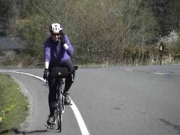
Cell phones are great! The office can call no matter where you are or what you are doing.
November 3, 2000, Breakfast at the Old Lake Quinalt Lodge and then a 30 mile bike ride around the lake. Two miles of narrow road in the rain forest lead us to Hwy 101. Another 3 miles and we are on the Northshore Road where we see almost no cars for 14 miles. Gawking at huge Fir trees we coast down to lake level. Once past the lake the pavement ends and the dirt road enters the broad Quinalt River valley with dense Maple forests. Vine Maples, Sugar Maples and Sweetgums show brilliant colors, but the big Maples have lost most of their leaves. We call these fur trees because they are covered from head to toe in a heavy fur coat of chain moss. Even the Fir trees up hear wear fur coats. It's fascinating to look at the grotesque shapes of the Maples with their hairy twisted branches groping out and upward. We enjoy about ten miles of this Disney like forest, then cross the Quinalt River and head back on the Sout Shore Road with water falls and more fur trees. Ferns are everywhere and mounds of mosses decorate fence posts and rails. The ride climbs 1,000 ft and we average 10.6 mph, not bad considering 11 miles of dirt road.
Sorry, I had to pull my email address, but you can contact me through my guestbook.
SORRY, the server truncates Guestbook messages at about 45 words
Return to Greatnorthwest main page
