
|
| Main Reactor | Nuclear Toast | Local Fallout | Radioactivities | The Reactor Files |
|
The Toast Reactor is classified as a Class 3 Hardened Site for a reason: the area around Seattle is geologically active. |
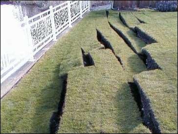
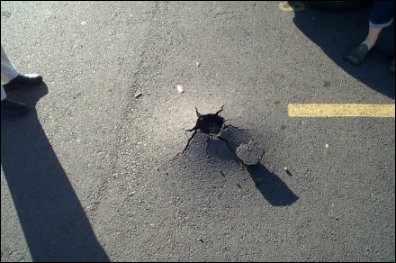
On Wednesday, February 28, 2001, a magnitude 6.8 earthquake shook Puget Sound. The epicenter was 11 miles northeast of Olympia, the state capitol, and 35 miles southeast of Seattle, at a depth of 33 miles. As big as the quake was, the extreme depth prevented much greater damage. It was the largest earthquake in the area since a 7.1 magnitude shaker in 1949, whose epicenter was almost the exact same location. There are lots of pictures and video of damage caused by the quake. But the Toast Reactor research staff, ever eager to please, has found these interesting photographs for you to marvel at.
|


| Copyright © 1996-2008 Nuclear Toast |