
This map illustrates the size of Israel (before 1967)
in comparison with the hostile surrounding countries
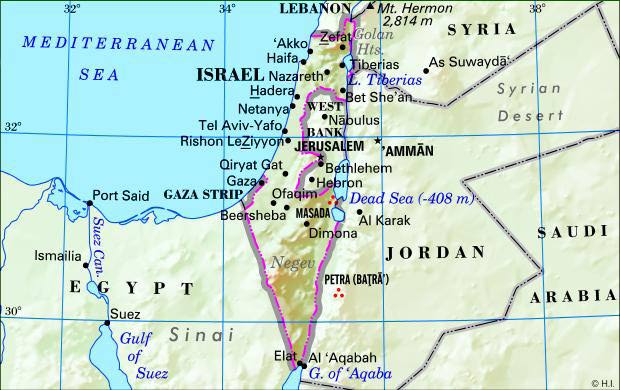
A closer look at the map of Israel and its neighbors [ jh ]
 THE VAUTOUR PAGES
| AIR BASE | DISTANCE (Km.) | LOCATION |
|---|---|---|
| El-Arish | 217 | North Sinai |
| Bir-Gafgafa | 315 | West Sinai |
| Kabritt | 370 | Egypt / Delta |
| Abu-Swer | 372 | Central Egypt |
| Fayid | 380 | Egypt / Canal |
| Mansura | 402 | Egypt / Delta |
| In-Shas | 439 | Egypt / Delta |
| Cairo Int'l | 456 | Egypt / Delta |
| Heluan | 483 | N.W Egypt |
| Cairo West | 495 | Egypt / Delta |
| Sharm-El-Aheikh | 526 | South Sinai (the straits) |
| Bani-Suef | 552 | South Egypt; {from Tel-Noff-467 |
| Guardaqa | 624 | South Egypt / Red Sea |
| Luksor | 813 | South Egypt |
| Ras-Banas | 967 | South Egypt / Red Sea |
| El-Maza | 133 | Syria |
| Damascus | 150 | West Syria |
| Dumayr | 180 | Syria |
| Saiqal | 220 | Syrian desert border |
| T-4 Palmira, Tadmur | 308 | Syrian desert |
| Hamatt | 308 | North Syria |
| Mafrak | 107 | Jordan |
| Amman | 130 | Jordan |
| H-3 | 428 | West Iraq |
| Tabuk | 496 | N.W Saudi-Arabia |