OSAT CASE*
97: Aconcagua
"Siga escalando montañas...y no deslice!"
(Keep climbing mountains
and don't slip!)
The Plan
Note: To see how the the actual trip went, jump to
our reports page
or
our photo page
The expedition left Seattle SEATAC airport on January 19, 1997.
We traveled to Santiago, Chile where we got our final supplies
before going across the border to Puenta del Inca, Argentina.
We have selected the Vacas/Relinchos approach to the Polish Glacier
route on the northeast of the mountain, in spite of the fact that
the 41 km (26 miles) approach is about 11 km (7 miles) longer
than the Horcones Valley approach to the northwest side Normal
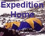
Route. Base Camp on the northeast side is Plaza Argentina, at
an elevation of 13,780 feet. (The picture at the top of our home page is
taken from near there.) We are working with famed Aconcagua climber
and guide Fernando Grajales
to arrange for a local muleteer to transport supplies and help
in making the river crossings for this portion of the climb. Señor
Grajales' web site includes a picture of him pioneering the southwest
ridge route in 1953. Thanks to the recent TCM Aconcagua climb
we also have a current picture of Sr. Grajales.
The base of the Polish Glacier (Camp II) is at 19,300. Our plan,
which follows standard practice, is two sets of double carries
above base camp, first to an intermediate camp and then on to
Camp II. Here's a great picture looking up the glacier from this camp
from the Ric Otte collection.
 Although some climbs reach the summit from this camp and return
in one very long day of climbing, our plan is to overnight at
one higher camp, near 21,000 feet at Piedra Bandera ("flag
rock"), which is named for its resemblance to the Argentine
flag (compare the rock, which appears in the upper left of the
Otte picture.)
Our schedule (below) allows several days for weather delays or
other contingencies.
Although some climbs reach the summit from this camp and return
in one very long day of climbing, our plan is to overnight at
one higher camp, near 21,000 feet at Piedra Bandera ("flag
rock"), which is named for its resemblance to the Argentine
flag (compare the rock, which appears in the upper left of the
Otte picture.)
Our schedule (below) allows several days for weather delays or
other contingencies.
To see what we actually did, compared to this plan, check out
our climb report.
We also came home with some GPS data,
for this side of the mountain, a collection of photos,
and some pointers regarding conditions and
the guide book
.
1/19    Depart Seattle
1/20    Arrive Santiago, Chile
1/21    Travel to Puenta del Inca, Argentina
1/22    Second night at Puenta del Inca - arrange mule loads
1/23    Punta de Vacas to Las Leñas (8,800)
1/24    Las Leñas to Casa Piedra (10,500 ft)
1/25    Casa Piedra to Plaza Argentina (Base Camp, 13,800 ft)
1/26    rest, organize loads, meet ranger and other climbers
1/27    carry to Camp I; return to Base
1/28    move to Camp I;  15,400 (or higher?)
1/29    rest day at Camp I
1/30    carry to Camp II; return to Camp I
1/31    move to Camp II, base of Polish Glacier (about 19,300 ft)
2/1     rest, or retrieve caches from below
2/2     move to High Camp (Piedra Bandera 21,000 ft)
2/3     Summit! (23,834 ft) and return to Camp II
2/4     Contingency for weather delay
2/5     Contingency for weather delay
2/6     Contingency for weather delay
2/7     Return to Base Camp (we may cross to Plaza de Mulas base)
2/8     Return to trailhead, Punta de Vacas or Puenta del Inca
2/9     Return to Santiago
2/10    Leave Chile
2/11    Arrive home in Seattle
|


Useage monitor  since 12/12/97
