

|
| Goiás
Area: 355,386 sq.km.
Population: 5,000,000
Capital: Goiânia
|
Distrito Federal
Area: 5,814 sq.km.
Population: 1,800,000
Capital: Brasília
|
Mato Grosso
Area: 881,001 sq.km.
Population: 1,800,000
Capital: Cuiabá
|
Mato Grosso do Sul
Area: 350,548 sq.km.
Population: 1,900,000
Capital: Campo Grande
|
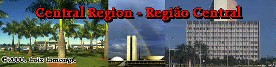
Essa região, coberta por extensas planícies e pastagens
tropicais, é ainda pouco
povoada. Embora ainda uma das mais isoladas áreas do País,
experimentou rápida
expansão de sua produção rural e o estabelecimento
de novas indústrias. Nela se
localiza a capital do País, Brasília, fundada em 1960.
O Governo Federal reservou
vastas áreas no Centro-Oeste como reservas destinadas às
tribos indígenas que
originalmente ali viviam. Também nesta região encontra-se
um paraíso da vida
selvagem, o Pantanal Mato-Grossense.
(Adapted from MRE, Brasília)
 |
Distrito Federal
-
Area: 5,814 sq.km.
-
Population: 1,800,000
-
Capital: Brasília
-
Sign: DF
|
Brasília, DF
Desde a segunda metade do século XVIII, as autoridades governamentais
do Brasil
consideravam, com níveis de prioridade variáveis, a transferência
da sede do
Governo do Rio de Janeiro para alguma parte do interior do País,
a salvo de ataques
navais. A primeira Constituição da República (1891)
chegou a definir onde o futuro
Distrito Federal deveria estar localizado - um retângulo dentro
do estado de Goiás,
no coração do País. Somente em 1956, entretanto,
após oito anos de levantamentos
e pesquisas, foram iniciados o atual projeto e a construção
da nova Capital, no
Governo do Presidente Juscelino Kubitschek. O local escolhido para
o Distrito
Federal, em Brasília, tem superfície de 5.814 km2, em
área esparsamente habitada
do estado de Goiás, num planalto situado a 1.100 metros acima
do nível do mar e a
1.200 km de distância do Rio de Janeiro. O concurso para a elaboração
do plano
diretor da cidade foi ganho pelo arquiteto e urbanista brasileiro Lúcio
Costa. Os
prédios governamentais mais importantes foram projetados pelo
arquiteto brasileiro
Oscar Niemeyer. O paisagista Roberto Burle Marx planejou os jardins
e a seleção
de plantas, de forma a adicionar mais verde à vegetação
seca e amarelada do
cerrado. No dia 21 de abril de 1960, Brasília foi oficialmente
inaugurada e começou
a funcionar como a nova capital do Brasil.
Since the second half of the 18th century, Brazil's
governing authorities considered, with varying degrees of intensity, transferring
the seat of government from Rio de Janeiro to some inland area, safe from
naval attacks. The first Republican constitution (1891) went as far as
defining where the future Federal District would be - a rectangle within
the State of Goias, in the heart of the country. But it was not until 1956,
after eight years of surveying, that the actual design and construction
of the new Capital began under President Juscelino Kubitschek. The site
chosen for Brasilia is located in the Federal District and comprises 2,245
sq. miles (5,814 sq. km) of a sparsely inhabited plateau carved out of
the State of Goias, 3,609 feet (1,100 meters) above sea level and 746 miles
(1,200 km) from Rio de Janeiro. The competition for the urban master plan
was won by Brazilian architect and urban planner, Lucio Costa. The major
government buildings were designed by the Brazilian architect Oscar Niemeyer.
Landscape designer Roberto Burle Marx planned the layout and selection
of plant varieties to add a vivid green backdrop to the otherwise dry,
yellow landscape of the savanna vegetation. On April 21, 1960, Brasilia
was officially inaugurated and started functioning as the new capital of
Brazil.
Fotos | Photos:
-
Pot
of Gold (Congresso), Brasília, DF
-
Congresso
Nacional, Brasília, DF
-
D.
Bosco, Brasília, DF
-
D.
Bosco, Brasília, DF
-
Ministério
das Relaçoes Exteriores (Itamaraty), Brasília, DF
-
Jardim
Nacional (Congresso Nacional no Fundo), Brasília, DF
-
Teatro
Nacional, Brasília, DF
-
Tribunal
Federal, Brasília, DF
Links to Distrito Federal:
 |
Goiás
-
Area: 355,386 sq.km.
-
Population: 5,000,000
-
Capital: Goiânia
-
Sign: GO
|
The Flag of Goiás is formed by alternated
diagonal stripes in green and yellow, four of each color, commencing with
a green one. At a blue oblong, upon which shines in horizontal direction,
the left superior angle, in silver the Southern cross.
The green represents the exuberance of the forests
and the yellow, the color of gold, the richness which, in its profundities,
is hidden in the soil of Goias. The Southern Cross, this beautiful
constellation appears upon the pavilion of the State, because at the fair
nights of Goias we admire it as a sparkling and brilliant splendor of the
indigo blue sky.
Links to Goiás:
 |
Mato Grosso
-
Area: 881,001 sq.km.
-
Population: 1,800,000
-
Capital: Cuiabá
-
Sign: MT
|
Mato Grosso's flag is made up of a blue rectangle,
with a white lozenge inscribed, and inside this, a yellow star in a green
sphere.
The blue represents the immense sky of Mato Grosso;
the white, peace; the green, the rich vegetation of the State; and the
yellow, the gold that caused the pioneers great fascination.
Fotos | Photos:
Links to Mato Grosso:
 |
Mato Grosso do Sul
-
Area: 350,548 sq.km.
-
Population: 1,900,000
-
Capital: Campo Grande
-
Sign: MS
|
Fotos | Photos:
Links to Mato Grosso do Sul:
Top of Page | Começo da Pagina
