
![]()
![]()
![]()
![]()
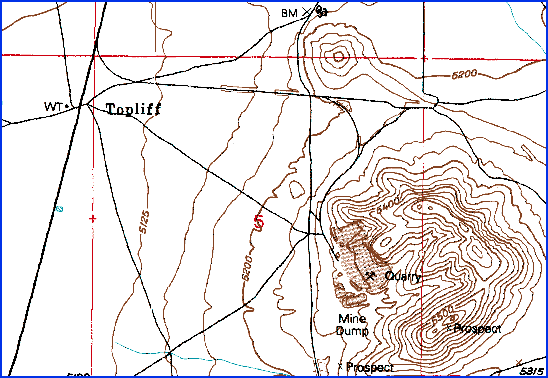
Map of Topliff
USGS 7.5 Minute Series Map "Five-Mile Pass"
Brief History of Topliff
The settlement of Topliff came into existence because of the need for limestone in the mid 1870s. The Salt Lake and Western Railroad setup tracks a mile away from the limestone quarry where the ground was flat and even and ran a spur to the quarry itself. Limestone was crushed then shipped out via the rail.
A rail depot and a water tower (see photos below) were located near the main rail line. By 1913 most activity had died down but Topliff's usefulness continued until 1937. Houses were moved away to nearby towns and the rails removed.
There are several brick foundations, brick walls and bricks in the area of Topliff both near the water tower and westwards in the direction of the quarry site.
Sources:
Carr, Stephen L. The Historical Guide to Utah Ghost Towns (page 33).
Pictures
Click on thumbnail image for a large image.


Two views of the water tower(?).
All photos copyright (c) Chad Carter 2000.


Left: Brick remains of a building's foundation.
Right: Entrance to a small closet size area (not a cave).
All photos copyright (c) Chad Carter 2000.


Two views of Topliff's surroundings.
Right: Notice the brick remains of a mill(?).
All photos copyright (c) Chad Carter 2000.


More of Topliff's surroundings.
All photos copyright (c) Chad Carter 2000.

Brick remains of some unknown structure.
All photos copyright (c) Chad Carter 2000.
Utah Ghost Towns and Mining Camps
All photographs and graphics (unless specifically stated otherwise)
copyright (c) Chad Carter 2000
Created in 800X600 resolution.
