|
Click on one of the links below to access the main areas of this site


| |
-
The Devon Local Studies Service has published Greenwood's Map of Devon c. 1827
on the internet. To see the sheet covering Stoke Damerel click on the thumbnail
image below.

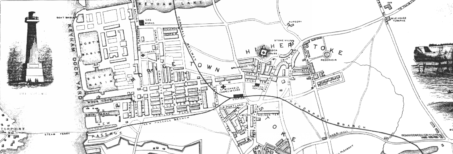
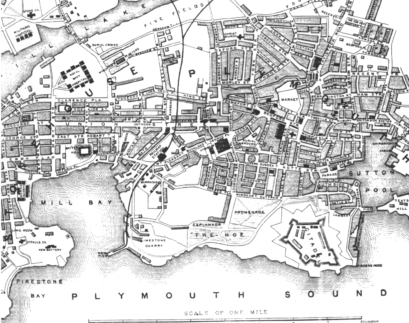
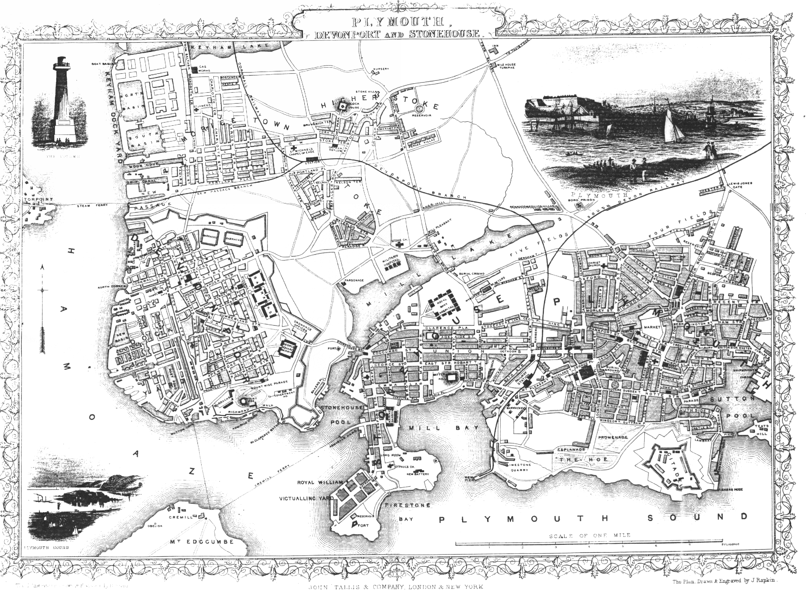
Map of Plymouth, now dated at 1860
Source: West Devon Record Office, Unit 3,
Clare Place, Coxside, Plymouth, PL4 OJW. Tel:+44 (0)752 385940
Click on the section of interest
General areas:
top Left = Morice town, Keyham, Torpoint Steam Ferry, Higher Stoke, Milehouse Turnpike
top right = Chester Place, Lewis Jones Gate
Bottom left = Devonport
Bottom Right = Plymouth City
Download Full Map (1862kb)
The digital version of this map has kindly been provided by Mark
Sandford
|


