Please save this site Ctrl+D or right-click mouse and Add
Bookmark Thank you !
The same page in other languages


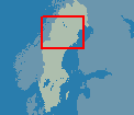
Meet a part of north Sweden, the links touch upon Västerbotten
and Lappland
Varning ! Watch out for REINDEERS on the roads,
or close to the roads !
In summertime the sun is up both day and night, please take pause often
!
The Weather
in the area.
Places to see and visit !
Timrå
industrial pulp and paper mills of SCA, both in Sundsvall
and Timrå,
also famous ice hockey team of Timrå
Sollefteå
The pearl of the Ångermanälven-river-valley
The
High Coast Bridge Following the Road
E4 30km north of Härnösand.
The Bridge is the highest building in Sweden. picture
HM The King of Sweden official declared
the bridge opened 1997.
Restaurant at the north end of the Bridge.
Docksta Baren
famous food bar, Truckers favourite!
The Skulemountain popular stop at the E4 road, with
the high cliffs close to the road, just a few km north of the Docksta willage.
The Skuleforest is a national park, the E4 passes throu. Skule Camping.
Bjästa/Köpmanholmen. One
of the harbours of the tour boats of High Coast.
Ulvön
the ilse and the famous old
fisherman willage
Örnsköldsvik
Industrial city between Härnösand and Umeå. Famous
ice hockey team MODO Hockey.
Husum Industrial
community. The Gideälven-river outlet into the Gulf of Bothnia.
Husum Hockey-team. MODO-companys pulp-mill of Husum.
Saluböle Camping.
District boarder between the provinces
Ångermanland and Västerbotten.
Discover
Västerbotten County
County Administration
Nordmaling and Hörnefors
Coast willages in the district of
Västerbotten.
Old paper mill in Hörnefors,
also the old home of football legends the Nordahl brothers, Gunnar, Knut
and Bertil.
University of Umeå.
The museum of Umeå University.
Norrland University Hospital.
The District Museum of Gammlia.
E4 and E12-Blå vägen-road crosses.
The ferry's for Finland, you find nearby
in Holmsund, follow E 12 east.
Following the Blue Road
E 12 to the west, from Umeå, direction Mo i Rana, Norway, Atlantic
ocean. E 12 follows
the river valley of Umeälven, a lot
of open views over water.
A lot of possibilities to stop for a break along
the road. Also a few willages, perhaps to see some locals, for a chat.
Vindeln
municipality by the famous Vindelälven-river, no waterpower plants
upthrou the hole river
Lycksele
what you must visit and see in the city of Lycksele:
Activities
in Lycksele
Zoo
garden located in the city, a few
hundred meters road 365 direction Vilhelmina/Åsele
Ansia Bath
Park Lycksele Ansia-Water-Bathpark Temperate outdoor
bath, (free car park), and at a few minutes walking distance from The Lappland
Camping and The Hotell Lappland
 Lycksele east part
The Old Cultureplace, Gammplatsen/Oldplace
(free car park)
Foresting Museum
(free car park).
The City of Lycksele, southern Lappland Shopping
centre (free car park).
This is the Gold-mine district of Sweden with a few mines in work.
Trollbacken - The Troll-hill in Lyckans freetimearea, from E12-Bridge ca 6 km E12 heading Storuman - Mo i Rana
(see roadsign at Betsele hydropowerplant)
Björngrottan - The Bearcave
at the top of Bocksliden - ski center, E12 ca 9 km heading Umeå (caved road all way)
Hotell Lappland
Park Hotell
Duvan Hotell
Motell Lycksele
Vandrarhem/Youthhostel
picture
Ansia
adventure Camp Lycksele
Tel +46 (0)950-10083 Fax +46 (0)950-124 93
Vormsele Camping ( more) (about 40 km north
Lycksele, follow road 365, at Vindelälven, turn west left)
Rusksele Camping (about 30 km north
Lycksele, follow road 365, at Vindelälven, turn east right)
Kattisavans
Camping ( more)
(about
30 km the Road E12 heading Storuman - Mo i Rana)
Lapplandsporten ( more)
(about
11 km the Road E12 heading Umeå)
Direction Storuman, Rest-pause-place "Blåviksjön" E 12
about 38 km northwest
of Lycksele (free car park, wc, water)
Storuman
municipality in Lappland 100 km northwest of Lycksele, Inland Road R45
and Blue Road E 12 are crossing, Inlandsbanan
the Inland railroad and the railroad Storuman-Hällnäs are crossing
Utsikten, outlook viewing
the Storumanlake
, follow the street passing the
Hotell Toppen, 100m turn left smaller road about 1,5 km to the top. A clear
day you can see almost 120 km to the west,
nearly to the municipality
Tärnaby and Hemavan old
home of the world-famous downhill-skiiers Ingemar Stenmark,
Stig Strand and Anja Paerson
Storumans Camping, Favorit-camping
of many, Central location in the municipality, Cottages, Shop-store,
big bathing pool like a small lake
|
Nybyggarland
Settlers Colonists land, 10 km south along Road 45 (Vilhelmina/Östersund),
rod tinsmith, café, children's play rest, reindeers, Colonists-Museum
Långsjöby, small willage
30 km west of Storuman (covered road), The Culture area of Volvo creek,
with small water mills, Open agriculture landscape, the lake 20 km, a willage
heading the future, new built centre, with new petroleum station (Polar
Oil), new food-shop-store, school hattstugan children's day nursery
leisure, about 60 households, Artist Erik Norberg (see the cranes at the
square of Storuman), A.Lindberg sawmill and wood-constructing,
C.Jönsson floors and wallpapers, TGs schakt,
Dikanäs
smaller municipality in western Lappland, about 80 km west of Storuman
Motorcycle-museum, Gas station, Food stores and a fine old wooden Church
Kittelfjäll
Famous winter sport willage, also summer offer sports like mountain climbing
Vilhelmina
municipality in south of Lappland, nearly a city, higher schools,
small hospital,
a lot of activities summertime, also in winter, famous old Church-town-houses
Dorotea
municipality in south of Lappland, factory for caravans, sawmill, forestry
industry
Willages in Dorotea
Högland Borgafjäll
Hunting-Fishing
Other notes:
Food, you find Restaurants, Pizzerias, Hamburger-bars
in all cities and municipality
Food-shops all over Sweden at the
Konsum -shops
Petroleum and other stuff for travellers at the
OKQ8 -stations (even some food at a lot
of stations)
For contacts with your relatives, use telephone-paycards
or use your gsm-phone
(Most Swedes understands English very
good, but everyone does not speak English fluently) |