Northern Negros Forest Reserve, Negros Is., Philippines
Elevation :
Location :
First Ascent :
Basic Features :
Approach :
Route Access Plan :
Climb Route :
Climb Route Plan :
Advisory :
5,033 ft.
South of Cadiz City near the borders of Victorias City and E.B. Magalona
Unknown; Climbed by the an SB team, the first mountaineers to do so, at 5:00 p.m. on August 29, 1999 although this feat was recognized by the SB after 1 1/2 years later
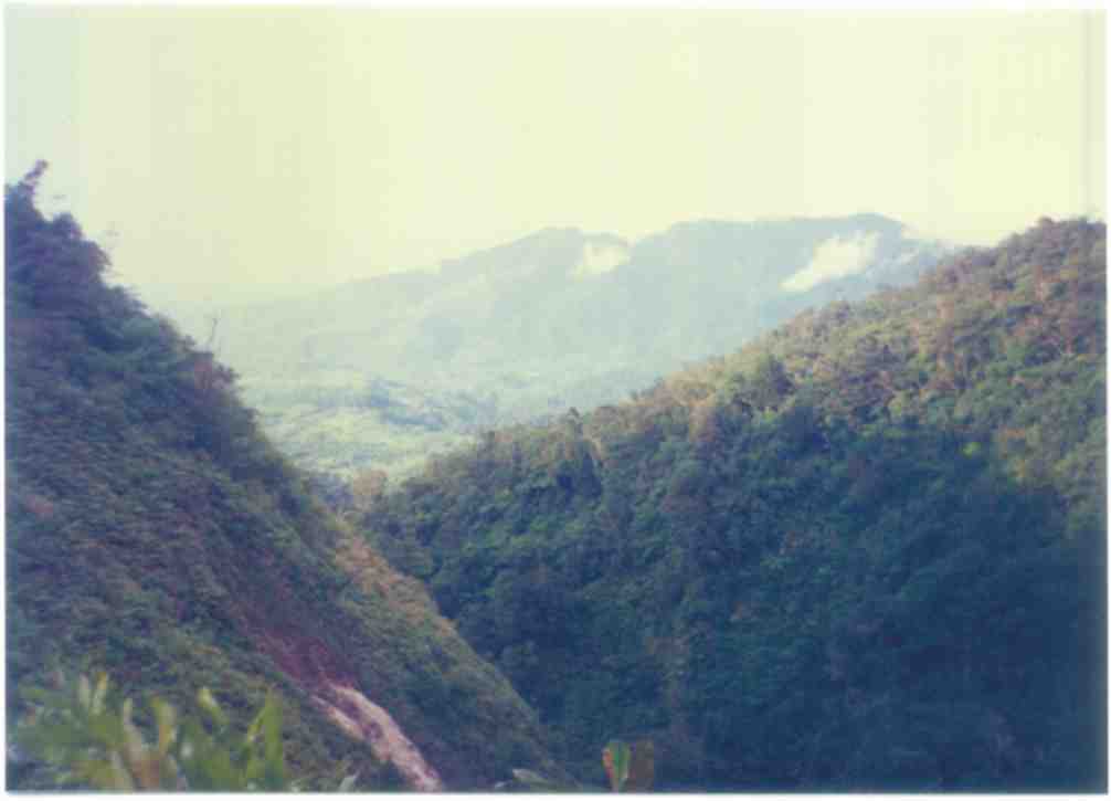
The official summit of Mt. Silay; mostly primary forest cover; volcanic mountain; sheer south face with a base that is difficult to approach due to its rugged terrain and thick forest cover
South Base from Barrio Gawahon
Uphill and downhill logging road (1 day); bushwhack to south base (0.5 days)
Nagabusay Col
Hack a trail to Nagabusay Col between the summit-ridge of Dinamlagan East Wall and Silay-Proper (1 day); climb the ridge and follow it to the northeast (0.5 days); bivouac is neccessary
Orienteering skills or a sense of direction in the forest is a must; pack water from water-sources

HOMEPAGE
MAINPAGE

Attempting the South Face for the second time, the SB clinched the South Face Peak (formerly the SB called it Makawili Peak) on August 29, 1999. Experiencing an anticlimax, the SB learned that the South Face mountain and the Dinamlagan belong to a singular mountain with the pinnacle of the later as the higher summit. This discovery lead to the formulation of the theory that Dinamlagan (a peak already climbed by the SB on October 3, 1998) is the true summit of Mt. Silay. This theory persisted for almost a year despite of the discrepancy it imposes on the relation of relevant peaks from map positions against positions taken from actual observations. There is no such thing as a Sicaba Diotay Peak southeast of Silay (granting it is Dinamlagan) contrary to the information contained in most maps (not topographical maps) consulted by the SB.
By June 2000 on the planning stage to climb Sicaba Diotay Peak, the SB discovered a least noticed mountain east of the Dinamlagan East Wall from reconnaisnace photographs assembled for the purpose. Indeed, this eastern mountain is the true Mt. Silay! Not alien to this mountain, the SB had actually traversed through its summit ridge, barely making it to its summit (150 feet short), on its northeast detour after climbing the South Face Peak.
UPDATE: The Singarong Backpackers recognized late on March 24, 2001 that it has already climbed Mt. Silay at 5:00 p.m. on August 29, 1999 after summiting South Face Peak at 11:00 a.m. in the morning. Unable to recognize that peak, they even bivouacked on it as a result of an eastward traverse in search of a route down the mountain - a move that standed them on the mountain and resulted in a dramatic northeast detour.

South Slopes (August 12-18, 2000)
Singarong Backackers : Dennis Ella, Pedro Palabrica, Mariebelle Porras and Roger Sildres
Nonguided Exploratory Climb
In a 7-day expedition for the tandem climb of Mt. Silay and Sicaba Diotay Peak, just 1.4 kms apart, the team blazed a 2-day trail from Barrio Gawahon (actually half of which is already known to the team) to the Northwest Slopes of Sicaba Diotay Peak. In the third day, the bid to assault Sicaba Diotay Peak was repulsed by an 'unscalable' rock-wall on the West Ridge. Loss of morale, depleted supplies and fatigue on the fourth day defeated the effort of Dennis (Climb Leader) to mount a reconnaisance of the Silay-Sicaba Diotay col. All the Climb Leader could do is to personally scan the South Face of Mt. Silay from a vantage position. The team returned to Gawahon on the fifth day.
South Slopes (Sept. 13-17, 2000)
Singarong Backpackers : Dennis Ella, Pedro Palabrica and Mariebelle Porras
Nonguided Exploratory Climb
Intending to utilize the Nagabusay Col (the Dinamlagan-Silay col), the team blazed an eastward trail from the ridge of Tiniphagan (the massive landslide in the lower slopes of South Face Peak or the Dinamlagan East Wall) towards the eastern 'sikwayan' (major declination of a summit ridge) of Dinamlagan. Without a map in the dense forest, the team overshot the 'sikwayan' and entered instead the Northwest Slopes of Sicaba Diotay Peak (S57E of Silay) in the afternoon of the second day. In view of the proximity of Sicaba Diotay, the team opted to cancel the bid for Mt. Silay in exchange for an attempt of the closer one. Although a failed Mt. Silay climb, the team gained great knowledge in this particular approach to Mt. Silay - the most difficult to approach in Upper North Negros..
Nagabusay Col through Naathagan Buttress (August 29, 1999 @ 5:00 p.m.)
Singarong Backpackers : Dennis Ella, Pedro Palabrica and Mariebelle Porras
Nonguided Exploratory Climb
During the Third Attempt of Mt. Silay, the SB's Messner Team summited at 11:00 a.m. on August 29, 1999 South Face Peak (assumed by the SB as the summit of Mt. Silay prior to the climb). Learning by actual observation that Dinamlagan Peak to the east towers above South Face Peak of the same mountain, the Team theorized that the former is the true summit.
In search for a new route down the mountain, the Team went westward past Nagabusay Col (depression between the true Silay and Dinamlagan) and, at 5:00 p.m., bivouacked on a pinnacle (then unrecognized by the SB as the true summit).
More than a year after the unrecognized climb, two actual observations shed light to an incontrovertible fact - Silay has been unknowingly climbed as stated. December 30, 2000: An SB party was able to view the full length of the east-west length of Mt. Silay from a ridge of Sulfatara-Gamay in Mt. Mandalagan; noticeably in this perspective, the SB learned that the pinnacle near Nagabusay Col (appears as a prominent depression in the ridgeline) is a dominant peak, much unlike as its lowly profile when viewed from a nearer perspective in Ubak Valley. March 24, 2001: An SB party took a compass reading in an observation point in Ubak to determine the location of Sicaba-Diotay Peak in corellation to a reeading taken on the very summit of Sicaba-Diotay (climbed through the West Ridge on September 15, 2000); this observation proved that the pinnacle east of the true Mt. Silay is Sicaba-Diotay, not Silay as theorized by the SB during the Fourth and Fifth Attempt.
North Ridge (June 5-7, 2003)
Singarong Backpackers : Joseph Victor Magdato, Glenn Sorbito and Aaron Cristal
Nonguided Exploratory Climb
The 7-man party arrived in Brgy Gawahon on at 9:30 a.m. on June 5, 2003 and headed north for Sicaba-Tuo Camp where it arrived at 3:00 a.m. Here in a base camp about 2,000 ft below the summit, the summit team composed of Joseph, Glenn and Aaron commenced the final assult through the North Ridge at 8:30 a.m. The team discovered a "mangunguway" trail over the west of the Ridge that eased its progress but Aaron, complaining of stomachache, slowed down the ascent. After 2 hours, the team could hardly managed to get to the 1144-meter pinnacle on the ridge and it decided to call off the day climb. The team arrived back to camp at 11:30 a.m.
Meanwhile, the guests - Tristan Opinion, Trivon Opinion, Erick Gaylon and Gilmar Almirante - who were not included in the summit team arrived at 12:00 noon of the second day on their nonguided trek to Sicaba-Wala River over the other side of the ridge.
This attempt is a miserable failure.
North Ridge (April 8-10, 2004)
Singarong Backpackers : Dennis Ella, Joseph Victor Magdato, Glenn Sorbito, Tristan Opinion, Trivon Opinion and Frederick Gaylon; Freelancers - Anthony Leonidas, Jeffrey Torres and Kenneth Gaylon
Nonguided Exploratory Climb
By far the largest NEC team ever assembled by the Singarong Backpackers, the 8-man team was led by Dennis Ella with the assistance of senior members such as Joseph (Navigator) and Glenn Sorbito (Base Camp Manager and Sweeper). In a bid to pursue the unfinished climb of the 2003 team on the route, the North Ridge, the team set up base in Sicaba-Tuo Camp (elevation 300 feet ASL), about 5 hours of hike from Brgy Gawahon, on the first day.
As the team confronted the remaining 4,700-foot vertical distance and 2-km horizontal distance on the second day, April 9, 2004, it immediately hurdled the scrambling slope of the 1144-meter peak on the North Ridge. In more than 2 hours, the team topped the 1144-meter, leaving earlier the greater part of the load. Tracking the spine of the North Ridge with a decaying trail was an easier task. Tackling the sheer summit wall later was another matter. Past the last vestiges of a trail, the team arrived at the dry source of Sicaba-Tuo (separating Dinamlagan Pk from Silay Pk) at lunchtime.
Tired and weary, Kenneth Gaylon, a lumbering behemoth at 230 lbs, opted to stay in the lunch site while the rest pushed on to the summit after luncbreak. Finally, after much confusion the team recognized the Silay summit a few minutes before 2:00 p.m.
Descent to Sicaba-Tuo Camp was made in only two hours. Return to Brgy Gawahon was accomplished in 4 hours.
This is the First Mountaineering Ascent of the North Ridge.