
ST Hills
Home

Santa
Teresa
Hills
Santa
Teresa
Park
Open
Space
Bay Area Back Pages
Bay Area Biking
Bay Area Hiking
Future
Hopes
Feedback
|
NOTE: These pages are under
continual
construction, so check back frequently for updates.
Introduction

Legal disclaimer: The
Coyote-Alamitos Canal is not a trail. In many places, it is private
property, and usage of it is trespassing. You could be arrested or sued.
This Website is not intended to
encourage trespassing, only to inform the public of the issues involved.
The Coyote-Alamitos Canal cuts along the lower reaches of the
Santa
Teresa Hills, with gravel-paved maintenance roads along the canal
levees.
The canal was built to carry water from the Coyote Canal along Coyote
Creek
to Alamitos Creek and the Guadalupe percolation basin in the Almaden
Valley,
but is now rarely used for this purpose. It serves as a winter
stormwater
culvert, but is dry for most of the year. The levee roads follow the
canal
starting from the east side of Tulare Hill, near Monterey Highway and
the
Coyote Creek Trail. The canal runs along Tulare Hill, crosses under
Santa
Teresa Blvd. at the entrance to the Coyote Valley, then runs along the
Santa Teresa Hills almost all the way to Lake Almaden. The level
maintenance
roads look like they would provide ideal hiking and walking trails, but
they are not continuous, and they are not officially open to the
public.
The Santa Clara Valley Water District has an easement to use the canal,
but most of the property under and around the canal is private.
In some places near private property, the canal is posted and
fenced
off. However, in many places, there are no fences and no signs, so
people
can frequently be seen walking their dogs, jogging, or biking along
these
sections of the levee roads, even though they are technically
trespassing.
The levee trail along the Coyote-Alamitos Canal has the
potential to
become one of the best in the Bay Area. Throughout its length, it has
great
views of the hills and valley. It will be one of the most important
trails,
as it will link and provide neighborhood access to several very
important
trail systems. It serves a neighborhood containing more people and
businesses
than any other single trail in the South Bay. Because so many people
live
and work near it, it will most certainly become one of the most popular
trails in the Bay Area. The sections below discuss the canal route, the
benefits of turning it into a public trail, and the steps required to
do
so.
The map below is a topographic map that shows the route of the
canal
along the Santa Teresa Hills:

Map from TOPO! Copyright 1997 Wildflower
Productions
(www.topo.com)
Contents:
Photo Tour of the Coyote-Alamitos Canal
Route:
Start of the canal
Santa Teresa Park
Cottle Road
Snell Avenue
End of the canal
Los Alamitos-Calero Creek Trail
Return to Santa Teresa Park
The Value of Recreational Trails
Benefits of the Coyote-Alamitos Canal Trail
Making the Trail a Reality
My Creek
Links
Photo Tour of the Coyote-Alamitos
Canal Route
The photos below provide a tour of the Coyote-Alamitos Canal
Route.
It shows the potential trail and the other trail that it could link up
to . (Note: Click on the thumbnails below to see larger
pictures.)
Coyote Creek
The story of the Coyote-Alamitos Canal begins at Coyote Creek. Coyote
Creek
is the longest creek in Santa Clara County. It starts high in the
mountains
of Henry Coe State Park. It is dammed and controlled along the way. Its
waters are impounded in Coyote
Lake Reservoir and Anderson Reservoir, then in a series of
percolation
ponds in the mostly-rural Coyote Valley. It runs past Coyote Hellyer
County
Park and Kelly Park. It runs through downtown San Jose and Milpitas,
eventually
flowing into San Francisco Bay north of Alviso. Along Coyote Creek runs
the Coyote Creek
Parkway. It's a multi-use trail route that has paved paths for
bikes
and skaters and dirt paths for equestrians. The parkway runs for some
15
miles from Anderson
Lake County Park to Coyote
Hellyer County Park. The heavily-used paved bike path is one of the
longest and best in the Bay Area. Along the way, it passes by parks, a
model airplane field, golf
courses, fishing lakes, horse
ranches, farms, homes, and rapidly-developing industrial parks. See
here
for more on the Coyote Creek trail.
 |
 |
 |
 |
| Coyote Creek Golf Club |
Water ski pond north of Metcalf Road |
Coyote Creek Trail north of Metcalf Road |
Cottonwood Lake, Hellyer County Park |
The Coyote Creek Trail is a great recreational resource,
but for
those who live in the Santa Teresa Area, it is not an easily reachable
one. Main access points at Silver Creek Valley Blvd. and Silicon Valley
Blvd. require traveling along a busy road and passing by a dangerous
and
unappealing gauntlet of freeway on-ramps and off-ramps.

Silicon Valley Blvd. and Hwy 101 west of Coyote Creek
Start of the Canal by Monterey Highway
The Coyote-Alamitos Canal starts just above Monterey Highway near its
intersection
with Metcalf Road on the northeast corner of Tulare Hill. The Coyote
Creek
Trail crosses Metcalf Road. Metcalf Road itself crosses over Coyote
Creek
just before it intersects with Monterey Highway. At the intersection
with
Monterey Highway is a pedestrian crossing light that allow safe passage
to the Tulare Hill side of the road. To reach the start of the canal
would
require a railroad crossing and a ramp up the side of the hill. Just
south
of here on Monterey highway is the tiny rural town of Coyote. On the
south
side of Tulare Hill, not far from here, are the proposed Metcalf Energy
Center and Cisco's Coyote Valley campus.
 |
 |
| Railroad tracks between Monterey Hwy and Tulare Hill.
The start of
the canal is up on the hillside |
Closer view of the canal start on the hillside above
the railroad tracks. |
Canal Along Tulare Hill
The canal wraps around the north side of Tulare Hill behind Pegasus
Court
and Way, Tulare Hill Lane and Road, Coburn Court, Cheltenham Way, and
Bayliss
Place. There are few fences blocking access to the canal, but there are
signs along the canal warning against trespassing. The canal dives
underground
to run under a shallow valley on the southwest slope of Tulare Hill. A
trail along here would probably have to be cut into the hillside to run
in and out of this the valley.
 |
 |
 |
| View east along canal at Tulare Hill Lane |
View northeast along canal above Cheltenham Way near
Cheltenham Court |
View southwest along canal above Cheltenham Way looking
towards Coyote
Peak |
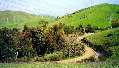
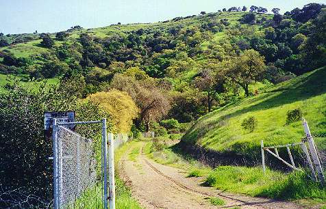
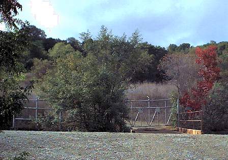
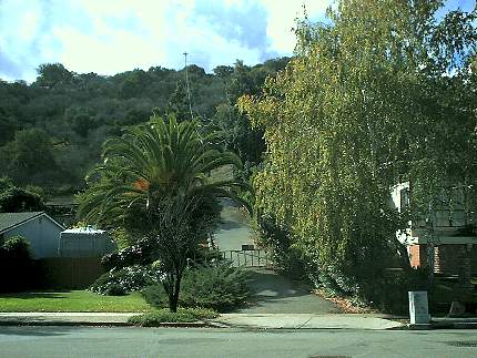
Canal on Either Side of Santa Teresa Blvd.
The canal ends at a gate on Santa Teresa Blvd. It runs in a tunnel
under
Santa Teresa and reappears on the other side. It then begins to run
along
the base of the southeast end of the Santa Teresa Hills behind Bayliss
Drive and the small streets that branch off it. This is the only place
along the canal route where the canal crosses a major road, where a
safe
crossing may require a traffic light. On Manresa Court, it runs behind
the Laguna Seca Community Garden. Shortly after this, the canal enters
the east corner of Santa Teresa Park.
 |
 |
 |
| Canal northeast of Santa Teresa Blvd. |
Canal southwest of Santa Teresa Blvd. |
Laguna Seca Community Garden below canal |
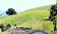
Canal Views from Santa Teresa Park Above
the Archery
Range
On Bayliss Drive is the entrance to the archery
range in Santa Teresa Park. The range is used by the Black Mountain
Bowmen, but is open to the public. The banks of the canal levee form a
backstop for the archery range. Signs on the canal levee warn against
walking
on it because of the danger from flying arrows. The archery range poses
a significant barrier to running the canal trail through this area.
However,
it may be possible to detour the trail off the canal levee and down
through
the lower park roads. Fortunately, this is all county parkland here.
Trails
lead up into the hills of Santa Teresa Park here, providing the views
shown
below:
 |
 |
 |
| View of north side of Tulare Hill, with the canal
running below it. |
View of the canal route along the Santa Teresa Hills
heading northeast
from the archery range |
View of the canal running along the south side of the
archery range |
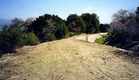
Canal by and Through the Santa Teresa Golf Club
It is ironic that two of the most challenging barriers to the canal
trail
are in public recreational areas. The archery range above is one spot.
The Santa Teresa Golf
Club is another. The canal runs through the golf course and
disappears
underground near the back of the driving range. A dirt service runs up
into the hills here, providing access to the Ohlone Trail and the steep
Coyote Peak Trail. The canal is unseen, put probably runs outside the
fence
behind and along the south side of the driving range. Southwest of the
driving range is a beautiful tree-lined pond, which was a popular
picnic
and fishing spot for families, but is now off-limits. A dirt road
circles
behind the pond, which could be used as a future trail. The canal
reappears
just south of the pond, then runs outside the golf course by the Laurel
Springs Nature Trail. It then runs under Bernal Road. A short section
of
the canal levee is commonly used by hikers to access the nature trail
and
the Ohlone Trail from Bernal Road. While the golf course is open to the
public, only golfers can walk along the canal. Bicycles are not allowed
in the golf course area at all. Santa Teresa Park's hillside Ohlone
Trail
can be used as a bypass for foot traffic, but it is a narrow path,
closed
to bicycles. An alternate bicycle route needs to be designed. It may be
possible to locate it at the edges of the golf course or on the lower
hillside
below the Ohlone Trail. Another alternative would be to put a trail
along
the north side of the golf course next to the boundary fence.
 |
 |
 |
 |
| Canal running through the Santa Teresa Golf Course |
View of the golf course and canal from the |
Canal entering the golf course by the Santa Teresa Park
Laurel Canyon
Nature Trail |
Canal levee east of Bernal Road leading towards the
nature trail and
Ohlone Trail |
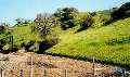
Bernal Road to the Buck Norred Ranch Site
The canal run under Bernal Road, which is a two-lane road leading into
Santa Teresa Park's Pueblo Day Use Area, the Muriel Wright Center, and
the Almaden Research Center. The road can be busy at times, but there
is
more danger from bicycles speeding down the hill than from cars, which
can be seen for a long distance. A crosswalk may be needed to provide a
safer road crossing to the canal on the west side. This part of the
canal
levee is probably one of the most heavily used sections. It connects
two
parts of Santa Teresa Park, and there are no gates and no signs warning
against trespassing. Santa Teresa Park property is above and below the
canal. However, the Santa Teresa Park map and brochure clearly state
that
the canal is not a trail. On the other hand, they do not explicitly say
that you cannot travel on it. The canal levee is narrow, well-worn, and
rutted here and shows signs of erosion. It could use reinforcing. It
runs
above a strip of open land, but comes closer to the backyards of houses
on Heaton Moor Drive as it nears the old former Buck Norred Ranch site.
 |
 |
 |
 |
| The canal crossing Bernal Road at the entrance to Santa
Teresa Park |
Canal levee west of Bernal Road, antenna-topped Coyote
Peak in the
background |
Greenbelt between the canal and the houses on Heaton
Moor Drive west
of Bernal Road |
Canal along the hills south of the Buck Norred Ranch |
Norred Ranch to Santa Teresa Springs
The canal disappears underground at the old road on the east edge
of the Buck Norred Ranch site. That road climbs steeply uphill to
become
Santa Teresa Park's Mine Trail. The Buck Norred Ranch site is part of
the
park, but the old ranch buildings are off-limits. Plans are being made
to put a park horse patrol here. The canal reappears again west of
Brockenhurst
Drive, which is an unofficial entrance to the park. An old ranch road
climbs
up to a stables area. The canal begins on the right side of this road.
The canal entrance here has been fenced off here for years, but
recently,
the fencing has been enhanced to further restrict access. This was done
at the request of neighbors in the area. The canal runs in the hills
behind
Heaton Moor, then turns right above San Ignacio and Bernal Intermediate
School. The canal levee can be reached from the open field near Bernal
School. Kids can often be seen riding dirt bikes through here. The
canal
runs behind an adobe house, which is owned by the parks district and is
used for ranger housing. It then runs behind a private house and ranch.
Beyond that is the Bear Tree Lot of Santa Teresa Park. The canal
disappears
into a siphon at Santa Teresa Springs. Another fence blocks access to
the
canal levee, but ruts in the hillside below it indicate that people
frequently
go around it.
 |
 |
 |
 |
| Small creek running by the Buck Norred Ranch house |
Closed canal levee west of the Buck Norred Ranch |
View of the canal running behind Heaton Moor to San
Ignacio |
Gate on canal east of Santa Teresa Springs |
Santa Teresa Springs
The Santa Teresa Springs area is the probably the most historically
significant
spot in the entire Santa Teresa Hills. The springs were named after St.
Teresa of Avila by Jose Joaquin Bernal, who first settled this area.
(See
here for more
about the springs.) A ramp leads down from the canal levee to the
meadow
below Santa Teresa Springs. A ramp leads back up to the springs and
pond.
Right next to this ramp, the canal and levee begin again. The levee
trail
is unblocked and unposted. As it leads to the Joice-Bernal Rancho in
Santa
Teresa Park, it is heavily used.
 |
 |
 |
 |
| Paved path below Santa Teresa Springs ends, dirt ramp
leads up to the
canal |
The pond at Santa Teresa Springs |
On the right, a path leads up to Santa Teresa Springs.
On the left
is the canal levee. |
Meadow between Santa Teresa Springs and the
Joice-Bernal Rancho, with
the canal above |
Joice Bernal Rancho
The Joice-Bernal
Rancho is at the corner of Camino Verde Drive and Manila Drive, a
couple
blocks west of Santa Teresa Springs. The ranch is being restored to
become
a museum and interpretive center. The canal ends at a siphon at the
edge
of the Joice Trail, which is a steep ranch road that climbs up into the
hills at the west edge of the park. To the west of the Joice Trail is a
gully and drain. Next to that is the ranch caretaker's house that is
being
restored as a park residence. Behind the caretaker's house, the canal
begins
again. A steep informal path up the brush-covered embankment behind the
house leads to the canal levee. The canal leaves park property just
past
the Joice Bernal Rancho, running behind homes on Manila Drive and
Brookmere
Driven, then enters Century Oaks Park near Cottle Road.
 |
 |
 |
 |
| Canal levee above the Joice-Bernal Rancho |
End of the canal above the barn |
View of the barn and farmhouse from the canal |
Canal levee behind the caretaker's house |
Views of the Canal From the Joice Trail
The Joice Trail begins across a ravine from the old caretaker's house.
It runs nearly straight up a steep hill before turning south to climb
more
gently along the hillside. Near its junction with the Vista Loop Trail,
a PG&E power line service road branches off from it and heads
towards
the power towers at the western boundary of the park. The Joice Trail
and
associated trails provide excellent views of the canal, the hills, and
the entire Bay Area on clear days.
 |
 |
 |
| Looking across a ravine from Joice Trail at the old
caretaker's house.
The canal is in the trees behind the house |
Canal runs along the base of the hills, with open land
below it at
the ends of Oberlin Way, Matthew Court, Brookmere Drive, and Manila
Drive |
View from the PG&E service road of the canal
running behind Dade
Court, heading towards Cottle Road. The fence marks the park boundary |
Views From Century Oaks Park at
Cottle Road
Century Oaks Park is an undeveloped San Jose city park next to Cottle
Road.
The hill here provides good views of the hills. The Canal levee runs
below
the hill, but is fenced off. In the pictures below, the canal can be
seen
running along the hill behind the neighborhood south of Cottle. There
is
a private horse ranch at the end of Cottle Road. Century Oaks Park runs
from Cottle Road to Galen Drive between the canal levee and the houses
on Curie Drive. The land for Century Oaks Park was donated to the city
of San Jose by the developer of the homes below it in exchange for
being
allowed to build houses on smaller than standard-sized lots. (See the
top
of the page for the view west.)
 |
 |
 |
| Canal above houses on Beckham Drive and Dade Court |
View of the west boundary of Santa Teresa Park at the
treeline above
Beckham Drive |
End of Cottle Road at the private horse ranch past
Lovely Creek Court |
Curie and Malory
Century Oaks Park has several access points on Curie Drive (see the
Santa
Teresa Hills page). The canal can be seen from Curie as a straight line
along the hills above the houses.
People on the canal levee above houses on Curie by Malory Drive
Canal Above Century Oaks Park at Didion Way and Curie Drive
At the corner of Didion Way and Curie Drive, a trail leads up a hill to
the fenced-off edge of the canal. The canal curves around the side of
the
hill. Views of the canal and neighborhood are shown below:
 |
 |
 |
| View of the canal behind the fence at the top of the
hill at Didion
and Curie |
View of the canal to the right of the hill |
View over Didion Way, canal running above Weybridge
Drive |
Galen Drive to Snell Avenue
At Galen Drive, the Century Oaks Park property ends. A fenced-off ramp
leads up to the canal levee. Signs warn against trespassing and using
this
to reach the canal. The canal runs above the houses on Mindy Way and
goes
under Snell Avenue.
 |
 |
| Fenced off ramp leading up to the canal by the end of
Century Oaks
Park off Galen Drive past Elder Court |
Canal above houses on Mindy Way east of Snell Avenue |
Canal at Either Side of Snell Avenue
Snell Avenue becomes a gated private road at the Coyote-Alamitos Canal.
The road leads up to a private cattle ranch. Cattle can be frequently
seen
grazing on the hills in this area. The canal to the left is fenced off
with some serious "No Trespassing" signs. The canal to the right only
has
a vehicle gate blocking the levee. Walkers and bicyclists can easily go
around it. Until the spring of 2000, there were no "No Trespassing"
signs.
A dog-shooting incident in the hills above here late in 1999 probably
caused
the signs to go up (see the news section).
 |
 |
 |
| Gate and fence on canal levee east of Snell Avenue |
Private ranch road at the end of Snell Avenue |
Levee and gate west of Snell Avenue |
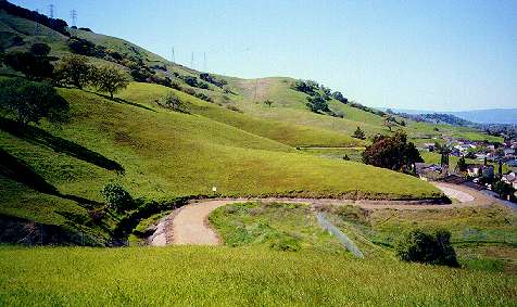
Canal Above Coyote-Alamitos Canal Park at Snell and Colleen
At the corner of Snell Avenue and Colleen is a wooden fence with a
pedestrian
pass-through opening. It indicates that this plot of hillside land is a
city park. It is the undeveloped Coyote-Alamitos Canal Park. A
well-worn
unofficial dirt path leads straight up the hill to the Coyote-Alamitos
Canal. Many people obviously use this to access the canal levee. Though
there are no fences preventing access, there are (or were) "No
Trespassing"
signs at the side of the levee. People may not realize that the city
park
property ends at the canal levee. (These pictures were taken from the
city
park property at the edge of the canal levee.) Views looking down from
the top edge of the park demonstrate one major advantage that the canal
offers over other water district creek trails: a great view.
 |
 |
 |
 |
| Fence at entrance to Coyote-Alamitos Canal Park, path
leads up to canal |
View from just below the canal of the intersection of
Colleen and Snell |
View from the top of the hill, canal running to the
left towards Snell |
Canal running west above Colleen |
Shadelands to Blossom Avenue
Near Blossom Avenue, a broad open field allows access to the hillside
below
the canal. A steep unofficial dirt footpath leads up the hill to the
unfenced
canal. Signs next to the canal warn that no trespassing is allowed,
however.
 |
 |
 |
| People on canal above houses on Colleen Drive by
Shadelands Drive |
View from top of hill above Colleen near Blossom Avenue |
Canal leading east from hill above Blossom and Colleen |
Rocky Glen Court to Cahalan Avenue
There is a small gap between houses at Rocky Glen Court. There is a
driveway
leading up to it. This could allow future access to the canal, but it
is
probably private property. Just west of here, Cahalan Avenue runs past
Foothill Park, then climbs up the base of the hill right to the edge of
the canal levee. Here is a fence and locked gate with "No
Trespassing"
signs. There is also an "Adopt-a-Creek" sign, indicating creek cleanup
volunteers may have access to the canal. Peering through the fence, a
small
bridge crosses the canal and a road, blocked by another locked gate,
leads
up into the hills.
 |
 |
 |
| Canal above houses and open land above Rocky Glen Court |
Closed gate to the canal at the end of Cahalan Avenue |
Canal levee, bridge over canal, road leading into the
hills past Cahalan |
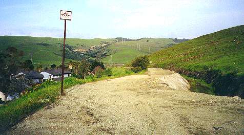
Foothill Park to the End of the Canal at
Miracle Mountain
Drive
Foothill Park is a San Jose city park at Cahalan Avenue and Foothill
Drive.
The park leads up to the top of a small hill. Below the park, the canal
can be seen, but a recently-repaired fence separates the park from the
levee. The canal runs behind Foothill Drive. There are a number of open
lots at the end of culdesacs and gaps between houses along the base of
the Santa Teresa Hills in this area. They are on private property. Most
are posted. These could provide future access points to the canal.
However,
they are starting to disappear as houses are being built on the larger
lots. (see the News on the homepage.)
There
is a paved and gated service road leading up to the canal opposite
Hillrose
Drive. The water district signs warn against trespassing. The
Coyote-Alamitos
Canal ends at Miracle Mountain Drive. A steep hillside and condominium
complexes block further access to the west. There are informal paths
through
the hillside. Residents of the condominium complexes can pass through
to
reach Winfield Blvd. At the end of Winfield Blvd. is the entrance to Almaden
Lake Park.
 |
 |
 |
 |
| Canal running up to the base of Foothill Park |
View from Foothill Park of canal running behind
Foothill Drive |
Hills and canal above the end of the culdesac at
Rolling Glen Court |
Hills and canal above Foothill Court |
 |
 |
 |
 |
| Small gap leading to the canal between houses on
Foothill Drive east
of Sanford Drive |
Gated paved service road ramp leading to the canal on
Foothill Drive
by Hillrose Drive |
End of canal by hill at the end of Miracle Mountain
Drive |
Apartment and condo complexes at the west side of the
end of Miracle
Mountain Drive |
Lake Almaden and the Los
Alamitos-Calero Creek Trail
Along Lake Almaden runs the Los
Alamitos-Calero Creek Trail. The heavily-used trail runs
north
past lake Almaden, runs under Coleman Avenue to the Almaden Light Rail
Station along the waterway that becomes the Guadalupe River. It then
passes
by the headquarters of the Santa Clara Valley Water District, goes
under
Blossom Hill Road, and currently ends at percolation ponds north of Hwy
85. Future plans call for extending the trail all the way to the Guadalupe
River Park in downtown San Jose, where it joins up with the Los
Gatos Creek Trail and will run all the way to the San
Francisco Bay Trail at Alviso. Lake Almaden is a popular city park
with a swimming beach, playground, boat docks, and picnic grounds.
Trails
run around the lake. The Los Alamitos-Calero Creek Trail runs south
from
Lake Almaden into the Almaden Valley. Even though it's surrounded by
suburban
housing tracts, it still provides a natural experience and is good for bird-watching.
It's a popular trail for bicycling, skating, jogging, and dog-walking.
Even though the trail is down in the valley, it is a part of the Bay
Area Ridge Trail. The trail splits at the confluence of Calero and
Alamitos Creeks. One leg follows Alamitos Creek to McKean Road, while
the
other leg follows Calero Creek to Harry Road, near the entrance to
IBM's
Almaden Research Center.
(See here for more information about the Almaden
Valley's watershed.)
 |
 |
 |
 |
| View across Lake Almaden of the west end of the Santa
Teresa Hills |
The headquarters of the Santa Clara Valley Water
District west of the
Guadalupe River |
The Los Alamitos-Calero Creek Trail near Mazzone Drive
heading south
along Alamitos Creek |
Harry Road near the entrance to IBM's Almaden Research
Center |
The Calero Creek Trail to Santa Teresa Park
South of Harry Road, the Calero Creek Trail continues as a dirt path
along
Calero Creek next to an orchard on IBM property. This orchard was the
focus
of a recent proposed
controversial development that was turned down. The trail runs
between
the orchard and tree-shaded Calero Creek. It turns and crosses Santa
Teresa
Creek, follows along the edge of the hillsides which are owned by IBM,
then reaches the Stile Ranch/Fortini Trailheads at Santa Teresa County
Park. The Fortini Trail is the easier of the two trails. It branches to
the right and parallels Fortini Road, gently climbing into the heart of
Santa Teresa Park, eventually ending at the parking lot of the Pueblo
Day
Use Area.
 |
 |
 |
 |
| The Calero Creek Trail by the orchard on IBM property |
Santa Teresa Creek crossing the Calero Creek Trail |
The Calero Creek Trail below IBM |
The Fortini Trail leading to the Almaden Valley |
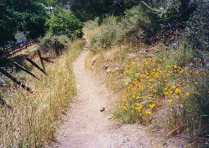
The Stile Ranch Trail
The spectacular Stile Ranch Trail, lined with brilliant wildflowers in
the spring, is one of the best trails in Santa Teresa Park. It is part
of the Bay
Area
Ridge Trail. It runs through an easement provided by IBM
through
their property. The trail zigzags up a steep, rocky hillside on
switchbacks.
It runs down and up two valleys, then joins the Mine Trail. Both the
Fortini
Trail and Stile Ranch Trail can be used to pass through Santa Teresa
Park
to reach the Santa Teresa side of the hills. Other trails run down the
hills and cross the Coyote-Alamitos Canal, allowing for a complete loop
trip around most of the Santa Teresa Hills.
 |
 |
 |
| The Stile Ranch Trail leading up the hill above San
Felipe Avenue |
Flowers lining the Stile Ranch Trail |
The Stile Ranch Trail switchbacks, looking towards the
Almaden Valley |
The Value of Recreational Trails
In a 1995 publication by the National Parks Service, ECONOMIC
IMPACTS OF PROTECTING RIVERS, TRAILS, AND GREENWAY CORRIDORS, the
following facts were brought out:
- Natural open space and trails are prime attractions for
potential home
buyers in 1995. According to research conducted by American Lives, Inc.
for the real estate industry, 77.7 per cent of all home buyers and
shoppers
in the study rated natural open space as either “essential” or “very
important”
in planned communities. Walking and bicycling paths ranked third.
- A study of property values near greenbelts in Boulder,
Colorado, noted
that housing prices declined an average of $4.20 for each foot of
distance
from a greenbelt up to 3,200 feet. In one neighborhood, this figure was
$10.20 for each foot of distance. The same study determined that, other
variables being equal, the average value of property adjacent to the
greenbelt
would be 32 percent higher than those 3,200 feet away.
- In a recent study, The Impacts of Rail-Trails, landowners
along three
rail-trails
reported that their proximity to the trails had not adversely affected
the desirability or values of their properties. Along the suburban
Lafayette/Moraga
Trail in California, the majority of the owners felt that the trail
would
make their properties sell more easily and at increased values.
- In a survey of adjacent landowners along the Luce Line
rail-trail in
Minnesota,
the majority of owners (87 percent) believed the trail increased or had
no effect on the value of their property.
- A land developer from Front Royal, Virginia, donated a 50
footwide
seven-mile
easement for the Big Blue Trail in northern Virginia after volunteers
from
the Potomac Appalachian Club approached him to provide a critical trail
link along the perimeter of his second-home subdivision. The developer
recognized the amenity value of the trail and advertised that the trail
would cross approximately 50 parcels. All tracts were sold within four
months.
- Thirty-five acres was set aside as a protected corridor
through a
71-lot
subdivision for approximately one-half mile of the Ice Age Trail in
Wisconsin.
The Ice Age Trail Foundation had purchased the parcel when the land
became
available for sale and was being considered for development. Later the
Foundation sold the parcel to a subdivision developer, after placing an
easement on the trail corridor. The developer now touts the easy access
to the Ice Age Trail in promotional subdivision brochures.
- Trail users of three rail-trails generated a total economic
impact of
over
$1.2 million for each trail, according to the recent study, The Impacts
of Rail-Trails. These trails were used mostly by people living nearby
who
visited frequently. “Users spent an average of $9.21, $11.02, and $3.97
per person per day as a result of their trail visits to the Heritage,
St.
Marks, and Lafayette/Moraga Trails respectively.”
- Maryland’s North Central Rail Trail, a 20-mile corridor
through
Baltimore
County has become quite popular in the last few years. Use of the trail
increased from 10,000 visitors in 1984 to 450,000 in 1993. The trail
supports
approximately 264 jobs statewide. Goods purchased in 1993 for uses
related
to the North Central Rail Trail were valued at over $3.38 million.
- The American River Bike Trail in Sacramento, California, is
included as
an important outdoor recreation amenity in the Chamber of Commerce’s
publication
All About Business in Sacramento. It is described as a 30 mile oasis in
the heart of the city. The President of the Metropolitan Chamber of
Commerce,
Roy Brewer, considers the trail to be evidence of the high quality of
life
in Sacramento, as well as one of Sacramento’s treasures.
- Businesses are realizing the benefits of healthy employees,
both in
increased
efficiency and decreased health insurance claims. Greenways help
promote
fitness by providing convenient opportunities for exercise, such as
walking,
jogging, or exercise courses...A study of a group of employees in San
Jose,
California, showed that those who exercised regularly had 14 percent
lower
medical claims, 30 percent fewer hospital days, and 41 percent fewer
claims
greater than $5,000.
- Greenways and trails also help reduce firms’ employees’
commuting costs
because they provide opportunities to commute by foot or bicycle. More
than 4 million adult Americans used a bicycle (at least occasionally)
to
commute to work or school during 1993.
- For every mile a person walks or runs, they will save
society 24 cents
per mile in medical and other costs.
- Recreation activities involving exercise reduce health care
costs.
People
who exercise regularly have 14 percent lower claims against their
medical
insurance, spend 30 percent fewer days in the hospital, and have 41
percent
fewer claims greater than $5,000. These figures were taken from a
Corporate
Wellness Study for the city of San Jose, Department of Recreation, in
1988.
- Exercise derived from recreational activities lessens
health related
problems
and subsequent health care costs. Every year, premature deaths cost
American
companies an estimated 132 million lost work days at a price tag of $25
billion. Finding and training replacements costs industry more than
$700
million each year. In addition, American businesses lose an estimated
$3
billion every year because of employee health problems.
Another National Parks Publication, THE
IMPACTS OF RAIL-TRAILS - A Study of User and Property Owners From Three
Trails described the results of a study of 3 trails, one of
which
was here in the Bay Area, Lafayette/Moraga Trail. Some of the findings
and conclusions are listed below:
- The vast majority of landowners were trail users and
visited the trails
frequently.
- The majority of owners reported that there had been no
increase in
problems
since the trails had been established, that living near the trails was
better than they had expected it to be, and that living near the trails
was better than living near unused railroad lines before the trails had
been constructed. Although owners along the Heritage Trail were the
least
positive and those along the Lafayette/Moraga the most positive, the
majority
sampled along each trail was satisfied with having the trail as a
neighbor.
- The vast majority of real estate professional interviewed
felt that the
trails had no negative effect on property sales and no effect on
property
values adjacent to or near the trails. However, those who felt the
trails
increased property values outnumbered those reporting decreased
values.
- Trail users and landowners alike reported that the trails
benefitted
their
communities in many ways. Health and fitness and recreation
opportunities
were considered to be the most important benefits of the trails by the
landowners. The trail users felt the trails were most important in
providing
health and fitness, aesthetic beauty, and undeveloped open space.
- Rail-trails can provide a wide range of benefits to users,
local
landowners,
and trail communities. They are not single use, single benefit
resources.
Residents and visitors enjoy the benefits of trail use, esthetic
beauty,
protected open space, and in some instances higher property resale
values,
while local communities enjoy bolstered economies and increased
community
pride among other benefits.
- The study rail-trails were found to have a dedicated core
of users who
visited frequently and were committed to "their" trails. This finding
represents
an opportunity for managers of existing trails and planners of new
trails
to tap into a potentially rich source of trail supporters and
volunteers
for assistance on a number of appropriate planning and management
activities.
The Maryland Greenways Commission published a report, Analysis
of economic impacts of the Northern Central Rail Trail. Here are
some
conclusions from that report:
Based upon our analysis, we are of
the opinion
that the Northern
Central Rail Trail (NCRT) provides a number
of substantial economic
and qualitative benefits to the people of
Maryland. Perhaps the most
significant economic finding of this study
is that while the 1993
budget to provide the Trail to the public
was $191,893, the direct
economic inputs to the State via tax revenue
alone were $303,750.
Additionally, we estimate the Trail supports
264 jobs statewide. The
value of goods purchased because of the NCRT
for 1993 is estimated to
total in excess of $3,380,000.
The attractiveness and demand for use
of the
Trail can best be
illustrated by the tremendous growth in the
Trail's use, from under
10,000 visitors per annum in 1984 to over
450,000 in 1993 - equating
to a compound annual attendance growth rite
of 53 percent per year.
Coinciding with this expression of interest
were a number of key
survey findings, such as:
- 93.72 percent of the survey respondents felt the Northern
Central Rail
Trail is a good use of State funds.
- Two-thirds of respondents liked greenways better than
traditional, more
confined parks.
- Over 95 percent of respondents view the Trail as an asset
to their
community.
- Less than 2 percent of respondents felt unsafe on the
Trail.
- Nearly two-thirds of respondents felt the trail enhances
nearby
property
values.
The NCRT is clearly recognized by residents as
an asset for the
region, especially the local community.
As the survey findings
demonstrate, nearly 100 percent of the Trail's
users come from
Baltimore County, and as a percentage of Trail
users nearly 80 percent
use the Trail at least once per week.
The concern about the possible increase in crime along public
trails
is often a concern raised by opponents. Most studies have shown that
this
is not true. Here are some excerpts from a letter
from the Chief of Police in South Burlington Vermont, which is
typical
of the experience of most communities along public trails:
- According to official records of the Burlington Police
Department there
were 71 police responses to the Burlington Bike Path during the 27
months
ending Jun 30, 1991...The bike path in Burlington, therefore, is the
scene
of .0013% of all calls over the last two years, making it one of the
safest
places in Burlington, according to Chief Kevin Scully.
- I reviewed the patrol strategy of the Burlington Police
Department and
found that most of the patrol is done on bikes by non-police personnel
who work in a summer program that existed before the path and is not an
expensive proposition. These patrols are primarily a communication link
to regular officers who also occasionally do bike patrol
themselves.
- The Stowe Police do no routine patrolling of the Stowe Bike
Path. The
police
department says that the path has made Stowe safer as pedestrians and
cyclists
do not have to be on Route 108 with the heavy traffic.
- There has been no increase in crime in Burlington or Stowe
which is
attributable
to the bike paths.
- My position is that bike paths proposed for Chittendon
County
communities
provide a healthy way of linking neighborhoods and are likely to have a
positive affect on the overall safety of the public.
- Crime and the fear of crime do not flourish in an
environment of high
energy
and healthy interaction among law abiding community members. Thus, the
quality of life is enhanced in several ways including the enhancement
of
individual physical fitness, a safer mode of transportation for
cyclists
and pedestrians and the potential for less crime overall in the
communities.
- In terms of public safety a system of bike paths for the
county is a
great
idea.
The Office of Greenways & Trails of the Florida Department of
Environmental
Protection has a Web
page on Greenways. Here are some excerpts from it relating to crime
on trails:
- Even though there has been no documented increase in
criminal activity
on greenways, crime is almost always a concern. In Greenways for
America,
Charles Little cites the example of Seattle's Burke-Gilman Trail.
Police
officers who patrolled the trail were interviewed about problems with
crime
and vandalism. Their response was that "there is not a greater
incidence
of burglaries and vandalism of homes along the trail." The police noted
that problems in parks are generally confined to areas of easy motor
vehicle
access.
- Despite fears that greenways will be used by "outsiders,"
it's usually
the local citizens who use the path. Merely opening a greenway to
public
use may in fact discourage unsavory activities in derelict areas. Crime
is discouraged because access to the trail is controlled compared to
pre-trail
access, and the large numbers of friendly and observant trail users who
act as volunteer police that report suspicious activity.
- Trails naturally encourage "crime-watch" activity. In Long
Beach,
California,
a 3.1 mile trail along a stretch of urban waterfront, known for its
significant
population of transients, reported reduced crime in the area as a
result
of the trail. The reduction was attributed by local citizens using the
trail (Joe Chesler, Port of Long Beach, personal interview, 1989).
- A 1988 survey of greenways in several states has found that
such parks
typically have not experienced serious problems regarding vandalism,
crime,
trespass, or invasion of privacy. Prior to developing park facilities,
these concerns were strongly voiced in opposition to proposed trails.
After
park development, however, it was found that fears did not materialize
and concerns expressed by the neighbors opposed to the trail have not
proven
to be a post-development problem in any of the parks (A
Feasibility
Study for Proposed Linear Park, Oregon DOT, 1988).
- Finally, a 1980 study by the Minnesota Department of
Natural Resources
compared landowners' attitudes on a pair of proposed trails with
landowner
attitudes along a pair of similar trails already established. On the
proposed
trails, 75 percent of landowners thought that if a trail was
constructed
it would mean more vandalism and other crimes. By contrast, virtually
no
landowners
along two constructed trails (0% and 6% respectively), agreed with
the statement that "trail-users steal" (American Greenways Fact Sheet:
Crime and Vandalism, no date).
Benefits of the Coyote-Alamitos Canal
Trail
To summarize, here are some of the benefits to the community
of Coyote-Alamitos
Canal Trail.
- The increased opportunities for exercise can improve the
health and
well-being
of the community.
- The trail can save lives. It can provide a safe,
easily-accessible
recreational
trail for thousands of users in South San Jose. Joggers and bicyclists
would be taken off the streets, which can reduce accidents with
vehicles
and their ensuing lawsuits.
- It can join and provide access to the Coyote Creek Trail,
Santa Teresa
Park, and the Alamitos-Calero Creek Trails. These in turn provide links
to many city and county parks. In the future, there will be links to
Guadalupe
River Park and Gardens, the Los Gatos Creek Trail, the Bay Area Ridge
Trail,
and the San Francisco Bay Trail.
- It has one major advantage over any other Water District
creekside
trail
in Santa Clara County: a great view of the surrounding area.
- It can provide for an off-road trail loop through the
Almaden Valley
and
Santa Teresa area, running through Santa Teresa Park, along the Calero
and Alamitos Creek Trails, and back along the canal.
- It can help to reduce traffic, pollution, and traffic
accidents by
providing
a safe commute route for non-vehicular commuters to businesses and
schools
in Santa Teresa, the Almaden Valley, IBM's sites, Edenvale, and the
Coyote
Valley.
- It can help reduce crime and vandalism and prevent fires by
providing a
vantage point for neighborhood watch volunteers to keep an eye on their
neighborhoods.
- It will make official and legal a de facto recreational
trail that is
already
used by many people, but is currently without trail rules, regular
patrols,
or maintenance. The lack of such rules may have directly contributed to
the dog shooting in the hills.
- Juveniles bent on mischief and vandalism like to go to
places where
they
will not be seen by adults. The current off-limits status of the
Coyote-Alamitos
Canal invites them. This may be why there are so many fires in the
Santa
Teresa Hills. Opening the canal such that more adults (including their
parents) are frequently in the area will tend to chase these young
troublemakers
away.
- The trail can be a good educational experience for
schoolchildren. It
is
within walking distance of many schools. They can learn about the
plants,
animals, insects, and rocks on the hills. They can see their
neighborhood
from up high and learn about the local geography and history. They can
help clean up the canal area and learn to respect.
- Regular patrols can report trail and canal maintenance
problems. This
is
important to the people who live below the canal, since it serves as a
storm drain in the winter and helps protect the homes below from
mudslides.
Blockages of the canal by debris can happen quickly and can cause
flooding,
but frequent patrols by park personnel and volunteers can help report
these
promptly to have them cleared. The Santa Clara Valley Water District is
responsible for canal maintenance, but since it is rarely used as an
aqueduct,
the district is not motivated to patrol it frequently.
- Joining the trails is one of the most significant benefits
of the
Coyote-Alamitos
Canal Trail. Though there are many great trails in Santa Clara County,
they are like isolated islands. Getting from one trail to the other
often
requires driving or traveling along busy city streets. Ideally, they
should
be joined together so users can enter at any convenient point and
travel
for as long as they want. Unfortunately, most of the trails follow the
natural paths of creeks, which do not necessarily lend themselves to
interconnecting
them. The Coyote-Alamitos Canal, however, is an artificial waterway
that
was built to join two waterways. It is only natural and logical that it
also be used to join the trails along those two waterways.
Making the Trail a Reality
The Santa Clara Valley Water District has many great trails
along its
waterways. These are some of the best trails in the Bay Area: the
Coyote
Creek Trail, Alamitos-Calero Creek Trail, Los Gatos Creek Trail,
Penitencia
Creek Trail, Guadalupe River Trail, Permanente Creek Trail, the awesome
Stevens Creek Trail, and the up-coming San Tomas Aquino Creek Trail and
Calabazas Creek Trail. The Los
Gatos Creek Trail is an engineering marvel, which required
expensive
causeways and underpasses to squeeze the trail along parts of the creek
that had no room for pedestrian traffic. Mountain View's short but
gorgeous Stevens
Creek Trail is a beautifully designed and landscaped trail that
includes
an awesome
pedestrian bridge over Central Expressway. Compared to the costly
and
heroic engineering feats required for these trails, the Coyote-Alamitos
Canal Trail is a cakewalk. The trail is usable today with no further
modifications,
which is why it has been used illegally for years. Some improvements
might
be needed to help reduce erosion from heavier trail use. Paving it,
however,
will make it accessible to skaters and baby strollers.
The Water District's charter includes provisions for providing
recreational
access to district waterways. However, while the district allows access
to these facilities, it typically joins with city and county parks and
recreation agencies to develop their recreational aspects. The canal,
in
many places, forms the boundary between San Jose City property and
unincorporated
Santa Clara County lands. The city boundary line runs right down the
middle
of the canal, which means the canal levee is mostly within the city
limits.
Several San Jose City Parks, including the undeveloped Century Oaks
Park
and Coyote-Alamitos Canal Park, run right up to the edge of the canal
levee.
Thus, the development of the canal levee road as a recreational trail
will
require a cooperative effort between San Jose, Santa Clara County, and
the water district.
The main obstacle to turning the canal into a trail is
probably political.
There are 3 major concerns:
- Cost of construction and maintenance
- Liability
- Neighborhood support
The first two concerns are primarily financial and would have to come
out
of parks budgets. Even though parks budgets are stretched thin, the
potential
benefits are worth it, considering how many people the trail would
serve.
Because employees of local businesses, like Santa Teresa Hospital, IBM,
and Cisco would benefit, they might be willing to contribute to the
development
of the trail. State and federal grants can also help. Volunteers from
these
companies and neighbors might be willing to help maintain and patrol
the
trail, as they do with Santa Teresa Park.
The biggest concern is the last: neighborhood support. Because
the canal
literally runs by the backyards of hundreds of homes, it may be
difficult
to get universal neighborhood support for the trail . People are
understandably
nervous about anything that happens in their backyards. They may be
afraid
of noise, litter, vandalism, the loss of privacy, and the impact on
property
values. However, here are some reasons why neighbors should not be
afraid
of the trail and how it can benefit them:
- Recreational trail users are typically much quieter and
cleaner than
users
of parks, playgrounds, or even the sidewalks and streets in front of
houses.
If you don't believe that, use a tape recorder and tape the sounds in
front
of your house. Then go to a trail, like the Coyote Creek Trail, and do
the same.
- Once it becomes a recreational trail, there can be trash
cans and dog
dropping
scoop dispensers provided along the canal, as well as regular
maintenance
patrols to keep the canal levee clean. Currently, these are not there.
Adopt-a-creek programs can recruit more volunteers to help keep the
area
clean if it is a public trail.
- Users of the trails will be people from the neighborhoods.
This can
help
bring neighbors together and get to know each other. More use by legal
trail users can help scare vandals away and discourage kids from
playing
with fire, which is the cause of many fires in the hills. Legal use and
regular patrols by volunteers and park rangers can improve the safety
and
security of the adjoining neighborhoods.
- Privacy concerns by people whose backyards are visible from
the trail
can
be addressed by the strategic planting of bushes and trees, either
along
the trailside or behind the backyards of houses. However, there are
advantages
to having at least parts of their backyards visible from the trail:
Neighborhood
watch patrols can spot prowlers and break-ins easier.
- Because of the trail links, the canal trail will be a
gateway to a vast
network of hundreds of miles of trails, one of the best in the country.
The recreational value of the trails can raise the value of adjoining
properties.
Those who are concerned about having a trail in their backyard should
visit
the Alameda
Creek Trail in Fremont. The trail runs on both sides of the Alameda
Creek Flood Control Channel for 12 miles. It runs behind the backyards
of hundreds of homes. Nearby trails
in Union City run by even more homes. The Iron
Horse Regional Trail in the East Bay is even longer, which will be
33 miles long when completed. It runs on a former railroad right-of-way
that runs behind countless numbers of homes, giving the neighbors
a safe off-road corridor to reach schools, parks, shopping centers,
golf
coures, museums, and workplaces. It is so popular that some new housing
developments advertize being along the trail, even though the trail
hasn't
beeen completed past them yet. These trails are a tremendous
recreational
resource for the people in the area. Many of them have gates in their
backyard
fences so they can get to the trails directly from their homes. The
pictures
below are of these trails, showing how close they run to peoples'
houses
and how the neighbors feel about the trails by the way they provide
access
to them from their backyards:
 |
 |
 |
 |
| Path leading up to the Alameda Creek Trail from a house
in Union City |
Alameda Creek Trail running behind houses in
Fremont |
Dry Creek Trail running above houses in Union City |
Union City Trail running next to backyard fences along
flood control
channel |
 |
 |
 |
 |
| Gate in backyard fence in San Ramon, with path leading
down to the
Iron Horse Regional Trail |
Fences of houses on both sides of the Iron Horse Trail
in San Ramon |
Gate on backyard fence on the east side of the Iron
Horse Trail in
San Ramon |
Bicyclist on the Iron Horse Trail in Danville, with
backyard fences
on both sides |
Many people along the route of the Coyote-Alamitos Canal also
have gates
in their backyard fences, but they open into the narrow and limited San
Jose city parkland below the canal. Once the canal is opened, they will
have access to a continuous park of virtually unlimited size in their
own
backyards. This is something to work for and treasure, not fear.
My Creek
I don't live next to the Coyote-Alamitos Canal, but I do have
a water
district creek (Canoas Creek) running behind my house. It's a
concrete-lined
storm drain that is not as scenic as the Coyote-Alamitos Canal, but at
least it's a creek. However, I have not been able to enjoy it. It's
fenced-off
and off-limits. I can barely see it through my backyard fence. I can't
even go back there to fix or paint the back of my fence. I can't go
back
there to chop down weeds that are invading into my yard. I can't go
back
there to retrieve balls or frisbees that my kids have thrown over the
fence.
It would have been a nice place to take my kids for a walk or go bike
riding
to local parks when they were young, without fear of getting hit by
cars,
but I couldn't take them back there.
However, other people go back there. Teenagers hop the fences
or crawl
under the gates all the time. They haven't caused me any trouble except
for the noise. They like it because there are no adults back there.
It's
their own private place to hang out and escape from adult scrutiny. If
adults were to use the trail, they would clear out, because the last
thing
they want is to hang out with their parents.
I would love it if this creek's levees were to become trails,
then I
and my neighbors could use it. (Hmm, a subject for a future Web page,
maybe).
I could put a gate in my backyard fence and use the trail to go riding
or jogging after work, as well as maintain my back fence. I could go
strolling
back there with my wife. My elderly mother-in-law, who's too afraid of
cars to go walking on the sidewalk, could use it to get exercise. Would
I mind if there were a stream of people travelling behind my backyard
fence?
No, because I'd be with them, and I might make more friends. I also
have
been on enough trails to know what trail users are like. I would feel
more
comfortable about them being back there and watching my back than a
bunch
of unsupervised teenagers. However, I could see how some of my
neighbors
might have their doubts, so I can understand the concerns about the
Coyote-Alamitos
Canal Trail. To cut through the fear and emotion and find out what the
facts are, see the links in the next section.
Links
See the links below for other examples of recreational trails
and the
value of trails.
General Trail Studies and Information
Trail Organizations
California Trails
Trails in Other Areas
West

Updated 11/22/00 by Ronald
Horii, revised 3/29/04
|


