MAPS

TRIBES OF THE BRITISH ISLES
Click here to view : Be
Warned in excess of 700k!
This map was made in 1852 and is based on Roman manuscripts. It lists
the names of the Tribes of the British Isles during the first centuries
of the Current Era, along with Tribal Centers and the Roman Provences.
Much of the information is taken from the maps of Ptolemy.
Click here to view : 59 k
IRON AGE BRITAIN
This map shows the main tribes of Britain in the Late Iron Age (First Century
C.E.). This was made for a project I worked on.
Click here to view : 43 k
IRON AGE EUROPE
This map shows `Celtic Europe` and neighbouring tribes, during the Iron
Age. Also made for the project.
Click here to view : 42 k
KINGDOMS OF IRELAND
The Five Irish Kingdoms, Connaught, Leinster, Mide, Munster and Ulster.
And again, created for the project.
Click here to view : 124 k
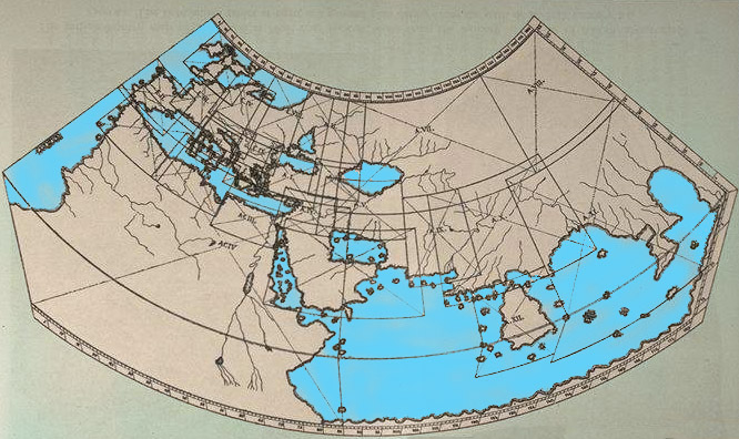
PTOLEMY WORLD MAP
The known world! At the time of the Roman Empire.
Click here to view : 500 k
PTOLEMY BRITAIN AND IRELAND MAP
Christopher Gwinn`s detailed map shows the Tribes of Britain and Ireland
as described by Ptolemy.