| WIND
TURBINES 
Because
of the several questions received, here you can find everything you wanted to
know about the eolic generators.
In the market there are cheap eolic generators
which have the capacity to cover the energy needs of about 60 houses, without
the need of doing a great electric wiring.
These systems work well in a speed
range of the wind from 3.5 m/s to 6 m/s. With mild winds or with great unexpected
demands of electric energy, the system can be complemented with solar pannels
and even with gas or diesel generators. Whereas, with the presence of hurricaned
winds, the sail can have a safe braking electromagnetic system.
The system
is complete with a long cycle battery (to store energy for several days) and an
inverter (that changes and amplifies Direct Current into Altern Current)
The
continual voltage range from 12 V (cabin) to 100 V (village) The increasing of
the power with the windspeed is in its major part linear. | THE
PETROL PROBLEM 
How
much petrol does it remain?
* Reserves: The statistics are taken from
"Oil and Gas Journal" and "World Oil" . The data have been
overestimated so through these mechanism the producer country may export more
crude. Corrected calculation: With a certainty of 50% there are 850 Gbo
*
To discover: Certainly, there is a finite amount of crude. The 90% has already
been found and 150 Gbo are left to be discovered
* Extraction rhythm: It is
not constant. M. King Hurbbert proved that the maximum will be reached when the
50% of the resource gets exploited. By extrapolation, this maximum will be reached
in 2010. 
|
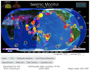
EARTHQUAKES: TO CONTROL OR TO PREDICT? 
Facing
natural disasters (hurricans, earthquakes, etc.) mankind has always had two alternatives:
try in same way to control the phenomenon or to recognize that nature is more
powerfull and only to predice (it implies a passive resignation attitude when
allowing the phenomenon occurs)
HOW EARTHQUAKES HAPPEN?
The cortex is
formed by tectonic plates that float in the "magma" (hot and semiliquid
rocks). The contact zone between two plates is called "fault". If the
plates slip slightly one over the other (or in other words, if the friction were
light) we would have an amount of shakes... slight and harmless. Unluckily in
the faults there is a great friction that keeps them in its place, while the vortices
of magma ("convection currents") produce a continual pushig which is
shown as increasing pressure.
So, when the accumulated forces exceed the friction,
there is a violent shake because of a strong movement of the plates. That is what
can be called an earthquake.
On other side, to settle a city is preferable
that the climate and the natural means of transport be favorurable. This leads
us to coasts, valleys and riversides, it means... on the faults. Effect? A 40%
of the cities in the world are in seismic zones. Just one quake can cause thousands
of deaths...
More... |
GPS TOPOGRAPHY 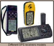
Satellites
transmit signals generated by atomic oscilators (Cs or Rb) sent to the GPS receivers.
Thanks to this the sphere radius that has the satellite as its centre and the
receiver on the surface can be determined. As data, the travelling time and the
light speed must be gotten. In order to determine the 3D position of the receiver
three spheres are needed (three equations and three unknown quantities) an a fourth
sphere to determine the error of the receiver stopwatch. It's important to say
that the system was designed in a way that from everywhere and at anytime could
be always observed a minimum of four satellites. 
Band L modulate three codes:
* D:
Data Code. It corresponds to a list with the navigation data 50 bits per second
* SPS: Standard Positioning Service (Pseudo-random noise) 1.0230 MHz (300 m resolution)
* PPS: Precise Positionig Service More... |