A Full Fenland is what you can claim to have gained if you have visited all the places with the names of multiple named settlements in the Fens of England. For the sake of clarity, a multiple named settlement is one which shares a common name with a least two other settlements and all are within 10 miles of another. This criteria rules out places like Quadring which have only two settlements sharing that name, despite an additional fen. Similarly Sutton near Ely is not required to gain a Full Sutton since it is more than 10 miles from any of the other Suttons. Nor do you need to visit the Yorkshire village of Full Sutton (or have done time at its prison) in order to gain one! All the places means all villages, Fens, Marshes and Commons with the name attributed to it. As a rule of thumb these are limited to those shown on the relevant 1:50000 map and exclude Manors or Farms with the name attributed to them. For instance, Whaplode Drove Common is not required as it only figures on the 1:25000 map. Also Whaplode Manor is not required. Internal points are given for reaching each place within a settlement group, to get the Full award for each settlement group, 100 points must be attained. The most famous of these awards is the Full Gedney. Points are not always given to all places, this is because they are synonymous with gaining another place. Examples of this include Gedney Marsh (the same as Gedney Dyke, Dawsmere or Drove End) or Holbeach Drove Common (the same as Holbeach Drove or officially the B1166 from Sheapeu Stow to Holbeach Drove). In terms of the points for a Full Fenland, there are settlement group points. These can only be gained once all places listed have been visited in that settlement, e.g. you have gained a Full Gedney or Full Kirton. A Full Fenland itself cannot be gained until all 100 settlement points have been gained, therefore you have to have visited all places listed in the Credit System table. A Barebones Fenland is also available. This entails gaining at least one settlement from all the settlement groups and is of greater prestige than the Quarter Fenland but not the Half or Full awards.
Comparing Scores
In terms of comparisons between people each without Full Fenlands. Their scores should be viewed in a similar way to the Olympic medal table e.g. one Full settlement group is viewed above a number of partial settlement groups. Taken to its extreme this could mean that someone who had a Full Kirton and nothing else would be higher than someone with all but one in every group but one. If two people have an equal number of group points, the comparison of internal points should be with respect to the weighting of each settlement. For example, having gained Holbeach Clough for 10 internal points is the same as gaining the 40 internal points for Thorpe Culvert and Thorpe Fen. To work this out exactly multiply the total number of group points available by the number of internal points you have in each settlement and divide by 100. Therefore Holbeach Clough is worth 0.8 and Thorpe Culvert with Thorpe Fen is also worth 0.8. Remember these scores are subordinate to the actual group scores and thus someone with a Full Gedney and having visited all Holbeachs except Holbeach Drove would have:
9 group points and 7.2 partial points.
This would be less than someone who had gained a Full Gedney and a Full Kirton. For a general idea of your progress the partial and group points can be added to get the Full Fenland percentage, which can be calculated using the special form
POSSIBLE FURTHER FULL FENLAND SETTLEMENT GROUP
While the Executive committee are yet to give a definitative ruling, it seems possible that Frampton may join the Full Fenland table after the existence of a settlement sign for Frampton Fen near the A52/B1192 junction. Expect developments in the near future. If anyone wishes to attempt to usurp the MFVCS and visit all the settlements on the current table plus Frampton, Frampton Fen, Frampton Marsh and Frampton West End feel free and you'll be able to say you got a Revised-Revised Full Fenland before us.
SECOND NEW FULL FENLAND SETTLEMENT GROUP
The executive board have decided to revise the Full Fenland further and admit a further settlement group. After some deliberation and a visit to the places in question, the Friskey's were admitted to the table. These were in full; Friskney, Friskney Tofts, Friskney Eaudykes, Friskney Low Ground and Friskney Fen. The controversy was over Friskney Tofts which is labelled with slanty writing on the OS map (ie. not a settlement). However various road atlases as well as the 1:100000 scale of multimap.com show it as being a settlement. While there is no sign at the location, there are indeed a number of houses along the A52 at that point and hence inclusion seemed fair. The inclusion is consistant with Pinchbeck Bars and to a lesser extent Gedney Dawsmere and is certainly more of a settlement than some of the Levertons. The Friskneys, as a new inclusion, will have a 1 point weighting which will come from a reduction in Bicker's score from 4 to 3 points. Fair considering Bicker Gauntlet and Bicker Bars are very small settlements. For full details of the exact points for each place see the Full Fenland table below. Only the Executive Board were affected by the new measures, but still have continuously held a Full Fenland since March 2000. They can merely add that on January 2nd 2001 they upgraded this to the revised Full Fenland.
Environment Agency indicts the Fens as a flood plain
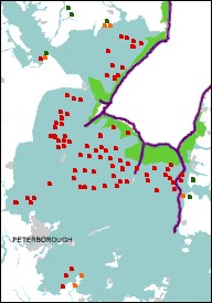
The recent flood plain maps the Environment Agency have released, paint the entirety of the Fens, with just a few exceptions, as an area at a 1 in 100 or greater risk of flooding in any year. The map to the left shows the extent to which the settlements in the Full Fenland table are affected. The red spots being those said to be at risk, the orange spots being settlements only partially affected and the green spots being those at no great risk to flooding. Only the wold villages of High and Low Toynton, and the fen edge villages of South and North Runcton and Tattershall Thorpe are out of the at risk zone. Runcton Holme, Ramsey Forty Foot, Ramsey, Toynton Fen Side and Toynton St Peter are only likely to be partially submerged. If the maps are to believed the only place that is truely fen that allegedly gets away without major risk is the Holland Fen area to the North West of Boston and to the west of the River Witham. Quite how this does escape major risk is a mystery as the land in this area is generally about 2 metres above sea level and runs parallel to the Witham. One can only assume it is protected through the fen to the east being flooded in the event of high waters but this defies logic as the eastern side is more populated, including the metropolis that is New York. Perhaps the chief executive of the Environment Agency lives there?
**** FURTHER NEWS UPDATE ****
Finally in 2004 the Environment Agency have seen the error of their ways and amended the flood plain map, which now more accurately shows precisely the areas most at risk to flooding. The good news is that many of the great Fenland village treasures are not at such great risk. Gedney Hill for instance is now only half submerged. Similarly Crowland, reflecting its historic position as having been an island in the Fens, is largely unscathed. However massive swaythes of Fen are still deemed at risk and the formerly safe Holland Fen is now doomed.
NEW FULL FENLAND SETTLEMENT GROUP
Following a recent trip, the Executive Board have rule in favour of Surfleet gaining Full Fenland group status. This is due to Gosberton Cheal being deemed to be actually called Surfleet Cheal. The prime evidence for this is a sign at Wargate near Gosberton clearly directing to Surfleet Cheal. Other evidence includes addresses using Surfleet Cheal and also Victorian maps showing Cheal House as Surfleet Cheal House. Surfleet has been given a rating of 1 point and Surfleet Fen, Surfleet Cheal, Surfleet Seas End and Surfleet must all be visited in order for a Full Fenland to be achieved. The point has been taken from Gosberton which has had Gosberton Clough and Gosberton Risegate seperated into seperate settlements once more. Currently Gosberton Cheal is not required for the Gosberton grouping as it is deemed to be Surfleet Cheal until further evidence can show the two places are seperate entities. The exectutive board have ruled that Lutton will not be a Full Fenland group because Lutton Gowts is too near Lutton itself and is little more than a farm, this is despite Lutton Garnsgate being uncovered. Finally Donington Wykes is required for the Full Donington, it is judged to be a fen rather than a settlement although Wykes Farm or Wykes Manor Farm must be visited for the points. See the updated Full Fenland table for full details. No current claimants have been affected.
Further research by the Executive Board has uncovered another multiple village group which we deem to be within the Fens. It is the Runctons. There are three Runctons, Holme, South and North. They are all settlements therefore the three settlement rule is met, they are all within 10 miles of another and they are indeed within the Fens being a hairs breath from Wiggenhall St Germans. The Runctons have been given a value of two group point due to the low number of settlements. One point has been found by changing Toynton's value to 4 from 5. Toynton was chosen due to its Fen edge location and some of the Toyntons being well within the Wolds. The other has been found by reducing Wiggenhall to 3 points, due to the lack of signs for those places (presumably because they were too expensive because the names were too long e.g. Wiggenhall St Mary the Virgin.
Also note the inclusion of Little Sutton for 10 points on the Sutton table and the reduction to 5 points from 10 of Sutton Corner and reduction to 20 points of Sutton St Edmund. Little Sutton has been deemed a settlement rather than Manor or Farm class due to the phone box and it also has a sign!
Neither of these developments affect current claimants. Prospective claimants should review their point scores.
Here is the full list of all places and their values which are required to achieve a Full Fenland.
| Settlement
Group | Associate
Name | Associate
Points | Full Group
Points | Photo |
|---|---|---|---|---|
| Gedney | 9 | |||
| Gedney | 5 | 
| ||
| Gedney Fen | 5 | |||
| Gedney Broadgate | 15 | 
| ||
| Gedney Dyke | 15 | |||
| Gedney Hill | 15 | |||
| Gedney Drove End | 20 | |||
| Gedney Dawsmere | 25 | |||
| Holbeach | 8 | |||
| Holbeach | 5 | 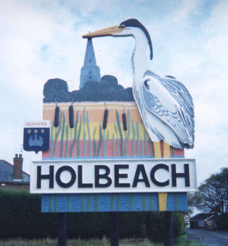
| ||
| Holbeach Fen | 5 | 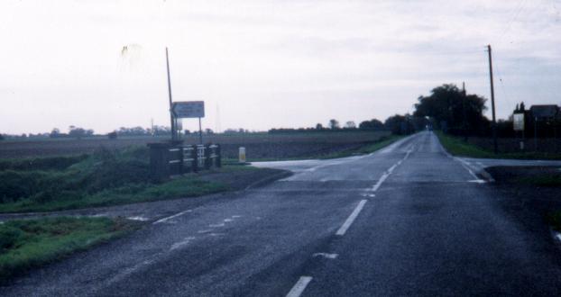
| ||
| Holbeach Marsh | 5 | 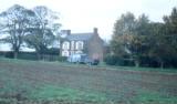
| ||
| Holbeach Clough | 10 | 
| ||
| Holbeach Drove | 10 | 
| ||
| Holbeach St Johns | 10 | 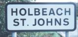
| ||
| Holbeach Hurn | 10 | 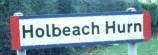
| ||
| Holbeach Bank | 10 | 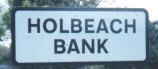
| ||
| Holbeach St Marks | 15 | |||
| Holbeach St Matthew | 20 | 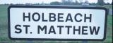
| ||
| Sutton | 7 | |||
| Sutton Corner | 5 | 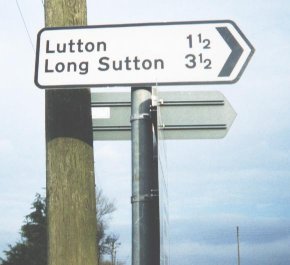
| ||
| Little Sutton | 10 | |||
| Sutton St Edmund Common | 10 | 
| ||
| Sutton Crosses | 10 | |||
| Long Sutton | 15 | |||
| Sutton Bridge | 15 | 
| ||
| Sutton St James | 15 | 
| ||
| Sutton St Edmund | 20 | 
| ||
| Moulton | 7 | |||
| Moulton East/West Fen | 10 | 
| ||
| Moulton Common | 10 | 
| ||
| Moulton Marsh | 10 | 
| ||
| Moulton Chapel | 15 | 
| ||
| Moulton | 15 | 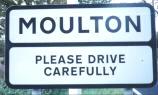
| ||
| Moulton Seas End | 20 | |||
| Moulton Eaugate | 20 | 
| ||
| Deeping | 6 | |||
| Deeping Common | 5 | 
| ||
| Deeping St Nicholas | 15 | |||
| Market Deeping | 15 | 
| ||
| Deeping St James | 20 | 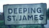
| ||
| Deeping Gate | 20 | |||
| West Deeping | 25 | 
| ||
| Walpole | 6 | |||
| Walpole Marsh | 15 | 
| ||
| Walpole St Peter | 20 | 
| ||
| Walpole St Andrew | 20 | 
| ||
| Walpole Highway | 20 | 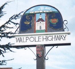
| ||
| Walpole Cross Keys | 25 | 
| ||
| Tydd | 6 | |||
| Tydd St Mary's Marsh | 10 | 
| ||
| Tydd St Giles Fen | 10 | 
| ||
| Tydd St Mary's Fen | 10 | 
| ||
| Tydd St Mary | 20 | 
| ||
| Tydd Gote | 25 | 
| ||
| Tydd St Giles | 25 | 
| ||
| Ramsey | 5 | |||
| Ramsey Fen | 5 | 
| ||
| Ramsey Mere | 5 | 
| ||
| Ramsey Hollow | 5 | 
| ||
| Ramsey | 10 | 
| ||
| Ramsey Mereside | 15 | 
| ||
| Ramsey St Mary's | 20 | 
| ||
| Ramsey Forty Foot | 20 | 
| ||
| Ramsey Heights | 20 | 
| ||
| Toynton | 4 | |||
| High Toynton | 20 | 
| ||
| Low Toynton | 20 | 
| ||
| Toynton All Saints | 20 | 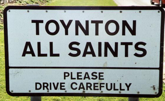
| ||
| Toynton Fen Side | 20 | |||
| Toynton St Peter | 20 | |||
| Leverton | 4 | |||
| Leverton | 15 | 
| ||
| Leverton Ings | 15 | 
| ||
| Leverton Highgate | 20 | |||
| Leverton Lucasgate | 25 | 
| ||
| Leverton Outgate | 25 | 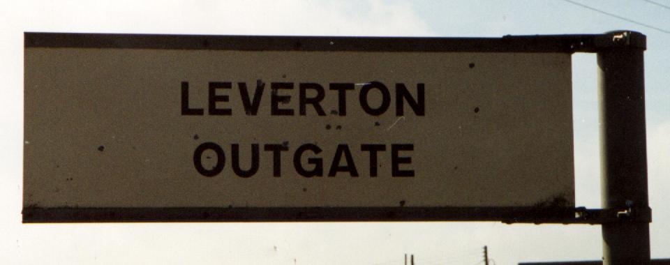
| ||
| Tilney | 4 | |||
| Tilney Fen End (Side) | 10 | |||
| Tilney All Saints | 15 | 
| ||
| Tilney High End | 20 | 
| ||
| Tilney St Lawrence | 25 | 
| ||
| Tilney cum Islington | 30 | |||
| Whaplode | 4 | |||
| Whaplode Fen | 5 | 
| ||
| Whaplode Marsh | 15 | 
| ||
| Whaplode | 25 | 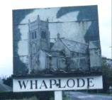
| ||
| Whaplode Drove | 25 | 
| ||
| Whaplode St Catherine | 30 | 
| ||
| Bicker | 3 | |||
| Bicker | 20 | 
| ||
| Bicker Fen | 20 | 
| ||
| Bicker Bar | 20 | |||
| Bicker Haven | 20 | |||
| Bicker Gauntlet | 20 | 
| ||
| Gosberton | 3 | |||
| Gosberton | 15 | |||
| Gosberton Fen | 15 | 
| ||
| Gosberton Marsh | 20 | 
| ||
| Gosberton Risegate | 25 | 
| ||
| Gosberton Clough | 25 |
| ||
| Wiggenhall | 3 | |||
| Wiggenhall St Mary the Virgin |
15 | 
| ||
| Wiggenhall St Germans |
20 | 
| ||
| Wiggenhall St Mary Magdalen |
25 | 
| ||
| Wiggenhall St Peter |
40 | 
| ||
| Pinchbeck | 3 | |||
| Pinchbeck | 10 | 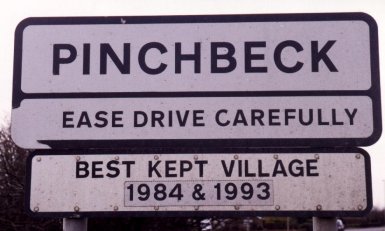
| ||
| Pinchbeck West | 10 | 
| ||
| Pinchbeck Bars | 15 | 
| ||
| Pinchbeck North Fen | 15 | 
| ||
| Pinchbeck South Fen | 15 | 
| ||
| Pinchbeck Common | 15 | 
| ||
| Pinchbeck Marsh | 20 | 
| ||
| Wainfleet | 3 | |||
| Wainfleet All Saints | 10 | 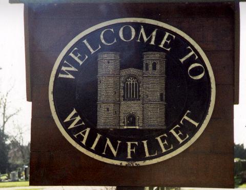
| ||
| Wainfleet St Mary | 10 | |||
| Wainfleet Tofts | 15 | 
| ||
| Wainfleet St Mary Fen | 15 | 
| ||
| Wainfleet Common | 15 | 
| ||
| Wainfleet Bank | 15 | 
| ||
| Wainfleet Clough | 20 | 
| ||
| Wrangle | 2 | |||
| Wrangle | 10 | |||
| Wrangle Lowgate | 10 | 
| ||
| Wrangle Bank | 15 | |||
| Wrangle Low Ground | 20 | 
| ||
| Wrangle Common | 20 | |||
| Wrangle Tofts | 25 | 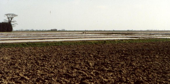
| ||
| Thorpe | 2 | |||
| Thorpe Fen | 10 | 
| ||
| Thorpe Dales | 10 | |||
| Thorpe Fendykes | 20 | 
| ||
| Thorpe Culvert | 30 | 
| ||
| Thorpe St Peter | 30 | 
| ||
| Leake | 2 | |||
| Old Leake | 15 | |||
| Leake Common Side | 15 | |||
| Leake Ings | 15 | 
| ||
| New Leake | 25 | 
| ||
| Leake Hurn's End | 30 | 
| ||
| Kirton | 2 | |||
| Kirton Meeres | 15 | |||
| Kirton | 15 | 
| ||
| Kirton Marsh | 20 | |||
| Kirton Holme | 25 | 
| ||
| Kirton End | 25 | |||
| Donington | 2 | |||
| Donington | 10 | |||
| Donington Wykes | 15 | |||
| Donington Westdale | 15 | 
| ||
| Donington Eaudike | 25 | |||
| Donington South Ing | 35 | 
| ||
| Runcton | 2 | |||
| South Runcton | 25 | 
| ||
| North Runcton | 35 | 
| ||
| Runcton Holme | 40 | 
| ||
| Tattershall | 1 | |||
| Tattershall | 25 | |||
| Tattershall Bridge | 30 | 
| ||
| Tattershall Thorpe | 45 | 
| ||
| Friskney | 1 | |||
| Friskney | 15 | 
| ||
| Friskney Tofts | 20 | 
| ||
| Friskney Eaudykes | 20 | 
| ||
| Friskney Fen | 20 | 
| ||
| Friskney Low Ground | 25 | 
| ||
| Surfleet | 1 | |||
| Surfleet Fen | 15 | 
| ||
| Surfleet | 25 | 
| ||
| Surfleet Cheal | 30 | 
| ||
| Surfleet Seas End | 30 | 
|

All claims should be sent to The executive Board of the Multiple Fenland Village Collecting Society. Claims should include some original observations if possible which may be verified.
You can get an idea of your own progress by using the Full Fenland Percentage Calculator.Here is the current table of claimants.
| Name | Group
Points | Partial
Points | Current
Claims |
|---|---|---|---|
| James Pepper | 100 | --- | Full Fenland |
| Andrew Titman | 100 | --- | Full Fenland |
| Daniel Felton | 100 | --- | Full Fenland |
| Katie Chatterton | 17 | N/A | Full Gedney, Full Holbeach |
| Ed Peacock | 17 | N/A | Full Gedney, Full Holbeach |
| Richard Mariner | 15 | N/A | Mandatory Full Gedney, Full Deeping. |
| Richard Lycett | 9 | 17.65 | Full Gedney, Half Deeping, Half Tydd, Partial Holbeach, Half Whaplode, Partial Surfleet |
| Zoe West | 9 | N/A | Full Gedney |
| Jake Simpson | 9 | N/A | Full Gedney |
| John Boulton | 9 | N/A | Full Gedney |
| Steve McLachlan | 9 | N/A | Full Gedney |
| Kevin Chapman | 6 | N/A | Full Deeping |
| 'Aussie' Tom Barley | 3 | N/A | Full Wiggenhall |
* The sign from the Gedney Hill direction has SUTTON ST. on the top line and EDMUND below, whereas the sign from the Parson's Drove/Throckenholt direction has SUTTON on the top line and ST EDMUND below. Both have 'Please drive Carefully' below this. However the sign in the Parson's Drove end is a long way down the sign poles.
* There is what looks like an old Methodist chapel dated 1869, but the bit on the side of it is dated 1868.
* There is a nice painted sign in the centre of Sutton St Edmund with 'Sutton St Edmund Chapel End' written on it and a picture of the church on it. It is on the opposite side of the road to the church.
* The church, or perhaps chapel as it might better be described is made of brick with a little tower with a white top.
* There is an old school house with the words 'BOARD SCHOOL' and 1896 written on it.
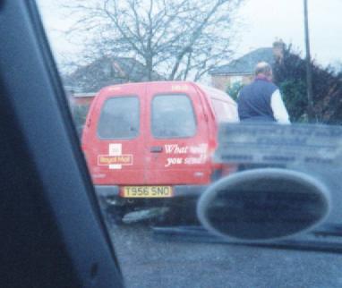
* You may also like to try to ease the upsurge in rural crime. We are doing our bit by telling you that a Royal Mail van was seen overtaking a car which was going just on 60mph, between Saturday Bridge and Holbeach on the B1168 at 11.32am on Monday 25th October 1999. The van had a registration plate T956 SNO and the offender was seen a few minutes later in Holbeach itself.
* St Martin's Church just outside Holbeach Bank is clearly well attended as the photo shows.

* School buses in the Fens seem to have nothing better to do than delay avid multiple village collectors. We deduce this from the fact that we were delayed by the very same bus at both 9 am between Sutton St Edmund and Parson's Drove and at 3.50pm at Holbeach St Johns. The bus has the registration number WKK 744 S, and is from W & M Travel of Parson's Drove. Cockrams Lorries seem to enjoy such pursuits as well, as we saw them on numerous occasions in the Tilney cum Islington area.


* We therefore thought it apt to return the favour and visit W & M Travel's Parson Drove depot on a later trip

* Workmen near Wiggenhall St Germans seem to get confused if you drive past them four times in the space of half an hour and even more so if you then take photographs of them and seemingly uninteresting signs.
* The telephone box at Sutton Crosses has no door, to call this extraordinary phone box call 01406 362118, call any time of the day or night. Who knows some passing resident may pick it up or even the horse in the nearby field!
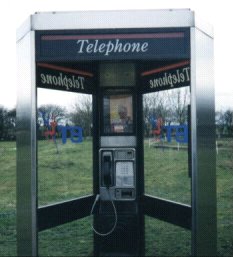
* There are numerous telephone boxes in Fenland villages and the surrounding area. Please feel free to call them day or night to enquire about the MFVCS and the Fens in general. Here is a list of just a few:
Tattershall - 01526 342210
Kirton Holme - 01205 290213
Kirton - 01205 722266
Hubberts Bridge - 01205 290218
Brothertoft - 01205 280201
Thurlby (a) - 01778 422320
Thurlby (b) - 01778 422433
Baston - 01778 560331
Frognall - 01778 343216
Folkingham - 01529 497213
Sutton Crosses - 01406 362118
Crowland - 01733 210364
Pondersbridge (near The Plough) - 01733 844239
Pondersbridge - 01733 844324
Ramsey Heights - 01487 813776
Ramsey Forty Foot - 01487 812379
Eastrea - 01733 351159
Parson Drove (Church End) - 01945 700570
Parson Drove - 01945 700380
Throckenholt - 01945 700345
Gedney Hill - 01406 330407
Gedney Hill (North Road) - 01406 330486
Holbeach Drove - 01406 330384
Sheapeau Stow - 01406 330331
Dowsdale - 01406 330230
Croft nr Thorney - 01733 849237
Nene Terrace - 01733 210291
* The Angel Filling Station in Terrington St Clements is clearly the local BNP headquarters, it is supplied by 'National' and flies both a Union Jack and the St George cross.
* Cekhira Avenue in Moulton Chapel is named in memory of F/O A.H.M Clark who was killed at Cekhira, Tunisia on the 7th April 1943.

* There must be some olde Fenlander measure of length which is roughly equivalent to 142 of your new fangled yards. Why else would there be so many Give Way, 142 yds signs???

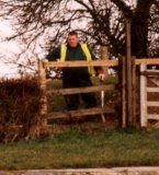
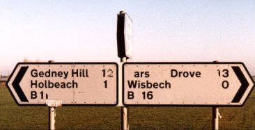
* Defacing signs seems to be a major pastime of Fenlanders. Mind you, who can blame them when the sign makers themselves make such blunders. A sign on the B1166/B1167 junction says Gedney Hill 12 even though it is about a mile from Gedney Hill. The two has been partially scratched out, and it is unclear whether the helpful person who did this was also the person who made Parson Drove, ars Drove, comical as it is. Sadly this sign is no longer there to be viewed as the local council have replaced the sign. Notably the new sign does not have any distances in the East-West directions so we can only conclude that the distances controversy was never properly resolved.
* As if it wasn't evil enough that the gits to the north of Horseshoe Farm near Terrington St Clement put a barrier up to stop people driving down the track. The depraved individuals also misunderstood what a scarecrow was and thought it was something scary involving a crow. They therefore killed some nearby crows and hung them by their necks in fields or just on a tree.
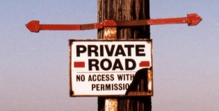
* The island in the Wash at NGR TF543270 is one of the best places on the face of the planet. It is equipped with a nice little beach on the south shore and rock defences on the north side. It is 12 metres above sea level at its highest point and excellent views of much of the Wash can be gained from its peak.
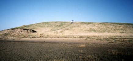
It was undoubtedly worth the near 6 mile, 1 hour 45 minute walk in the cold north-westerly wind to reach it from NGR TF553235 which is 2.25 miles away even as the crow flies (although it gets strung up in this area). The only regret came after we found that some people were able to park just south of the Wash Coastal Path. Obviously we should have taken more notice of the sign which clearly states no access with permission, and since we didn't have permission we'd be alright!
* Bicker Bar services has an appalling road safety record as this rodent would undoubtedly agree if he was in any fit state to do so (although last time I looked rats couldn't talk regardless of whether their guts were spilling from their mouths!)

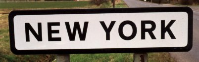
* Not a lot of people know this, but, the city of New York is not on the East coast of the USA, oh no, it is in fact in Lincolnshire. And it isn't very big either, although the crime rate may be as high if the lack of a phone in the phone box is anything to go by.
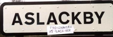
* Eloquence and correct pronunciation is a very handy skill, therefore the villagers of Aslackby should be grateful we were able to let them realise that they live in As-lack-bee not Azelby!!!
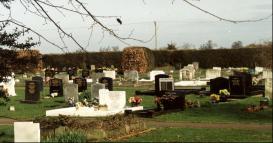
* In contrast to the graveyard at Gedney Dawsmere, the Ramsey cemetery is very full.
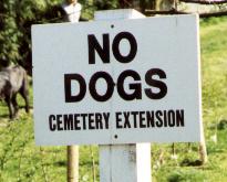
* Worse still, at Wainfleet All Saints there's a cemetery extension!
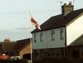
* The residents of Ramsey Heights are not as dumb as they look, they are well aware that their below sea level position puts them at a grave risk of flooding in the near future. Which is why there is an RNLI flag (and small rowing boat) at Ramsey Heights, some 30 or so miles from the nearest coastline.
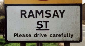
* Its a little known fact that the soap Neighbours is filmed in Cambridgeshire, as this sign shows:
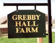
* There's a certain hamlet in central Lincolnshire which is really disgusting and grebby, its Grebby!!!
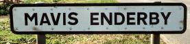
* Parish councils in Lincolnshire have become so strapped of cash that they have been forced to allow people to have a sign with their name on it erected by the road side for a small fee. Mrs Mavis Enderby for instance, paid Ł100 for this:
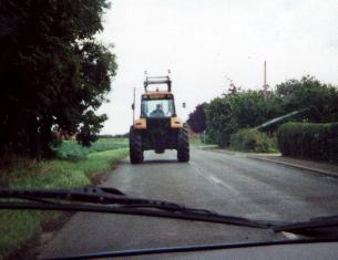
* Farmers get confused and/or worried if you pass them and then let them overtake you three or four times, and take photos of them as you go.
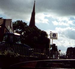
* The church has a very wonky tower spire indeed. Chesterfield's might be twisted but Surfleet's just looks like its going to fall onto the pub on the opposite side of the road. Unfortunately this poor photography doesn't illustrate the problem very well.
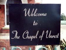
* There is a sign outside the chapel in Quadring Eaudike which says 'Welcome to the Chapel of Unrest'. Credit must go to Daniel Sellers for pointing this out.
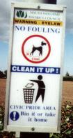
* South Holland District Council have a Ł500 fine for fouling in their Civic Pride Areas. Incidently, Gedney Hill F.C.'s ground is not a Civic Pride Area which might explain the nature in which they play (not that we've seen them play or anything).
* The Pinchbeck Engine/Drainage Museum is one of the most interesting museums in the entirety of the world and at Ł0.00p entry its quite good value for money too.

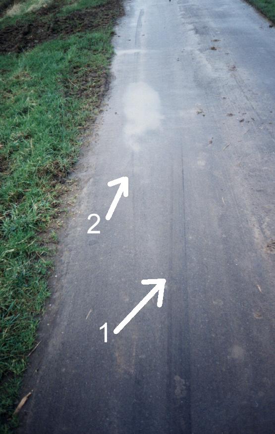
* Observe the photo of the road. Arrow 1 points to a skid mark of approximately 7 metres (23 feet) in length caused inadvertanly. Arrow 2 points to an additional skid mark made purposefully a few minutes later. These famous marks were made on the 2nd of January 2001, to see how long skid marks stay on a road visit NGR TF433564, thats on Landranger map 122 and on the road between Eastville and Friskney Eaudyke. To add to the interest the famous dead rabbit was also found but a few miles from here on the same road!
Obviously just one picture of the Pinchbeck Engine Museum isn't going to be enough, so head over to the MFVCS Gallery in order to see many more pictures and an unabridged version of many of the photos featured on this page.
You should now be Fenland bound!
![]()
![]()