
Tena with our new kayaks on the beach in Barkley Sound, July 1998
Hi, I'm Earl.
I'd like to share these pictures with anyone interested in: HIKING RECUMBENT BIKES, alpine skiing and back country telemark skiing TELESKI, SEA-KAYAKING, CANOE SAILING, SNORKELING (Hawaii). See below for REPORTS on our latest adventures in the Great Northwest.
Click here to see some homemade woodworking tools WOODWORKING TOOLS
Click here to see our HIKE PAGE
 Island Canoe's Canoe Sailing and Sea Canoeing Page of Pictures.
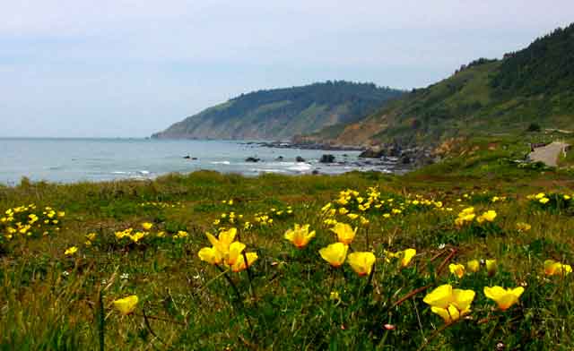
Poppies seen on our bike tour of the Northern California Coast
Pictures from our tandem recumbent ride to San Francisco on the Northern California Coast.
Interested in Yakaboo? click here to see my article on Fenger's rudderless sailboat YAKABOO
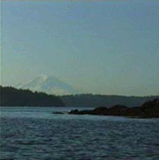
Mt Rainier and Orchard Point, taken while canoeing to the Manchester Inn for Breakfast
Pictures from our ride on the Big Sur Coast.
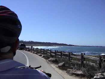
More pictures from our ride on the Big Sur Coast.
Still more pictures from our ride on the Big Sur Coast.
Tena and I live on Bainbridge Island. I'm 66 years old and retired. After retireing in 1996 I built a couple of sea kayaks to replace our old ones that were slow, stiff and liked to weathercock. I finished them just in time for our annual trip to Vancouver Island with the BIPS (Bainbridge Island Paddling Society) at the end of July.We published current and tide tables (Island Canoe Inc) and current guides for 17 years. Now we're retired. If you have any questions about sea kayaking and tides and currents, let me know (via Guestbook).

Gary and Sharon tackle the surf in Pachina Bay, West Coast Vancouver Island - open canoe fashion!
We enjoy sailing open canoes on tidal waters. We go where the sea kayaks go and when the wind is right we sail. It's a blast. Interesting places we have sailed our open canoe include Cape Flattery, La Push, Strait of Juan de Fuca, San Juan Islands, Puget Sound, West Coast of Vancouver Island (Barkely Sound, Clayoquot Sound, Nootka Sound, Nuchatlitz, Bunsby Islands).
 Video, Sailing Island Cruiser in strong wind at Rolling Roadstead, west coast, Vancouver Island.
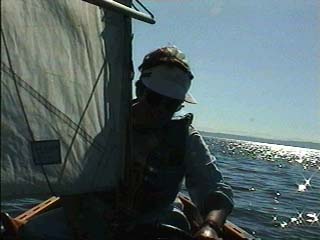
In our sailing canoe the Island Cruiser
Our sail rig is designed for cruising and we use whitewater air bags for flotation in case of a capsize. Somethimes we wear dinghy suits or wet suits for added safety and we always wear our PFDs. The whitewater airbags make a canoe easy to self rescue. It's easier than a wet reentry of a sea kayak. If you have any questions about sea canoeing or canoe sailing, let me know (Guestbook). Also, take a look at our sea canoeing and canoe sailing page listed below (link).
Video of canoing in sea caves on Washington's Pacific coast.
Video of canoing at Point of Arches.
Video of canoe sailing with sea kayakers at Florencia Bay, Quadra Island, Canada.
Video of canoing with sea kayakers in rough waters off La Push, Washington.
Video of canoing with sea kayakers at Catala Island, west coast of Vancouver Island.
HERE'S WHAT WE'VE BEEN UP TO LATELY
July 2008, I haven't been updating the activities, though I have added video clips. Now it's time to catch up with the major recent activities. Son Shawn and I had a bike ride on the Oregon Coast in early July.
SLIDE SHOW OF OREGON BIKE RIDE.
Click on the slideshow tab - upper left.
In mid July Tena and I went with the Bainbridge Island Paddling Society (BIPS) to Orcas Island in the San Juans where we kayaked for 5 days. Slides to follow.
April 2008, We take a road trip to Denver, Taos, Canyon de Chelly, Death Valley and places in between.
DENVER BOTANICAL GARDENS AND FRIENDS
TAOS
BANDALIER
WINDOW ROCK HIKE
CANYON DE CHELLY
WHITEHOUSE RUINS HIKE
GANADO, ARIZONA AND WILDFLOWERS
DEATH VALLEY AND WILDFLOWERS
Haven't updated the activities in a year. We did a lot of skiing last year and it was wonderful until Tena's knees started to fail. Lots of Powder snow at Stevens. A few days in the Gold Hills house with skiing at Crystal and 2 days of wonderful skiing at Mt Hood in the Spring. Also, a trip to Hawaii in October with our parents aged 92 and 96 with lots of snorkeling.
January 10, 2008, Hurricane Ridge in Olympic National Park had 19 inches of new snow. I enjoyed a great ski hike out toward Hurricane Hill. The heavily laden trees were snow ghosts and late afternoon sun turned the landscape into a wonderland of shadows and textures. Hurrican Ridge Ski Hike
May, 2007, We travel to Turkey. What an experience! Ancient ruins. Persian hisotry, Biblical history, Greek history, Roman history, Ottoman history, Modern history. The people and culture and food are fantastic. Scenery along the Aegean is beautiful and we especially enjoyed the five day small boat cruise in the Aegean.
We had two week-long kayak trips to Canada in the summer, one to the Broughton Archipelago, northern Vancouver Island with our kayak group. The other with our sons and daughter-in-law to Nuchatlitz on the west coast of Vancouver Island. Both were wonderful trips with excellent weather and wonderful companionship.
We managed to work in a few hikes and bike rides too as well as volunteer stewardship of rare native wildflower species through Rare Care at U of W. Finally, back to Mt Hood in Sept. for more hiking and bike rides along the Deschutes and the Columbia rivers.
Oct 5, 2006, We take a short ride on the Olympic Discovery Trail from Robin Hill Park to Port Angele. It is cold, but views along the Strait of Juan de Fuca are a treat. We have a picnic in the sun at Port Angeles and a chance to warm up. 27 miles.
Oct 2, 2006, We got brave and rode a new route on the tandem. Started in Winlock and headed up the hill and northwest toward Lewis and Clark State Park, eventually reaching Onalaska where we had lunch and a potty stop. The roads are quiet, rural byways for the most part. A few short steep hills gave us a good work out on this 35.5 mile ride. We averaged only 10 mph, Max speed was 37. New gears work well for us, even on steep hills.
Sept 26, We rode the tandem to Chimacum from Port Ludlow. The new gear system and short cranks worked well for us. Had to replace it all when the 3x9 dual drive hub failed in Victoria. To get the low gears we need I had to go to mountain bike cranks. Also wanted shorter cranks which are hard to come by (165mm Captain and 160mm Stoker). DaVinci cranks had the goods. They are beautiful. This was the first real test and we are happy with them. The low gear is adequate and the short cranks are easier on the knees and allow a faster cadence.
Sept 23,24, We have a rare opportunity to lock through McNary Dam on the Columbia River with Washington Water Trails. Led by Sarah Krueger about 28 kayakers and we in our canoe paddled to the dam from Plymouth Park. We were escorted by Coast Guard Auxiliary and Corps of Engineers Boats. Special arrangements had been made to allow us to remain in our small boats as the lock was flooded and we were lifted 75 feet. We rose quickly, though one of the escorts said the lock flooded slowly to give us a gentle ride. After the lock was opened we paddled to the Oregon side and had lunch at McNary Beach. Then we continued to Hat Rock State Park for the take out. We saw a couple of Great Horned Owls in a tree close to shore. Pictures of locking through the dam
The next day Tena and I put in at Patterson and paddled to the Patterson Unit of the Umatilla National Wildlife Refuge where we saw White Tail Deer, Great White Egrets and White Pelicans along with ducks and Yellowlegs. Weather was warm and the wind calm both days.
Pictures Patterson Slough
Sept 12, we ride the tandem recumbent to Quilcene, a nice little 21 mile trip. Lots of fish were migrating up the Big Quilcene River. Enjoyed nice weather for an easy conditioning ride.
Aug 26 - Sept 5, Travel to Vancouver Island for sea kayaking on the west coast at Nuchatlitz. With 7 friends we spent a week at Nuchatlitz Island in a very nice rustic house. Each day we kayaked in the ocean or among the islands of Esperanza Inlet. Sunny days, blue skies, calm winds, gentle seas made for a perfect kayak vacation. Gourmet meals cooked on a gas range topped the fine dehydrated noodle meals we used to enjoy cooked at camp on a one burner stove. We made good use of the oven too.
Every day we saw Sea Otters. A large pod lives in the ocean a few minutes paddle from where we stayed. Individual otters swam by in front of the house too. We also saw Humpback Whales, Dolphins, Seals, Sea Lions and Eagles and other birds. It is a fascinating place to kayak. This was our third trip to the area, which is on the north side of Nootka Island.
Pictures from .
August 16, Hiked one of our favorites - Deer Park to Elk Mountain. Solid cloud cover blocked the sun and a cold breeze inspired us to walk fast. After an hour the sun was out, but the breeze held until we reached the summit where we enjoyed a warm sunny rest with excellent views of Olympus and all the surrounding peaks.
Pictures Elk Mountain Hike.
August 13, 2006, We hike up the Duckabush River Trail with friends Mark and Willow on a beautiful late summer day. We stop at an open slope above tall cliffs and enjoy our lunches with a spectacular view of the Duckabush Valley and the cliffs and peaks of St Peter's Dome. We continue after lunch to the top of Big Hump before returning to the car. We end the trip with a stop in Quilcene for ice cream cones. Ummm good!
August 7, we hike up Mt Townsend in the Olympics. It's a nice day and there are still lots of wildflowers. We see tons of Woodland Penstimon in the forest. Coming out of the woods on top we see the indiginous Piper's Bellflower. There are also a lot of Eligant Camus. On top there are excellent views of Buckhorn, Greywolf ridges and the Needles, but the view toward the Cascades is very hazy. On the way up I saw a string on the ground and found that it was attached to a little purse that contained a digital camera. I picked it up and carried it down. I left my name and number in the register with a note that I had found something, but I didn't see the note the owner had left on the kiosk. The Ranger Station at Quilcene was closed when we got down, so I called them in the morning and arranged to mail the camera to them (two cameras had been reported lost). In a few days I received a nice phone call from the owner who very much appreciated my returning the camer. She even offered to send me a gift for my camera or take us to lunch, but I think it is best to just pass on the courtesy. I have personally lost two cameras that were not returned to me.
July 29, we take the bike on the ferry to Seattle and ride to Alki Point and along the coast to Lincoln Park with lunch at the Alki Bakery. There is an arts and crafts fair at Alki and we spend an hour looking at the booths on our way back. This was a fun ride on a nice sunny weekend day.
July 20, 2006, We ride our tandem recumbent bike on the Olympic Discovery Trail. We have an new rear wheel sans 3X9 hub. This means our lowest gear is 30% higher than before. That's why we have chosen the relatively easy trail. Some short steep grades will give us an idea of how bad it is without the ultra low gear. We decide that lower gears are indeed needed. We will have to get new cranks with smaller chainrings to obtain lower gears. This is a nice ride and we go about 28 miles through Sequim, farmlands and deep woods in nice weather.
June 27, Mt Zion in the Olympics. Warm weather, so early start to avoid heat. Hazy view of Cascade range.
June 21, 2006, Lake Ozette Loop. Great weather, low tide, pleasant hike.
June 11-13, Visit Victoria, Canada by bike and ride the Galloping Goose Trail. We drive to Port Angeles, park the car and load up the bike with clothes and overnight gear. Bike riders board the ferry with foot passengers instead of on the car deck. The long ramps up to the deck have tight switchbacks that are a challenge to negotiate with our 8 foot long tandem recumbent, but we manage.
The voyage across the Strait of Juan de Fuca is dulled by dense fog. Just before reaching Vancouver Island the fog begins to clear and it is nice and sunny in Victoria. Our first destination is the Visitor center a short distance from the ferry terminal. We ride the streets in moderate traffic and do ok with the left turns at traffic signals. There are no maps of bike routes on Victoria streets, but we get a map of the Galloping Goose. We check into a condo on the waterfront and ride around the harbor and over the James St bridge to Spinnakers brew pub for dinner. It is a fine place and reasonably priced. The food is great.
Next day we ride downtown for breakfast at the Dutch Bakery, then head out on the Goose. It's a nice trail and we ride to Thetis Lake Park. Then down to 6 mile house for lunch. Return via Tillicum St and Gorge Rd. After a swim in the pool we ride to the Thrifty Mart to buy groceries, so we can fix our own dinner. It's steaks on the grill.
Next morning we walk to a restaurant for breakfast, then head out on the scenic drive along the Strait. We leave the shoreline drive for a climb up some hills to view picturesque gardens and quaint homes.
We have discovered that our 3X9 dual drive rear hub has suffered a breakdown. I try to adjust it and only make matters worse. I finally concede that it is cooked and resign to leaving it in low gear, so we can at least ride it.
Then head back to the scenic drive and out to Oak Bay. This is a pleasant old community with interesting shops and restaurants. We head for the touted White Heather Tea Room for an excellent lunch. This popular place is always crowded, but we are lucky and snag a table without waiting. After lunch we climb some easy hills for a look at local sights and lovely gardens. Then it's back to the condo to pick up the rest of our bags and down to the ferry for the trip back. The weather was lovely and so was the city.
June 7, Today we rode the Screamer from Miller-sylvania state park to the little town of Rainier. It's a nice easy ride with a few steep hills thrown in for variety. The sky was sunny and the weather cool for a nice ride. Not too many wildflowers, but we did see Sitka Columbine, Foxglove and Bleeding Heart. Took time to chat with other riders on the Chehalis Western Trail. 28 miles.
May 30, 2006, an "easy" bike ride. Steamboat Island turned out to have some short steep hills on the side roads of the return route. We got kind of burned on this easy ride. It was fun though.
MAY 20, 21, 22, With our kayaking friends we return to the Pot Holes lakes near Moses Lake in Eastern Washington. Paddling in the desert means cliffs, canyons, strange birds and, the downside, ticks, poison ivy and rattle snakes. Well, it seldom rains, but we did see a little precip. Look
HERE
for pictures from the Pot Holes. After paddling with the kayak group on Hutchinson and Shiner lakes on Sunday, Tena and I drove to The Dalles, Oregon. Monday we planned to look at wildflowers near Mt Adams. We saw lots of Penstimon, Lupine, Balsam Root and Brodiaea. Heavy rain kept us in the car a good part of the time and some of the area we intended to explore was still snowed in. One shower was so intense we had to pull over and get off the road as we could not see.
May 10, We try a more difficult ride: Port Ludlow to Chimacum and return via West Valley Road. It's only 24.5 miles, but has lots of climbing, long and steep hills. We have lunch and pie at the Chimacome Cafe including delicious Raspberry-Rhubarb pie. We average only 8.5 mph, but are taking it easy to get back into shape.
May 4, We need a bike ride. An easy one. We choose Elma, McCleary, Malone, Porter loop. The weather is nice and we see a few wildflowers along the way. It's 37 miles and not too hilly. We average only about 9 mph, but we are out of shape.
April 30, Back country skiing again! finally! It's been over a year since we've done this. We start at Paradise, Mt Rainier, with Son Brian and his wife Wendy. They are on snowshoes. We hike up past Alta Vista to Glacier Vista at the base of Panorama Point. Tena is using her Atomic Outback skis with fish scale pattern for climbing. I'm on my old Tua Big Easy skis with the new VP II binding and release safety binding. I'm also using my Crispi CX 2 boots for the first time in the backcountry. Everything works fine, except maybe my old narrow skins. full width skins would be better, but these are ok for this easy hike. Tena is using her Garmont Excursion boots for only about the third time and she still likes them. Low clouds at Paradise allow only partial views of the mountain until we gain some elevation. We climb 1,000 ft to Glacier Vista and luckily the clouds settle into the valley to give us good views of the mountain. As we start down the clouds come up to meet us, so we ski mostly in the fog. The snow isn't the best for easy skiing, but we enjoy it. This easy hike was just right for us being out of shape. It was fun to do it with Brian and Wendy. They took us to a neighborhood Pizza Pub and treated us to dinner afterward. It was a wonderful day all around.
Pictures
April 22, Brooke led our kayak group, the BIPS, on an Earth Day trip to Prichard Park to help pull Scotch Broom and cut Ivy. We (Brooke, John, Kathy, Tena, Earl, Bill, Rita, Jeanette, Donald and Mike) left from the road end near Brooke's condo and paddled Eagle Harbor ahead of a cold tailwind. At the park we pulled and cut for about 2 hours. It took hard work to warm us in that cold breeze. After a snack we got back in the boats and headed out to the mouth of the harbor, then crossed over to Wing Point. We hugged the shore on the way back to stay out of the wind. It was warm and calm as we wound our way through the maze of docks and moorages back to Brooke's place. A strong headwind challenged us the last little bit to the take out. Brooke treated us to a pot of delicious Mexican Sopa which was served with all kinds of goodies everyone had brought.
April 17 - 20, A few days at Mt Hood. On Tuesday we skied at Mt Hood Meadows on perfect Spring snow. It was a gorgeous day with clear skies and perfect temperature. The snow never got slushy all day. There were a couple of inches of fresh snow to dip into off of the groomed runs. The view of Mt Hood is spectacular from anywhere in the ski area. A friendly local guy showed us around for a couple of runs to be sure we didn't miss the best parts. On Wednesday we drove to the Columbia Gorge to look at wildflowers. First we went to Dallas Mtn on the Washington side where we saw mostly Balsam Root. After lunch we went to Rowna Crest in Oregon and hike to McCall Crest with a variety of wildflowers. On Thursday we headed home, but stopped first at Catherine Creek on the Washington side of the gorge for the most spectacular show of wildflowers.
Mar 29, 2006, Skiing at Stevens Pass on firm Spring snow. When the sun came out the snow was slow, when a cloud passed over the snow was fast. Eventually the clouds stayed and the skiing improved. Off piste was terrible, grabbing the skis and holding them like a giant fist.
Mar. 22, skied Stevens again. Fun as usual.
Mar 14, 2006, Skied at Stevens again. No new snow, but it's been cold,so the groomers were in good shape. Off Piste wasn't so hot. We had a good time and Tena was in great form rolling her edges and doing smooth turns on the fast snow.
Feb 28, Skied at Stevens in heavy snowfall with about 4 inches of fresh on the surface. It was good skiing. Off the runs the snow was pretty broken up and you could feel the crust underneath as you went over the thin spots. Had a good day working on my carving and edge release.
Feb 22, 2006, We ski at Stevens Pass again. There were a few inches of new snow overnight, so some powder skiing was to be had in the trees and at the edges of the ungroomed runs. It was pretty good actually. We had a great time and I practiced releasing my edges before switching leads. Worked pretty good.
Feb 18, Tena joined the annual sea kayak trip to the Skagit Delta to view the Snow Geese that rest in the area during their migretion. Here is Brooke's artful description of the trip:
Our Skagit River paddle was lovely. The day was bright and beautiful.
Cold as Blitzen, but the sun compensated well. Picture trumpeter swans in
pairs gliding over a sunset gilded delta, snow geese on the wing, and swaths
of dunlins swooping across the horizon. Also, ask us about the Wet Portage
method of travel. Ask us how to thaw out toes and fingers near the car
heater. Ask us about Conway Country Pub.
Feb 12, So we got on the bike for the first time in 7 months yesterday. I thought we should do an easy ride of about 20 miles as we are not in shape and I'm still adjusting to my new seat (it's a Rans lightweight). Tena says we can do more than that! I should have known better - I did know better - I went along anyway. We did the Black River ride, 31.5 miles with several short steep hills. At 1/3 through the ride I knew we should short cut it, but didn't bring it up. Too Bad. I was in severe pain and cramping by the time we finished, so I didn't really enjoy the fine weather like I should have. Still, I'm glad we finally had a ride and I'm getting the new seat dialed in.
Feb 3, We ski at Stevens Pass again and they finally have plenty of snow = 137 inches at the lodge. It's the best skiing I've had in two years with about of foot of powder off the runs. The powder is all tracked up, but I'm desparate and love it. Took a lot of falls and had to dig myself out some, but I was stoked. Tena love it too, especially when it started snowing hard and the runs had a light coating of powder. It was fast and easly turning.
Jan 19 to 26, 2006 - Baja. We had a good time in Baja, mostly bird watching. We saw a lot of species that were new to us and some of them are only found on the tip of Baja. We enjoyed Cacti Mundo too. It is the world's largest cactus conservatory. Some people laughed when we said we were going to a cactus garden down there, but they are really fascinating plants and we are big fans of them.
Didn't do any kayaking nor snorkeling, but we did take a trip to La Paz. We rented a car for one day and drove there with a stop in a little arts community on the way. We walked on the promenade in La Paz and did more bird watching. Saw a Reddish Egret, my favorite bird of the trip. It has a very active way of feeding that at first I took for a courtship dance.
Looking for a restroom on the promenade we went into a courtyard Mariscos restaurant and ordered orange Fanta. The men's room was small enough for you to hold the door shut, with the little chain provided for that purpose, while you sat on the pot. There was a unisex sink outside for washing hands. This place was very busy, but we were the only tourists there. The prices were so low that I decided to try a shrimp taco even though I was not hungry. It came with a basket of chips and several salsas. It was so good Tena decided to order a Marlin taco, also delicious.
Driving back after dark I had some opportunities to experience what I had read on a web site about the different uses of the left turn signal in Baja. Down there the left turn signal is used to mean, among other things, it is safe to pass. Sometimes it is a "hello" signal between passing trucks. It actually came in handy, once I remembered what the left turn signal can mean down there.
We rode the local bus to Cabo from San Jose a couple of times. That was a lot of fun too. Of course it's mostly locals who use the bus to get to work or for shopping or going about other business. Bus riders were an interesting mix of people from various walks, friendly and eager to help tourists in the back communicate with the driver, so they didn't miss their stop. In Cabo we walked the waterfront out to the harbor entrance and along the ocean beach, but the most interesting part of town was the side streets.
We happened onto a couple of other restaurants that catered to locals. In one case we met the "chef" as he was passing a little outdoor bar where we were having a soft drink. The bar's proprietor introduced him as the best taco chef in town. His place was not easy to find, literally a hole in the wall, but nicely finished in white tile (the whole thing, even the walls). He was fastidious about cleanliness, washing his hands frequently while we were there. The carne asada taco was really different and delicious. He grilled several large pieces of thin sliced beef and chopped the meat with a cleaver and tongs while it cooked in his homemade sauces. Served in a soft corn tortilla with avocado. Delicious!
While walking into San Jose from Cacti Mundo I spied a dirt road (ruts) that lead into the jungle. Lots of birds in there and the map showed an estuary near by. Tena wasn't too interested at first, but the host at the cactus garden told us we would find a path in there that goes along the estuary. A short way into the jungle we found the paved path that runs from resorts at the beach a mile or more beside the estuary and ends at a crossroad in town. This was a popular spot for families, children on bikes and strollers out for a walk. Along the estuary we saw lots of fly catchers, ducks, moorhens, herons, egrets, ibises, ospreys, orioles and warblers. We also met a bird watching couple - experts. They pointed out rare species, showed us pictures of them in a huge guidebook to Mexican birds and let us look at them with their powerful spotting scope. We visited the estuary several times.
Jan 3, we ski at Stevens again. They have 20 inches more snow this time, but it's still not enough for good skiing off the groomed runs. Still, I did get some turns in fresh powder. It snowed most of the day. Lifts closed early at 4pm, so we felt a little cheated.
January 1, 2006, Jill led the annual BIPS New Years kayak trip. This year we went to Lake Union in Seattle. We launched near Gerry and Tanya's houseboat and paddled to Portage Bay and through the Montlake Cut to the Arboretum. We saw Herons, Gadwals, Woodducks, Buffleheads and Hooded Mergansers among other birds. We even had an Eagle fly close overhead. The sun came out for us a couple of times and the rain was too weak to melt anyone. The wind on the way back was a real challenge, so we had good apetites for the potluck at G and T's housboat. There were 14 boats and 18 BIPS on this trip. One of the really big ones.
Dec 29, 2005, we skied again at Stevens Pass. Very crowded, but the crushes were on the high speed quads. We skied Big Chief and Tye Mill with no lift lines. The snow was ok, mostly wet and packed. Had a good time and left early as we are not in shape and tired out.
Dec 8, we skied at Stevens Pass. The snow was very good considering it hadn't snowed for several days. Stayed on the groomed runs due to low snow cover. One exception was a couple of runs on Walls street. Met a fellow telemarder who lead the way saying the snow was good, though tracked and mogulled. Tena even tried it once. My big challenge for the day was doing the moguls on the lower part of Skid Road. We skied til we were bused (3 1/2 hours), then headed home.
Oct 19, 2005, As Rare Care volunteers we gather seeds of certain rare plants assigned to us. The seeds go into the rare seed vault at the University of Washington. One of our plants is Carex pluiflora, a sedge. We need to find our assigned population and identify the plant before we can collect seeds. We meet a DNR representative who knows the way to the bog where our population is located and drive for an hour to the logging road that leads to our bog. We hike around the bog for over an hour before finding access accross the streams to the peat where our sedge grows. We locate several patches of the our target plant, but the seeds have fallen off in the rains. We will return next summer to collect them.
Oct 17, It is a cool and cloudy day and we head for the Olympics and the Hamma Hamma, but when we learn that hunting season has opened we shift gears and direction and head for the National Park to be safe from stray bullets. The Lake Angeles trail looks just right at 3.7 miles and 2,000 ft of climbing. It is not too steep and we enjoy the hike in the deep, dark forest. The lake is very picturesque with cliffs and a good sized island, all shrouded in clouds. Later on it was all obscurred by the clouds. Too cool to stay long at the lake and we are a little short of time, so we head back down after a brief rest and a snack.
Oct 8, 2005, A lot of people like the short way up Mt Townsend from the Bon Jon Pass road. It is shorter with less elevation to climb. We prefer the west side trail for better views and a more consistent grade as well as a far superior wildflower show. However, we want to try this route again and are pleased to find that the views of the Buckhorn and Graywolf ranges are worth it. It is a cool day and we don't spend much time on the summit, but we have clear views of Mt St Helens, Adams, Rainier, Glacier and the lower part of Mt Baker.
Oct 2 - 7. Mt Hood in Oregon is our base for a few days of sight seeing, bike riding, and hiking. Unfortunately, heavy rains dampen our enthusiasm somewhat. We drive to Eastern Oregon for short walks along the Deschutes and White Rivers and a trip to the High Planes Museum in Bend. The White River hike, though short is the most interesting with several falls close together. The museum is very interesting, especially the Raptor exhibit where the birds are brought out of their cages. Our one bike ride was from Hood River to Rowena Crest. The weather was perfect and the ride was beautiful and challenging. The best hike was in the Timberline trail were we made a loop on the West side of Mt Hood with close up views of the snow covered mountain.
Sept 24, 2005, Le Tour des Tres Parques. We led a kayak trip from Fort Ward State Park along Rich Passage and Port Orchard to Illahee State Park where we had lunch. Six kayaking friends joined us and we all had a good time paddling on calm water in the warm early Autumn sun. From Illahee we crossed to Waterman Point and paddled along the coast to Point Glover and Manchester State Park at Middle Point where we saw a wedding taking place. After waiting around in vane for a invitation to join the reception or at least toast the bride and groom we headed back across Rich Passage to Fort Ward.
Sept 12 thru 15, I hike with son Brian and his wife Wendy on the Wonderland Trail at Mt Rainier. We hike from White River to Summerland where we have 3 inches of snow on the ground. Then it's 11.5 miles to Nickel Creek via Panhandle Gap, Ohanapacosh Park, Indian Bar and Wahakapakin Falls. From Nickel Creek we hike to Lake Louise where my wife meets us and takes us to Paradise Inn for the night. Then back to Lake Louise to continue our hike to Longmire where we camp in the inn again. The next day Brian and Wendy head out for Devil's Dream camp. Tena and I hike a few miles with them, but I have done this part of the trail, so I go home with Tena. I will meet them at Mowich Lake on the 26 to travel the last 3 days with them to White River. I missed the views when Brian and I did this part of the trail 2 years ago. I'm hoping for better weather this time.
Pictures from the Wonderland Trail hike.
Sept 8, From Deer Park in Olympic National Park we hike to Elk Mountain. It's about 6 miles on a high ridge skirting Maiden Peak. The hillside is very steep above a deep, deep valley. Views of Graywolve Ridge, the Needels, Mt Olympus and the Bailey Range are spectacular and the weather is perfect.
Sept 1, 2005, Tena's 66th birthday = time for a hike. Mt Ellinor in the Olympics is a good workout and the views of Puget Sound and the southern Olympics are wonderful. It's a sunny day with some low haze in the distance. We can see Rainier, Adams, St Helens and Baker. Puget Sound is a maze of waterways from here. As we reach the ridge top the rugged southern Olympics come into view spectacularly clear in deeply contrasting greens, browns and blacks set off by the bright blue sky. On top we can see peaks to the north and west including some that we have climbed in years past like Mt Cruiser, the Sawtooths, Mt Jupiter and Mt Constance. We see Mountain Goats on the way down. One is as close as 20 feet from the trail. One couple told us they wanted to turn around and head down, but they were afraid of the goat and kept moving up because he was coming up the trail. After our hike we had a nice birthday dinner at Robin Hood Dell on Hood Canal.
August 16, 17, 18, Son Shawn and I hike from Silver Creek to Big Quilcene. Tena walks as far as the Tull Canyon Trail with us. We have lunch together, then she hikes up above Tubalcain Mine to see the wildflower before returning to the car and driving home. Shawn and I continue up to Tull Canyon and set up camp. Then we hike up the steep way-trail to the saddle between Hawk Peak and Mt Worthington. Mt Constance, Inner Constance and Warrior peaks are spectacular as is the Ridge of the Gargoyles.

Shawn at the saddle between Hawk Peak and Mt Worthington
Marmots are catching the last rays of sun in the meadows below the saddle. There as still some wildflowers blooming. The Delphinium are especially nice to see. Rain is predicted for this evening and it is preceeded by clouds and fog. Drizzle starts around midnight and the rain around 2 am. Showers and winds wake me now and then through the night.
In the morning there are puddles near the tents and one extends under Shawn's tent, but he stays dry. We eat breakfast and head down to the Tubalcain trail and on to Buckhorn Lake. The lake is very small and the water level is down about 6 to 8 feet. Not too pretty except for the steep, tumbling stream that falls into it at the upper end. We fill our water bottle as this is our last water source until tomorrow.
Shawn's tent in the puddle
After a long rest we head up to Buckhorn Pass where we intend to spend the night. However, the predicted clearing does not occure by 5:30, so in heavy fog we trudge on to Marmot Pass. The trail has been re-routed and is steeper and climbs higher than before. At Marmot Pass we are still in fog. We decend to a camp spot in the trees below the saddle and set up our tents. As the sun is setting we climb to the ridge where the view of the Needles is spectacular with dramatic clouds lying in the valley and hanging around the peaks.
Indian Paintbrush and the Needles Range at sunset.
Back at camp we enjoy the view of Hood Canal, Everett and the Cascades in the twilight. After dinner we turn in early due to the cold breeze.
In the morning we have coffee and hashbrowns, then head up the ridge to the South to get a look at the Ridge of The Gargoyles and Constance. It is all clear and spectacular.
The Mt Constance Group from ridge above Marmot Pass.
We pack up and head down to the spring to refill our water bottles. We have a lunch break at Camp Mystery then head down the Big Quilcene trail to meet Tena who has driven up from to meet us and take us home. Soon we are greeted by her World Class Smile as she comes around a corner on the steep trail. We sit and talk a while as she eats some lunch and fills us in on her meeting with her cousin who is writing a family history. On the hike out we marvel at the spectular huge Hemlocks and Firs that dominate the lower trail. Many trees have fallen across the trail and while most have been cut, some must be climbed over or around and one was so large they dug the trail out of the steep hillside instead of trying to cut it.

Shawn and Tena taking a break.
There is a new restroom at the parking area - much appreciated as we have been paying use fees for years with no added benefits. We drive home and clean up and head for the Winslow Way Cafe for a delicious dinner. Shawn surprises us by picking up the check.
Autust 1, 2, I hike into Silver Lake in the Olympics to scout out a route over Hawk Peak for a circuit hike I want to do next week with my son. It takes me almost 5 hours to hike the 5 1/2 miles with a full backpack. Wildflowers are still in their prime. It is a little buggey at the lake, but not too bad. Some teenagers from an Olympic Trail Crew are having busman's holiday, camping at the lake as a reward for their hard work. They catch several good size trout. In the morning I hike up the climber's route to Hawk Peak, but decide it is too steep for full backpacks befor I reach the ridge top.
The Mt Constance Group from saddle above Silver Lake.
Next I try climbing the steep landslide that rises from the lake to Hawk Peak. This leads me to a small bowl a short distance below the summit and I can see an easy trail the rest of the way up. However, this route is also too steep, so I decide we will take another route on our circuit hike and skip Silver Lake.
Paintbrush above Big Quilcene Valley.
July 30, 2005, We do a short bike ride on the Olympic Discovery Trail to test out a new seat. The seat didn't work very well, but it's a nice trail.
August 2, Mt Townsend's wildflowers are even more spectacular than Hurricane Ridge. The summit area is blanketed in Elegant Camus. Just below the summmt we see the rare Lewisia. We take a side trip to the Silver Lake Pass to look for the rare Flett Violett and are not dissappointed. Clear weather with a cooling breeze. The Cascades are obscured by a fringe of clouts, but Rainier shows above. The San Juan Islands stand out clearly to the North.
July 26, 2005, Wildflowers are blooming on Hurricane Ridge and the trail to Klahanie Ridge. It's 3.8 miles of blossoms each way with a close up of a large Buck and a Mountain Goat thown in. The weather is clear, but not to warm. We have good views of Victoria and the islands to the Northeast. In the other direction Mt Olympus stands out. On the summit at Klahanie we see the rare Olympic Bluebell - Piper's Bellflower.
July 17 thru 22, with 8 of our kayaking friends - The Bainbridge Island Paddling Society - we spent 6 days at Nuchatletz on the West Coast of Vancouver Island. Six of us took the water taxi out and four paddled from Little Esperanza Inlet, around 15 miles. The rainy weather cleared just as we got to Zeballos our launch point. We camped on Chu Island (180 on the chart)where we were on protected water, but could reach the open ocean in less than 10 minutes. Most days we paddled in two groups - those who wanted to go far and those who prefer to look into the coves and watch the sea life in the clear shallows. We saw lots of Sea Otters and Eagles. A bear wanted to pay us a visit. Make that a very large Black Bear, but we discouraged him. *more later and pictures*
JULY 7,2005, We return to Belfair for the Elfendahl Pass-Tahuya ride. Along Hood Canal we see an Osprey and Kingfishers. On the hill climbs Foxglove and Silvan Goatsbeard are blooming. At Menard Landing Park a lady is painting the benches. She is a volunteer working to save the park from short-sighted right wingers who want to sell the county owned property for tax revenue. We use this park for launching our canoe and for bicycle rest stops. We donate some money to help preserve the park. It is very popular and unique in that it has a launch ramp for hand carried boats. Good luck to those fighting to save this park.
July 5, We do the Mt Zion hike with Tena's sister Nina. Their 95 year old father goes a little way up the trail with us, then returns to the car and the novel he is reading. We see Rhododendrons, Ground Dogwood, Queenscup, Paintbrush, Penstimon, Western Starflower, Wild Ginger, Sitka Columbine, Sitka Valarian and tons of Saprofites. The view from the top was only so-so. Clouds in the distance hid the Cascade Mountains and San Juan Islands.
June 29, 2005, Tena wants to do a strenuos ride to get in shape. Toledo - Toutle fills the bill. Rural valleys and forested ridges dominate this ride. We see lots of wildflowers and birds along the way and there are views of Mt St Helens and Rainier. From Toledo we ride country roads past farms and pastures, up and down hills for several miles. Then we climb a high ridge and enter the Toutle River valley. In a stump filled field next to a farmstead we laughed at a hand lettered sign that said, "FREE STUMPS, YOU PICK". We pass through Toutle and on to the Mt St Helens vistor center. More hills and a long descent bring us to the Toutle again. Another small ridge and we at riding along the Cowlitz River. Which brings us back to Toledo. 45+ miles, 1890 ft of elevation.
June 25, Tena and I lead a classic BIP trip on Hood Canal - not too much work, but plenty of food and treats. We put in at the Tacoma City Light Park near Potlatch and paddled North up Hood Canal in fine sunny weather with no wind. There was only slight current and it was with us. The tide was low as we started and would drop to minus 3 feet in a couple of hours. We saw several Jellyfish and Anemonies. Lots of people were gathering oysters on the beach. When we reached Hoodsport we pulled out and ate lunch at the little public park beside Highway 101. After our picnic we mosied about town looking into the shops and heading toward the Ice Cream Parlor where they have excellent Olympic Mountain ice cream and sorbet. YUM! After the snack we decided to check on our boats and make sure they were still high and dry as the tide was now rising. On the way back down the canal we saw an Eagle up close as it flew low over our heads. We drove home for pizza and salad on the deck. Then we discussed our coming summer camp out at Nuchatlitz on Vancouver Island and watched some video of previous BIP trips.
June 21, Winlock, L&C st pk ride. 28 miles. We find ourselves heading toward a thunder storm, complete with lightening and turn back early.
June 18 and 19, Mt Rainier hikes. Son Brian and wife Wendy gave us two nights at a B&B near Mt Rainier as a Christmas present. Best part is they came with us. We had two days of nice hikes on the mountain and a nice place to stay. Saturday we hiked from Reflection Lakes up Mazama Ridge and below Panorama Point to Golden Gate then down to Paradise for ice cream before continuing back to the car. Tons of wildflowers were blooming. Mostly we saw Avalanche Lilies and Glacier Lilies. The Bog Marigolds were profuce too and Magenta Paintbrush was everywhere. Sunday we hiked up the Pinnacle Peak trail to the saddle and also did the Snow Lake Trail. Brian and Wendy got all the way to Snow Lake, but Tena and I cut out early. The weather was perfect both days. I took lots of pictures which I will have to post sometime. A fabulous weekend.
June 14, Bunker Creek bike ride. Same old Bunker Creek. That one hill has a grade that reaches 17%. No wonder it strains our legs and lungs.
June 6, Aurora Ridge Hike above Lake Crescent in Olympic National Park. We have never been on this trail before. It starts on the South side of the ridge that lies South of Lake Crescent, climbs to about 800 feet and then follows the ridge up and down for several miles. We didn't get any views of the lake in the 4 miles or so that we explored, but we saw lots of Coralroot and other Saprophites. This is a little used trail from the overgrown appearance of the lower part of it. Higher up the trail was clear, but another couple we met said that farther on it gets hard to follow due to lack of upkeep. They were planning to camp out one night and then try to find their way down the Barnes Creek Trail where a bridge is washed out and they will have to forn it. We hike about 8 miles all together.
June 2, Mt Zion hike. We had nice views of mountains, waterways and islands from the top.
May 24, 2005, The Skookumchuck ride from Miller-Sylvania State Park to Tenino via Johnson Creek and the Skookumchuck River is our choice today. It's 39 miles with 1200 feet of climbing. Nice cool weather with sun and a little wind. We see Solomon Seal, Fringecup, Foxglove, Lupine, Columbine and a few Camus. We saw some hawks and lots of swallows, an eagle and a few vultures. It was a good ride, but we weren't as strong as we thought we were.
May 12, It's a nice Spring day, so we drive to Shaffer State Park on the Satsop River for a bike ride. The road to Buck's Prarie heads up a pretty valley with large over-arching Maple trees that are hung with green moss. The edge of the road is covered with Fringecup flowers and Bleeding hearts. We also see the twin flowered Solomon Seal and Foxgloves are begining to grow, but not blooming. The open meadows of the prairie are carpeted with blue Camas flowers. From Buck's Prairie we head over Highland Rd to the Shelton Matlock road. Here we have lots of log truck traffic, but there is a narrow shoulder. At Lake Nawatzel we stop at the fishing access for lunch and a chat with fishermen. It's another 7 miles to Matlock where we shop at the little store for snacks and to use the restroom. We expect to find lowland Beargrass in the fields on the last stretch of the route, but see only one small clump. Maybe we are a little early. The ride is 39+ miles and we average 10.7 mph. Not impressive, but we seem to be slowing down and are lucky to get that much speed.
05/05/05, It's the fifth day of the fifth month of the fifth year of the century and we decide to do something about it. A bike ride. It's been a while. We should have taken it easy, but decide on the Elma, McCleary, Malone, Porter, Oakville loop ride of 48 miles. Pollens are dragging us down, so we are lethargic at best. About half way through I start having pain in the groin and abdomen from a kidney stone. Luckily it is a small one and the pain isn't "the worst pain I ever felt" as many people say of kidney stones, but it was an ordeal to finish the ride. The upside is that we saw lots of Camus blooming - whole fields of it. There were Bleeding hearts and Fringecups too. Two large hawks spiraled up in a thermal as we passed under. We saw 3 Osprey nests; one with a bird on it and a guard nearby. An Osprey winged by one of the other nests. It was an ok ride, all considered, 48 miles, 10.5 mph, but I guess 05/05/05 is not our lucky number. We'll just stay home the next time it rolls around.
April 13 - 26, 2005, Mt Rose is a high angle ski area near Reno and Tena's nephew is a fast skier, so are his folks. We have trouble keeping up, but enjoy trying. From Reno we move on to Monterey, Ca. with a stop at Los Gatos for a bike ride on the Los Gatos Creek Trail. It's a nice ride and we see lots of Egrets along the way as well as several Black Crowned Night Herons. At Marina Dunes on Monterey Bay the fierce wind blasts our bike and canoe and car with sand while we sleep soundly in the condo. What a mess.
We drive over to Elkhorn Slough Marine Estuarian Preserve and launch the canoe at Kirby Park. Some men from the Monterey Aquarium are waiting for a boat to pick them up for some specimen hunting. They are looking for Leopard Sharks and some kind of Rays. We paddle for a couple of hours and see lots of wildlife including Sea Otters and River Otters. High winds are predicted and we feel the breeze picking up, so we turn around before reaching Moss Landing. We put up the sail and get back to Kirby park in half an hour.
At the condo they have aquarium tickets that are good for two consecutive days for the price of a one day ticket at the aquarium. So, the next two days we ride out bike into Monterey to see the wonderful undersea exhibits. This place is always fascinating.
On the fourth day we drive to Monterey and launch our canoe in the bay for a little sailing. It's a moderate breeze, but the chop is steep and a little spray gets into the boat, so we take it easy as we are out of practice sailing in rough water. We just tack out and back on a close reach for an hour and then take the sail down and paddle along the shore and among the moured boats. Here and there Sea Otters are spotted. We paddle around the breakwater and start to head West, but the wind has gotten stronger and we decide to take it easy and head back for a picnic lunch on shore. After lunch we head to Point Lobos Preserve and hike several trails with gorgeous views of the water, coves framed by the wonderful Monterey Cypresses. We discover a protected boat launch and decide to return next day for some canoeing.
Next day our luck runs out as the wind builds early and we are stuggling against 20 mph winds with higher gusts. The waves crashing on the rocks are too big for us to get very close to interesting things. After exploring the cove we head West toward the point, but only get about half way there before deciding to head back to safety. By the time we land the wind is so strong we have a lot of difficulty getting the canoe on the car and tied down. Divers help us hold it in place while we secure it. After lunch in a quiet Cypress grove we stagger onto a point near China Cove and are blown off our feet. The wind by now is gusting well over 40 mph.
Next day we start for home by a slow and circuitous route along back roads near the coast. We have one more bike ride along Santa Rosa Creek. Then we visit Dry Creek Valley and the Pedroncelli winery where we sample wines and eat our lunch. The fabulous Spring Creek-Stewarts Point road starts at the head of the valley and takes us back to the coast. The rest of the trip is wildflower hunting and back roads exploring. I took too many pictures, but will try to select a few to post.
April 4, We need a bike ride and this looks like the only day of the week with a chance of staying dry. We drive to Belfair State Park and ride the Tandem up Elfendahl Pass Rd and wind our way to Tahuya and Menard Landing near The Big Bend on Hood Canal. We see Trillium blooming and Salmonberry, Oregon Grape, Wild Current, Manzanita and Coltsfoot. We also saw some Hairy Woodpeckers, a Redtail Hawk, Grebes, Herons and a Hummingbird building a nest. The nest was well protected, though only a few feet from the road. It hung on a Blackberry Blackberry vine that drooped over the edge of a cut bank. It was almost impossible to see, but the Hummingbird caught Tena's eye as it flew to the nest. I tried to get a picture as it was only about 15 feet from us, but it was so tiny and hidden so well that it didn't show up in the photo. We got caught in a shower on the ride back, but by the time we stopped and put on our rain gear the downpour stopped. It was a 35 mile ride with 1,200 feet of elevation and we averaged a mere 10 mph.
March 31, 2005, We packed up the XC ski gear and headed for Hurricane Ridge only to find that the road was closed. Luckily, we had our hiking boots along, so we went on to Crescent Lake to look for a hike. First we went to Marymere Falls - Very pretty. Then we hiked up the river to where the trail got steep and turned around. On the way back we detoured to Crescent Lake Lodge where we ate our lunch on their porch with a nice view of the lake on a comfortable bench. Then we found our way back to the car via the Moments in Time trail. We saw Trillium, Indian Plum and Salmonberry blooming. There were a coule of ducks on the river, probably Merganzers. It rained the whole time we were out, but we still enjoyed it.
March 24, We are both suffering from allergies, but the weather is decent and we need some exercise, so we choose an easy bike ride. Starting in Rochester we ride along the Black River to Gate, then Northward to Mima Mounds Natural Area. We see some Kestrels and Scrub Jays along the way. At Mima Mounds a few Buttercups and Trillium are blooming. Dense clouds and rain threaten from the South, but our only problem is a light headwind the leads us around all day. From Mima Mounds we continue North through Capitol Forest, then head South in the Black River valley. At Littlerock we stop for a snack. The last 8 miles are along the Black River with an increasing headwind. 31.5 miles total, 10 mph average speed. 950 ft of elevation, 36mph max. speed.
March 19, 2005, Chuck and Teri led a kayak trip from Manzanita Bay through Agate Passage to the Northeast part of Bainbridge Island. Bill and Rita and Tena and Earl braved the rain and enjoyed the paddling. After exploreing Manzanita Bay we paddled toward the Agate Pass bridge. There were Scoters on the water as well as Buffleheads and a couple of Common Merganzers. We saw several Eagles, including two that watched us hungrily from a perch a few feet above the water. Near Hidden Cove we saw a few Oldsquaw Ducks and more Eagles. A River Otter swam in front of us and crawled out on the shore nearby. We landed where Bill and Rita have an access driveway and walked to their house for lunch. By then it was raining hard and we appreciated the warmth of the house and the hot drinks they served. This was a fun, but somewhat wet trip.
March 15, Mt Townsend is nealy free of snow, so why not go up and look for wildflowers. Besides, winds predicted for today discourage us from doing a bike ride. The drive to the trailhead gets us above the clouds. Many people have been up here in the last few weeks according to the trail register. On the summit ridge some Buttercups are blooming and a lot of purple Hydrofoils. A cool wind is blowing while we enjoy our third snack break on this hike. The Needles range to the west looks dramatic with winter snow hanging on the peaks and clouds wrapping their shoulders. We were slow coming up and the last mile was more of a struggle than usual, but we enjoyed the hike and the early wildflowers.
March 5-12, 2005, No snow in Washington, so we drive to Utah for 5 days of skiing near Ogden. We ski 3 days at Powder Mountain, just 5 miles up the road from our condo at Wolf Creek. A big, laid-back area with a few old, slow lifts that stop at least once on each trip up. Absolutely no lift lines here. And no powder snow either as it hasn't snowed in over 2 weeks. The last two days we ski at Snow Basin, 15 miles to the south of Wolf Creek. Snow Basin is a big, plush resort with gondolas and high-speed chairs. The scenery here is magnificent with sharp rock peaks and massive cliffs. The runs are longer and more challenging than at Powder Mountain. The lodges are opulent, the restaurants have excellent food and reasonable prices. Everyone eats lunch on the huge patio in the warm sun, even brown-baggers like us. We will be back to Utah next year.
February 26, Our friend John led a kayak trip to the Skagit River estuary to see the migrating Snow Geese. We started downsteam on the river in cold fog. While negotiating a route through the sandbars of the estuary a large flock of Snow Geese flew over and honked loudly at us. Many of us were distracted and came aground in the shallows. So we got a little hiking in too as we towed the boats to deeper water. There were hundreds, if not thousands of Dunlin on the sandbars. John spotted a Ferigenous Hawk and we saw a few Eagles. We ate our lunches afloat while the fog cleared and the sun came out. As the tide started rising we headed back to the boat launch. We loaded up the cars and headed to the farm fields to look for flocks of Geese. On the way we spotted a flock of about 400 Swans resting in a field near Conway. A little farther on we saw the Geese. Thousands of them. In a field beside the road - about 20 feet from the road - binoculars not required. It was a stunning sight with Mount Baker in the background and hundreds more Geese flying in and landing right in front of us. When we tired of this spectacle we headed for Laconner and dinner at the brew pub. It was a perfect BIP trip.
 Pictures from the Skagit trip
Feb 22, 2005, On the Port Ludlow to Chimacum ride we see large white birds in a field. They are not close enought to know for sure, but they seem larger than geese and appear to have long necks - Swans. At the Chimacum Cafe we have a nice lunch and I finish with hot out of the oven raspberry/rhubarb pie. Great. On the return ride we see a Fox cross the road and lope across a field. Later we see and Eagle and hear the cries of two. 24 miles +, 9 mph + average speed, 37 mph max.
Feb 15-18, Depot Bay on the rugged Oregon coast is our base for a few days of beach combing and wave watching. We hike the spectacular sea-stack beach at Bandon, explore tide pools at Yaquina Head, watch the action at Devil's Churn and Devil's Punchbowl and hike some short trails along beaches and steep seaside hills. We see Oystercatchers, Turnstones, Snowy Plovers, Surfbirds, Eagles, Ospreys, Loons, Surf Scoters, Cormorants, Gulls and various ducks. We buy fresh crab at Neptune's Choice seafood in Depot Bay - Delicious! From our condo we watch waves breaking on the offshore rocks and nearby cliffs. The weather is clear; cold in the mornings and warm in the afternoons. At night we can hear the waves crash and sometimes feel the building shake from their impact. Paradise where ocean struggles against against continental ramparts.
Feb 10, 2005, Castle Rock/Longview loop is hilly, has some narrow roads with traffic and goes on busy city streets in two towns, but we haven't done it in 10 or 15 years (guess why) and we are desperate to find some sunshine on this cold, foggy winter day. It's a long drive to Castle Rock, but it's where we find some sun breaking through the fog. After checking out the museum (bathrooms) we move the car to their parking lot and load up. There is more to Castle Rock than we knew as we ride side streets towards the bridge over the Cowlitz River. Plenty of restaurants, shops, groceries and hardware and a nice riverfront trail. We wind our way to the Delameter Valley and enjoy a lovely farmland ride with light traffic. The air is sharp and cold in spite of the sunshine. At the head of the valley we climb over a steep hill (1.5 miles, 5, 6 and 7% grades). Then we drop down to Coal Creek and ride along this interesting river with small canyon and rapids. A stop at the Coal Creek Store for restroom and snacks, then on to Longview and Kelso. These towns are traversed partly on side roads and partly in heavy traffic. We stop at the Cowlitz County Museum in Kelso for help finding the Pacific Hwy back to Castle Rock. The Museum Director rides to work on his bike and offers to show us the way. He's too fast for us, but we appreciate the help. Plenty of hills on the way back as the road goes alongside the Cowlitz and crosses the freeway back and forth. The last mile is on the Riverside Trail. It's 33.8 miles with 1,300 feet of elevation gain. Average speed is just 8.5 mph.
Feb 3, The tides are right for getting around the headlands, so we do the Lake Ozette triangle, in spite of forecast rain. It rains alright, but there are a few breaks too. We see a young Osprey up close. He found a carcase and didn't want to leave it. Saw lots of other Ospreys and Eagles, Ravens, and several Winter Wrens. Oh, and a Varied Thush too. We heard Oystercatchers, but didn't see them. There were the usual tame deer too. We ate lunch during a break in the rain, but a snack later on was enjoyed in a shower. It was slow going on the slippery plank trails and we took a few slips.
Feb 1, 2005, It's another nice day in this ski-less winter, so we are doing another bike ride. From Onalaska SE of Olympia we head for Cinebar on a gently climbing highway with light to moderate traffic. The countryside is farmland in the broad Shoestring Valley with wooded ridges on either side. We see several small hawks on the way, probably Kestrels or Prairie Falcans, also what was probably a Sharpshined. We have a glimpse of Mt St Helens too, but the best view of our active volcano comes several miles down the Cinebar road when we crest a hill and look across at the crater with a small pume of smoke rising. We drop down a steep hill to Mayfield lake and cross a bridge to the State Park where we eat lunch at a sunny picnic table and use the restroom. It's a steep climb up from the lake and mostly uphill back to the highway, then we fly down the grade to Onalaska. There were aid cars at a 2 car wreck on the edge of town. People were not too seriously injured compared to the cars. Half a block from our car the fire department was cleaning up after putting out a fire that destroyed an RV and a car in a plastic and metal framed shelter. This was a 34 mile ride with a little over 1,000 ft of climing. We averaged 10.3 mph, max was 38.
Jan 25, This bike route goes from Winlock to Castle Rock and back. It would be about 43 miles if we did it all, but at a little over 17 miles we had to turn around in order to get back to the car before dark. We were hampered by several delays. It's a long drive to Winclock, we had a hard time finding a store with a battery for our bike computer and it took longer than it should have to install the battery and set up the computer. Oh well, we enjoyed it anyway. This farmland ride has lots of small hills and a few larger ones. There were lots of hawks and a few Eagles. We saw Cormorants and American Merganzers on a lake where we had lunch at the County Park. It was foggy most of the day and cool. In the afternoon drizzle started and briefly turned to rain. We'll try this again later in the year. The full loop route would be 43 miles with 1500 ft of elevation gain.
January 21, 2005, There is a break in the weather (rain, rain, rain), so we make a quick decision to do a bike ride. The fog is thick, so we head south in the car looking for a little clearing. We choose Rochester as the most likely place to start as other options seemed to be still fogged in. It is a 3 county ride: Lewis, Grays Harbor and Thurston. We start in sunshine, but the route heads toward the fog. Down to Independence Valley we are in for for about half an hour, then the sky clears. The Chehalis River is very high from all the rain and a crew is repairing a breach in the bank where the river runs close to the road. It is a beautiful rural valley with old farms and a few new houses. We see several hawks, Kestrels, a Merlin and Red Tails. At the head of the valley we turn up Garrard Creek Rd and over the ridge to Garrard Valley, another picturesque area. More farms and hawks, some cattle and lots of dogs. Soon we cross the Chehalis again and head into Oakville. At the Old Mill Cafe we have lunch and talk to the locals about the recent flooding. They advise us to alter our route a little to avoid water over the roadway. Look at the picture link below to see how one kid took advantage of the flooding. On the return to Rochester we have nice views of Mt Rainier with fresh snow gleaming brightly in the sunshine. This was a very pleasant ride on 31.5 miles. We averaged a little over 10 mph with a max of 29 (held the speed down on the curvey decent due to wet pavement).
Pictures from Independence Valley/Garrard Creek ride.
January 13, We skied at Stevens Pass. They only have 47 inches of snow at the base, looks more like 37. However, the snow was good: soft, on the groomers, even some powder, but not safe off of the trails. Had a good time and skied pretty well for the first day of the season, probably due to the fitness classes we have been taking which improve balance and agility as well as strength.
January 1, 2005, We joined our sea kayak group, the BIPS, for a New Year's day paddle from Fort Ward state park to Manchester Inn for brunch. We live only a short distance from the park, so we walked down with the boats on carts. The forecast was wind and rain mixed with snow, so I thought we were brave to even get out of bed. Luckily, it was a quiet morning and the rain and snow went South. There was a large raft of Scoters in Rich Passage and we saw an Eagle fly over. Tena saw some Grebes and a Guillemot and we heard lots of Sea Lions near the fish pens. There were Seals swimming with us most of the way across. We got to Manchester in little over 40 minutes with the ebb current moving us along. We enjoyed hardy conversation and good food at the restaurant with 12 people all talking at once. Tena and I had to get back home right after the brunch, but the rest paddled the Manchester shoreline toward Yukon Harbor. On the return we saw some Hooded Mergansers and several Sea Lions. New Year's 2005 pics
December 28, 2004, It's a cold day, but sunny day and we need a bike ride. On the drive to Port Ludlow we pass from fog and low clouds to sunshine and blue skies. It is almost warm in the sunshine (mid 40s), but most of the route is shaded by trees and there is frost in the grass beside the road. We are dressed warmly and we need it, especially on the downhills where the wind chill bites. At Chimacum Cafe we have lunch and pie, the head back via the quiet, West Valley Road. A relief from the heavy traffic on most roads today. People must be on vacation as these roads are usually quite peaceful. It's only a 25 mile ride, but we haven't ridden for a month and we are out of shape, so our average is less than 10 mph. It was fun, glad we did it.
December 19, We hiked up the Mt Zion trail in the Olympics. It was warm and sunny. View from the summit was pretty good, but clouds obscured the waterways of Puget Sound and the Strait of Juan de Fuca. Couldn't see the San Juan Islands either. It was a good hike though. We ate lunch on top, then hiked down and drove to the maul(sic) for some Christmas shopping.
November 28, 2004, Pyramid Mountain rises above Lake Crescent in Olympic National Park. The trail is 3.5 miles and rises over 2,000 feet. However, a landslide at about 1.5 miles cannot be crossed safely, so we turned around there and headed for Stormking Mountain. It was a cold, clear and beautiful day. The lake was picturesque with the steep mountains rising up from it. At the Stormking trailhead everything was coverd with hoarfrost. We were cold until we got to the start of the Stormking hike, 1/2 mile up the trail. This is a very steep trail, but very interesting with the moss covered trees and occasional views of the lake and surrounding mountain. The views become spectacular when you reach the cliffs. Here the trail runs the top of a fin of rock for a short distance and you can look out at the lake below and the cliffs adjacent and the highway running along the shore. We went only a little farther than the cliffs as we were getting tired and the wanted to save some strength for the steep descent - which turned out to be easier than we anticipated.
Lake Crescent and Pyramid Mountain from Stormking, Strait of Juan de Fuca in background
November 11, It has been a long time since we did the Lincoln Valley/Independence Valley ride, so we head South to Centralia. We start at Fort Borst Park and ride past the state game pheasant hatchery to Galvin and Lincoln Creek valley. It's a nice day with no wind, but kind of cold. At the head of the valley we ride over the steep ridge to Independence Valley. Soon we are riding beside the Chehalis River. We pass the turn off to Michigan Hill in order to go into Rochester to find a restaurant where we can get out of the cold and have something warm to drink. The only place we find is a little old drive-in with a small dining area. It works though and we are warmed up when we return to the ride. It's back to the Michigan Hill road and up Lundeen road to the top of the hill; very steep and we have to get off and walk the bike for a short way. The top of Michigan Hill is a nice long ridge ride. Then we descend to the Chehalis River and head back to Centralia on old highway 99. The ride was 39.4 miles. We averaged 10.29 mph and our maximum speed was 40.5 going down the hill into Independence valley.
In Lincoln Valley
November7,2004, We had a wonderful hike Sunday on Jefferson Ridge in the Olympics. This is the ridge just South of The Brothers. It is surrounded on three sides by rocky peaks. The road to the tail head is rough and slow going. We parked the car quite a ways down the ridge as it looked like we might not find another parking place or turn around and I didn't want to try to back down the narrow steep road. The road was an interesting walk and as steep as many trails. After a couple of switchbacks we found a trail head, but stayed on the road as the trail looked too narrow, steep and overgrown. About a mile and a half up the road we came to another trail head and started up the steep track towards the ridge top. We passed through a clearcut, then made the ridge. Now the walking was easier and the views of Saint Helens, Rainier and near-by peaks were wonderful. Soon we were in old growth forest and the trail was very pleasant walking. There were mushrooms everywhere. The trail ends at an old abandoned fire lookout site. It was a warm day and we were above a sea of clowds. I estimate it was about 3 to 3 1/2 miles each way from where we left the car. At the upper trail head it is about 1 1/2 miles to the top and the road improves above where we parked.
A sea of clouds over Puget Sound seen from Jefferson Ridge
November 4, We rode the Screamer on a loop through Elma McCleary, Malone and Porter. At Porter we went into the little store/restaurant and were pleasantly surprised by the Asian decore of the small cafe. We had coffee and tea and some sweets. 50 cents for coffee. It was very cold (34 degrees at the start). In McCleary we stopped at the Subway for sandwiches. It was so hot in there we were uncomfortable after the cold ride. A local guy came in to talk about bike riding for a few minutes. Later another local dropped in to talk cycling - it must be a bike-friendly town. We rode 31.6 miles at 11 mph average speed.
Oct 28,2004,We hiked up the Tunnel Creek Trail in the Olympics. It was very cold, but sunny. There were lots of mushrooms everywhere, especially Satyr's Beard, Angel Wings and Oyster mushrooms. We picked and ate some of the Satyr's Beard and it was delicious cooked in butter. Above the shelter cabin there was lots of snow on the ground, about 3 to 4 inches. We hike about 4 miles and turned around as it was getting late and we wanted to get back before dark even though we had flashlights.
Oct 27, From Miller-Sylvania State Park we rode the Screamer to Rainier, Wa. It was a cool day, but mostly sunny. After lunch and ice cream in Rainier we went West to MacIntosh lake and back to the park. It was 33 miles and we averaged 10.6 mph. Nice ride. On the a log restroom built by the CCC in the '30s we saw this big moth
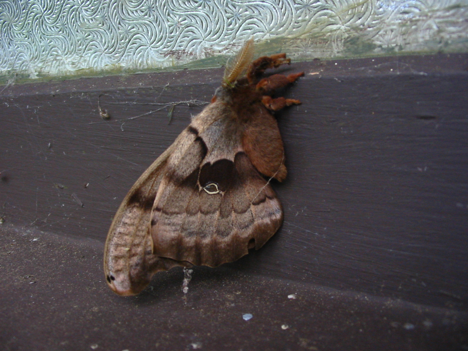
large moth, about 3 inches long
Oct 14, 2004, The Chehalis to Lewis and Clark State Park ride is one we haven't done for several years. It's 36 miles of mostly easy riding in the Neawakum River Valley. The rural route takes us past many pretty flower gardens at well kept homes. We see a Northern Harrier and hear a Redtailed Hawk. We see lots of Flickers too. We stop in Napavine for a piece of Grandma's home made pie. This is a busy little town with a lot of traffic. We have a head wind for more than half of the ride, but average 10.1 mph.
Oct 3, We rode the Screamer from Belfair State Park to Tahuya and Menard Landing. 35 miles, 10.2 ave speed, 38 max. Beautiful warm fall day. Saw lots of Loons on Hood Canal. A few Rhododendrons were re-blooming after the draught and recent rain. Part of the road was closed due to a dangerous washout, but we found we could get by with the bike.
The slide dropped very steeply to the river far below
Sept 28,2004, We hike up Mt Ellinor in the Olympics. It's been years since we climbed it via the gulley. The new trail is wonderful, though steep. The views are magnificent. A mountain goat came up to the summit as we were eating and seemed very tame. He came within a few feet of us (left the camera home - darn!). We had spectacular clear fall weather and views of Puget Sound and Mt Rainier. St Helens was just barely visible in the far distant haze.
Sept 25, A sea kayaking trip. When we got to the boat ramp at Port Hadlock the fog was beginning to clear, so I dressed for warm weather. So did Ed, Teri and Jill. Tena and Brooke were more cautious, so they didn't shivver when the fog returned and the wind picked up. We paddled north in dense fog to Old Fort Townsend State Park. Some of us who needed them put on warm clothes and we all sat down at a picnic table to fuel up. The fog continued to hide the sun. After lunch the sun came out and we could see Port Townsend and Indian Island. Some of us climbed the hill to the restroom. It was warmer on top of the hill where the wind wasn't blowing. On the way back to Port Hadlock the water was a little choppy from the wind and waves. It was a nice little trip on foggy/sunny day.
September 22, my birthday, and Brooke's. Tena and I meet Brooke at the Warf Street shoreline access on Bainbridge and launch our kayaks in the rain. We paddle to Manchester for breakfast at the Inn. Brooke arranges for them to place a candle in my potatoes and the waitress surprises brooke with one for her too.
Sept 21, 2004, We hike to Klahanie Ridge from Hurricane Ridge in Olympic National Park. It's a beautiful day and the air is crystal clear. At the top of the ridge we see a couple of Mountain Goats and they cross below us as we are eating - within 20 feet. Got a couple of close pictures. It was cool, but sunny. 3.8 miles each way.
Sept 9 - 16, Hawaii - Big Island. We stay in a condo south of Kilua Kona with friends Gary and Sharon. Snokelling everyday, trips to see petroglyphs and historic sites, the Volcano (hike) and Hilo. We had lots of good food and wine. Went to farmers markets in Kona and Hilo. Visited waterfalls and high mountain rain forests. I took less than 500 pictures. Thank heaven for that.
Sept 7, From Deer Park in Olympic National Park we hike to Elk Mountain. It's a little over 6 miles each way with great views of the Olympic Mountains, Vancouver Island, the San Juans etc. It was a nice sunny day and a little cool - perfect hiking conditions.
Sept 1, We transport the bike to Miller-Sylvania State Park for a ride, but road construction interfers, so we detour to Tenino and do the Skookumchuck ride in reverse, except we don't go to M-S park. 30.5 miles, 11 mph.
August 27, 2004, We take an easy bike ride to Chimacum and have lunch and homemade pie at the Chimacum Cafe. 24 miles, 1200 ft, ll mph.
Aug 19 and 20, We carry our packs up to Tull Canyon in the Olympics for a campout with our sons Shawn and Brian and Brian's wife Wendy. Next to the campsite is the wreck of a B-17. We had a lot of fun poking around the wreckage as the boys are history buffs. Go to http://www.peak.org/~mikey/746/index.htm to learn more. In the morning we hike up to the saddle between Hawk Mountain and Wakenshaw. The views of Mt Constance, Warrior and other peaks were breath taking. We could also see much of Puget Sound and the Cascade Range. Shawn and I went on to the top of Hawk and enjoyed more spectacular views. We had excellent weather for both days.
Aug 12, It's going to be a scorcher in Western Washington. Tena's knee and foot have not recovered from the hike to Summerland, so we decide to do a bike ride instead of another hike. Sequim, on the Strait of Juan de Fuca is supposed to have a high of only 79 degrees, so that is where we go. The Olympic Discovery Trail is completed from Sequim to Port Angeles and we have not ridden some of the middle part, so this is our route. Most of the trail is on dedicated pathways and most is paved. Parts of the route are on city streets and some of the trail is on gravel. We pass through 3 parks on the way and there are sani-cans and picnic tables in places too. Three large RR trestles are crossed as well as lesser trail bridges where you drop steeply down to the stream and climb steeply back up. The hills are all short, but many are very steep and we have to walk the bike up a few of them. We rode as far as the public warf in Port Angeles. It was 23.3 miles one way. We averaged less than 9 mph. It was foggy on the water and a steady wind blew all day, so it never warmed to anything like 79 degrees. It felt more like 59 in PA. In Port Angeles we ate lunch and got ice cream at the Dairy Queen. It was an interesting ride, but we were beat by the time it was over.
Aug 9, We hike to Summerland on the East side of Mt. Rainier. It is a warm and sunny day. We get an early start as we spent the night in Yakima and got up a 6am. Tena hasn't been to Summerland since we were up there as teenagers climbing Cowlitz Chimneys and other peaks. That was 49 years ago. It's still a beautiful alpine park. The jagged spire of Little Tahoma sets off the close up view of Mt Rainier spectacularly. Wildflowers were blooming, especially Lewis's Monkeyflower. There were lots of Lupine, Gentian, Yellow Mimulose and Paintbrush too. The old log shelter cabin has been replaced with a handsome stone one. We hiked a little ways above Summerland to retrace part of our route to Cowlitz Chimneys, but didn't get as far as Panhandle Gap. Returning to Summerland brought back memories of a very special time when we were young. These alpine meadows will always be one of our favorite places.
Aug 4, 2004, We decide to do the strenuous Adna/Vader ride, even though it�s been a while since we�ve been on the bike. This is a 47 mile ride with some long steep hills. There is mist in the air as we start in Adna and it comes and goes all day, sometimes increasing to a light rain and even a harder rain for a few minutes when we get to Winlock, 3/4 of the way through the route. There is a tough hill at about the 1/2 way point that always seems harder than it looks. It turns out to have a 10% grade - hard indeed! The �10% grade� sign is at the top of the hill, but faces away from us as we climb, so we hadn�t noticed it before. On the long descent we hit 46.5 mph, our top speed. At Vader we stopped at the cafe for a snack. In Winlock we used the bathroom at the Senior Center and got candy at the convenience store. There is a long steep hill out of Winlock as the Tennessee Road climbs toward Pleasant Valley. This hill goes up in steps and the last one is very steep indeed. I tried to shift too fast and lost the chain. We put it back and started up again in the middle of the steep part. We averaged 10.8 mph for the ride.
July 27, We ride the Screamer from Belfair State Park on Hood Canal up Elfendahl Pass Road, to Seven Devels hills, down the the Canal and on to Menard landing. After lunch in the shade of the gazebo and a walk to the beach we face the near 90 degree heat again and ride the last 15 miles back to the park. It was a 34 mile ride with about 1,200 feet of climbing and we averaged 10.5 mph with a max of 37 mph.
July 17 to 24, 2004, Brooke, Kathy, Teri and Chuck, Jill, Bill and Rita, and Earl and Tena got together for the annual kayak trip to Clayoquat Sound on Vancouver Island's west coast. We paddled from Tofino to the northeast area of Vargas Island for the first night's camp. Showers dampened us and clouds hung low on the mountains, but we enjoyed exploring the wild coastline with many picturesque little islands and views of deep fjords. The next day we moved to a lovely, long sandy beach with a view of islands and mountains to the north and the ocean to the west. The rain continued off and on through the third day, with some heavy showers. Each day we paddled up inlets and around islands or out to the edge of the ocean, always returning to the long sandy beach. Four hardy people took a swim on the first sunny day and others took baths in a little stream. Meals were a lot of fun with everyone pitching in with food to share.
The last evening was devoted to a memorial for our founder and leader, Tom Thompson, who died last summer. Brooke brought some of his ashes to be spread on the waters of his favorite kayaking area. Tom�s ashes were carried in a beautiful model kayak that Kathy had commissioned from a skilled woodworker. Kathy showed us how to make paper boats for the Japanese Obon ceremony. After dark we shared memories of Tom. Then Brooke took his ashes from the miniature kayak and spread them on the waters. We lit candles in the paper boats, sat them on the water, and watched as they drifted away from the beach. The little lights on the dark water were beautiful. The moon was up and the distant islands and mountains stood out against the dark night sky. Slowly the boats spread out in an irregular line and drifted out a passage between rocks at the edge of the beach. Then the lights floated on into open water and were gone. Every one of us feels that this was the most beautiful and fitting way send a kayaker on his final journey.
 Pictures of the Obon Ceremony
July 13, It's been a long time since we have ridden the Sequim loop route. We start at the Marina in calm sunny weather. Up a long easy hill, then down to sea level and up a short steep, steeeep hill. Soon we are riding along the Strait of Juan de Fuca; then back inland. We cross the Dungeness river, then along Dungeness bay on a high bluff. After a visit to Dungeness Spit Park the route takes us East of hwy 101 and through farmland. Soon we find the old railroad trail and cross the river again on a long old RR bridge. The Audubon Center in the bridge park has an impressive collection of stuffed birds and mammals. The day has turned hot and windy. The trail picks up on the South side of town and crosses another interesting trestle, 210 feet long and 87 feet high. It's a 35 mile ride and we average only 9 mph.
July 5,2004, We hike up Mount Townsend in Olympic National Forest. It's 4 miles each way with 3,000 ft of elevation gain. On the drive up we see Tiger Lilys and Foxglove blooming beside the road. Only a few feet up the trail we find Queenscup Lilys, Ground Dogwood and Indian Pipe. There are still a few Rhododendrons blooming in the dark woods. Higher up we find Pacific Starflower, Solomon Seal and a few Wild Ginger. Penstimon is everywhere, mostly the Littleflowered Penstimon. In the meadows below the cliffs Indian Paintbrush, Tiger Lilies, Lupine, Wallflowers, Columbine and Yarrow cover the hillsides with blankets of color. Wild Azalia is blooming beside the trail too as well as Vanilla Leaf. Between 5 and 6 thousand feet we see Anemone, Pedicularus, Lewisia, Camas, Toeheaded Baby and Ballflower Lupine. Tena spots some Horned Larks feeding in the summit meadows. There are clouds around and below us on the summit, but we still catch a glimpse of Mt Baker through the breaks. In fact most of the main sights are visible, Vancouver Island, the San Juans, Greywolf Ridge, the Needles, Mt Deception, but not Mt. Constance. Lots of people are on the trail and several dogs, all well behaved. A very good hike. I should post some of the excellent pictures I got.
June 30. It's been too long since we've ridden the bike. We drive to Centralia and head out for Claquato, Adna, Bunker Creek and Lincoln Creek. It's a nice ride, not too strenuous, with one longish, steep climb. Wildflowers are mostly Foxglove and Daiseys. A few Columbine show themselves. We see a small hawk and some Scrub Jays. Nice ride at 38.3 miles with a 10.8 mph average.
June 29, Dust off the canoe; too much of this kayaking stuff. Our friends from Tacoma mostly have canoes, so it's a canoe trip (mostly). Gary and Sharon, Bob and Mariella, Dick and Vera, Kathy (kayak) and Jack and Billy (double kayak) join us for a trip to Hope Island at the South end of Puget Sound. It's another beautiful day. We paddle from Arcadia around Hope Island and pull out at the main camp area where we can drag the boats above the high water mark. The tide is very low, but will come up fast to 13 ft. We eat lunch in the camp area and then hike around the Island. After exploring the Water Trails camp site we load up and paddle under the Steamboat Island bridge on the was back to Arcadia. We have some current to contend with, so we get a little exercise. Afterwards we stop for pie and ice cream in Shelton.
June 21, 22, It's out to Neah Bay with my brother and his wife. First stop is the wonderful Museum with artifacts from the Ozette Villiage dig. Then we go out to Cape Flattery for the hike to the Point. It is a beautiful day and the Hole In The Wall is gorgeous with a gentle swell lapping the cliffs, sea stacks and Islands. At the point we enjoy views of Hell's Gate and Tatoosh Island. Cormorants, Guillemots and seals are seen and finally Puffins, lots of Puffins.
We spend the night in Port Angeles with dinner an excellent at the Garden Cafe. Next morning linger over a delicious breakfast at the Chestnut Cottage. All this fine food spells trouble for my waistline. So, let's take a walk. We drive to Hurrincane Ridge and walk out the Hurricane Hill trail. The hills are lush with wildflowers. Checkered Lilys, Delphinium, Lupine and many, many others.
June 19, 2004, Teri and Chuck lead a trip from Matts Matts Bay to Port Ludlow in excellent weather. We join them with Kathy, Brooke, Jill and Ed. The sky was beautiful deep blue with fluffy clouds off where they looked nice, but didn't bother us with shade. The water was pretty calm with just a gentle swell and some light chop. We ate lunch at a picnic table at Port Ludlow and a few people took a turn at flying Chuck's kite. The wind was a little wimpy. It picked up though on the way back and we had to put some muscle into it. We saw a lot of seals around the offshore rocks. There were Guillemots and Cormorants and one Marbled Murrelette. A Racoon was digging clams on the shore as we returned to Matts Matts. After the kayaking we went to Port Hadlock where Teri had made reservations for us at the Ajax Cafe. A fun place to eat and the food is excellent - so was the live music.
June 15, 16 and 17, we join Tony and Davida in a cabin on the beach at La Push. They have the cabin for a week and kindly invited us to join them. We have our canoe and make good use of it. On the 16th we paddle down the Quilleyut River to the ocean and part way around James Island. Then back to the river and around the other side of the Island and explore some of the sea stacks. By then the breeze is coming up, so we hoist the sail and cruise up river past Rialto Beach to the Dickey River and about 3/4 mile up past the bridge. On the return we paddle down to Rialto and walk over to the beach to watch the surf crash. Back to the canoe and we use the sail again for some good sailing in a good breeze.
The next day we paddle around James Island counter clockwise almost to the river. We see whales spouting try to keep our eyes on them and get a little closer. It is a cow and calf. They surface and spout frequently and we see their backs and tails. A couple of times the cow surfaces on her side and we see a long pectoral fin. They may be Humpbacks. This day we also see Puffins, Guillemots, Cormorants, Oystercatchers, Pelicans and at the cabin, Hummingbirds, White Crowned Sparrows and Cedar Waxwings. We had a lot of fun paddling around the sea stacks and small islands in the ocean and felt we were getting out sea legs back after a long absence from sea canoeing.
June 10, 2004, The ride from Shaffer State Park, to Buck Prairie, to Lake Nahwatzle, to Matlock, to Shaffer is 40 miles with about 1,000 ft of elevation gained. We had a 10 mph and upwards headwind for about 2/3 of the way. Wildflowers were blooming, Foxglove, Columbine etc. We got a few sprinkles, but didn't get wet. It was a nice ride and we averaged 10.7 mph in spite of the wind.
June 1, Monterey, California: It's sunny and mild, just perfect for starting a tour of the Big Sur Coast. We load the bike with camping gear for a five day trip and get rolling before 10 am. From mid-town Monterey we ride to the shoreline bike trail. A memorial to Doc Ricketts has been erected since we last did this ride. There is a railroad crossing signal, tracks and a bronze bust of Ricketts with a plaque commemorating his life. This trail is fun by itself, passing murals, quaint shops and scenic coastline. Seals are perched on offshore rocks and colorful boats are anchored in the bay. The bike path ends in Pacific Grove and we swing onto a bike lane on the road. Lots of walkers and joggers are enjoying the narrow, dirt path beside us. The scenery gets better with waves crashing on jagged rocks. At Pebble Beach we pick up 17 mile drive for a cruise under arching Monterey Cypresses. The road curves and undulates past beautiful, picturesque coves and cliffs. Here and there are large estates, golf courses and scenic pullouts. In Carmel it only gets better. The houses are quaint and beautiful, the shoreline a mix of sandy beaches and rocky coves.
We reach highway 1 near the Carmel River. Our route is 13 miles longer than the official bike route, but much more scenic, much less hilly and with far less traffic. We enjoyed it, but will pay the price later. On highway 1 we have a generous shoulder up steep hills with plenty of traffic beside us. In Carmel Highlands the scenery improves again, the road now high on steep cliffs, the views down the cliffs into gorgeous blue water. Past the Highlands traffic thins and soon the shoulder is gone. This has to be the most scenic bike ride in the world. But it's not easy. The hills are short, but steep and numerous. At Rocky Point we detour to the restaurant for a drink and a pottey stop. We are in no hurry as we have plenty to time to get to Big Sur. The scenery here begs for photographs. We take them and talk to other travelers who are interested in our bike.
The hills are shades of green with tan colored rock ridges. The road is etched above the cliffs. The blue Pacific sparkles in the sunshine. We can see farther in this area, miles of steep mountains meeting wild ocean. The hills are getting a little longer now, but not quite as steep. We stop frequently for photos, drinks and snacks. Our bike is heavily loaded and we need to keep our energy up. At Bixby Creek Bridge the first big climb starts. We stop a couple of times to catch our breath and let the legs recover. At the top it is very windy with gusts over 30 mph. The views are fantastic.
On the way down I pulled over to a narrow patch of shoulder to let a bus pass. It was a mistake. We were in a narrow cut, the wind was gusting hard, the bus passed close with lots of turbulence and the shoulder squeezed down. The front wheel started shaking side to side in the turbulence and I lost control. We went on to the gravel and crashed. Luckily we had slowed down and it was a gentle fall to the side. No one was hurt. A couple who were taking pictures just ahead offered to help, but we were ok.
Near Big Sur Lighthouse we leave the coast and head inland up Big Sur valley. We stop at Andrew Molera State Park to use the restrooms. Next is a long, moderate climb to Big Sur and the park where we will camp. We stop at the first grocery store for fruit. It's a small store and they don't have much, but it's the best there is, so we take it. We set up camp in the State Park and meet a young man from Switzerland who is riding from Belize to Canada. Later, we have dinner at the restaurant in the lodge. Tena's knee is swollen and gets stiff. 46 miles was about 13 too many on the heavily loaded bike.
After a warm pleasant night we have breakfast at the lodge. Tena's knee is still swollen and stiff, so we decide to bag it (the trip, not the knee). I take the bus to Monterey and come back with the car. We decide to head for Santa Barbara and see if Tena's knee recovers enough to a short tour of the historic town.
May 25, 2004, 47 miles and 2000 feet of elevation: that's the Toledo - Toutle ride near Mt St Helens. We average 9.7 mph which is slow, even for us. We just can't get the bike moving and I think it is the heavier and wider tires and heavy front tube. It's pathetic that we can't get the average over 10 mph on any long ride. Well, before conceding that we are out of shape, I'm going to try a lighter front tire with less rolling resistance. This was a good ride though. We saw lots of wildflowers and birds. Mt Saint Helens showed from all the hill tops. We had a view of Goat Rocks and a glimpse of Mt Rainier. It was sunny and warm to begin with. Later clouds came in and it cooled off. Finally it started to sprinkle and then to rain as we ended the ride. The drive home was in a downpour.
May 20, The Onalaska ride starts at Lewis and Clark State Park with an easy climb. The hills get steeper and longer as the ride climbs over ridges to green valleys, then descends to the Cowlitz River and finally climbs to the Cowlitz Plateau where the hills are steep, but not so long. We see Columbine, Lupine, Camas, Solomon Seal, Fairy Bells and lots of wild Iris. We also see some Scrub Jays and several Ospreys and their nests. This is a 40 mile ride and quite strenuous for us. I left the computers home after readjusting them, so I don't know our average speed. Nice ride in cool, but comfortable weather.
At the little store in Onalaska
May 17, 2004, We are in Leavenworth, the Bavarian Capitol of the Cascade Mountains enjoying a few days with my mother and aunt. Leavenworth is on one of our favorite rides, so of course we have our bike along. However, in the morning it is raining hard. We expect it to clear by 9:30 or 10, but no luck, so we go for a drive up Icicle Canyon with mom and Marie and find lot of wildflowers blooming, Paintbrush, Lupine, Penstimon, Delphinium and others. By 12 am the rain has turned to light showers, so Tena and I get on the bike and head up Chumstick Canyon Road toward Lake Wenatchee. It is cool and we have the occasional light shower, but we don't get seriously wet. Wildflowers are blooming here too. We see Solomon Seal, Scarlet Gilia and Mariposa Lilies. We also see Ospreys, Redtailed Hawk and a couple of Blackheaded Grossbeaks. At Highway 2 we hit a headwind, but not too strong. We reach Leavenworth in sunshine after a scenic ride down Tumwater Canyon with its cliffs, waterfalls and raging Wenatchee river. It was 39 miles with about 1,700 feet of elevation gained. We averaged over 10 mph.
May 13, We need a longer ride to get in shape for our California trip, so we head for Elma and ride to McCleary and Oakville. It's 48 miles with a few easy hills. We have a headwind on the way back that develops into real challenge. We are tired before it is over. We saw fields of wild Camas and lots of bleeding hearts. The average was 10.5 mph, that's somewhat better. I think the computer needs to be adjusted for our new tire.
May 8, 2004, With Chris and Sylvia we paddle to Hope Island from the boat launch at Arcaia. The big dark cloud that we saw as we left Arcadia stars raining on us as we reach the island. I doesn't stop raining the whole time we are there. Occasionally it dumps on us. We get thunder, hail and wind too. Lunch is a cool and damp affair. By the time we leave the rain is letting up, but it comes back before we reach Arcadia. Pie and coffee at the Timberland Cafe in Shelton helps revive us. It was an experience.
May 6, we ride from Miller-Sylvania State Park to Rainier. Tena is not feeling well, so we cut the ride short. Nice weather and fields of Camas are seen blooming along the way.
May 2, The Belfair - Tahuya ride should help get us in shape. We are still not in condition as we should be and average only 9.8 mph.It's a good ride though with cool, clear weather. We see False Solomonseal, Bleeding heart and Beargrass blooming along the way. Part of the Tahuya River Rd is closed and the detour shortens the ride by about 2 miles.
April 28, 2004, Wildflowers are blooming and we are out of shape for bike riding. The Black River ride will give us a good workout and the promise of Camas and other wildflowers along the way will be the incentive. The weather is perfect, except for a moderate headwind on the last half of the ride. Wildflowers lighting the way are Camas, Bleeding Heart, False Solomonseal, Columbine and Buttercups. At Mima Mounds we see a Chocolate Lily and Violets. 30 miles. Our average is only 9.7. Blame it on headwind, wider tires and out of shape.
April 24, 25, Sea kayaking on the lower Columbia River at Skamokawa. With out paddling group we rent a couple of condos at the Skamokawa kayak center. Nice rooms, great view, small kitchens, nice furnishings. We paddle on the Columbia. Most of the group crossed the river and paddle on the other side. I didn't want to paddle 9 miles with the wind coming up, so I stayed on the North side of the river and explored Steamboat Slough, Brooks Slough and the Skamokawa River. In the Evening we enjoyed a fine dinner with salads, soup, baked salmon, garlic bread and pie and cookies for dessert. The next day most of us paddled up Steamboat Slough to Cathlamet in very warm weather, but with the current and wind against us.
April 13, 2004, The Chimacum ride from Port Ludlow goes a little slow. I don't know if it is because we are out of shape from our winter lay over or is it the new wider tires on the bike? Our coasting speed seems a little slow. 25 miles, Average speed 9 mph.
April 7, 8 and 9, We travel to Eastern Washington to gather seeds of two rare wildflowers for Rare Care, the University of Washington program for monitoring and protecting rare native wildflowers. On our previous trip to identify the flowers we had a problem with Taushia hooverai. The experts gave us a better description and identifying characteristics, so we were able to make a positive ID this time, however, the seeds were not ripe, so we will have to return. We did collect seeds of a Buttercup in the Columbia River gorge.
On the 9th we did a bike ride on the Historic Columbia Gorge Highway. We rode from The Dalles Oregon to Rowena Crest and Memaloose Overlook. The old highway is one of the most scenic in the world. The Rowena Loops wind up between basalt cliffs to a promontory with a magnificent view of the River and Gorge. The hills are green this time of year and wildflowers are profuse. For pictures click HERE.
April 5, 2004, We do the Quilcene ride on the Olympic Penninsula. Just 20 miles and no significant hills, but it's our first real ride in many months and we enjoy it and feel the work in our legs.
April 2 we tried out our modified tandem recumbent. It has been cut apart with couplers added, so it can be taken apart for shipping. It now has disc brakes front and back. Rode it to Point White from the house for a test run. Needed some adjustments.
March 28 - April 1, Travel to Big White ski area in Canada for a few days of skiing with friends. Nice Spring skiing the first day, heavy slush the second day, fresh snow the third day, good skiing the fourth day. Skied a little fresh snow, lots of black diamond runs and some off piste. Good food and wine after skiing and a couple of parties.
March 18, 2004, drove to Stevens Pass, but it was raining. Started to turn to snow, so we rode the chair to Tye Mill run. Snow was not good - icey in places and grabby in others. Skied for an hour - no improvement. Ate lunch and went shopping. Tena got a new bread mixer and picked up her custom shoe inserts. I exchanged some piano hinges. Checked conditions later, still too warm at the pass at closing time, so we didn't miss anything.
March 14 - 16, We travel to Eastern Washington to locate and study two rare, native wildflowers, the obscure Buttercup and Hoover's Taschia. In a couple of weeks we will return to gather seeds for Rare Care, a University of Washington program for preserving and protecting rare plants in Washington. This was a fun road trip with walks in the dry sagebrush country. Also explored a couple of bike routes in Oregon for future use.
March 10, 2004, Spring skiing at Stevens Pass. Sunshine, warm weather, Spring snow, views of Mt Stuart and Glacier Peak. Nice day.
March 2 and 3, We travel over Snoqualmie and Blewett passes to Leavenworth. Original plan was to XC ski at Blewett, but we had to take a computer in for repair and lost a lot of time on that and other errands, so scratched that. The condo in Leavenworth was nice and had a view of the mountains. We had a nice dinner with wine, watched a movie with the fireplace going and by morning it was snowing. It's a short drive to Stevens from Leavenworth, so we were on the hill a couple of hours earlier than usual. There was lots of fresh, heavy, wet snow. It was a little hard to push around and Tena had to quit after a couple of runs to protect her knee. It snowed hard and the wind was fierce. There was lots of fresh snow to ski in, but it was a challenge to handle that cement. I skied with a telemarker from Portland who was very fast and offered me a further challenge trying to keep up. It was fun, but the heavy snow wore me out by 2pm, so we left early.
Feb 25, 2004, Skiing at Stevens Pass. Ligh snowfall turns to heavy. By the end of the day we have plenty of fresh snow to make tracks in. Tena skis a black diamond run again. She's doing better. I'm doing not so good. Several bad falls where I come close to getting hurt. Don't know what's wrong, but I feel slow and uncoordinated. A hard face plant near the end of the day feels like it breaks my nose, but no such luck, still the same old nose, but with a few scratches on it. Pretty good day of skiing.
Feb 18, Stevens again. It's warm, snowing - just barely, and the off piste is heavy, but manageable. Still, it's kind of fun. My first run on Roller Coaster is an inept failure. Next run is good though. I try the moguls and find that pushing speed in the transitions (tele skiing) helps a lot. At the top of Tye Mill I see a couple looking down through the trees at the backside. I want to ski this, but don't know the route (off piste). They let me join them. It's challenging and fun. Lots of falls and a tree well, but it's worth it. I'll be back. We quit early as the vacation crowd is too much.
Feb 12, 2004, Skiing at Stevens Pass on a beautiful sunny day. It hasn't snowed for several days, but it has been cold and the groomed runs are fine. Tena skis two black diamond runs with me, the first she has done in years. The backside was good and a guy on the chair clued me in to where I could find a little powder for a couple of turns. It was surprisingly good for old snow.
Feb 4 - 6, We join friends at a house on the slopes at Crystal Mtn for the annual ski get together. Lots of good food, wine, Scotch, conversation and friendship. We ski too. The snow was good and I was able to take several runs with Laura, a former instructor, who took me on double diamond runs and showed me some powder stashes. The last run down Gold Hills, on Friday morning, we one of the best with a few inches of fresh snow. We had a wonderful time with old friends, some going back 40 years or more.
Jan 31, 2004, XC skiing at Snoqualmie Pass Nordic Center. We ride the chair up to the trails. There is about a foot of fresh snow, so I get in some good telemarking under the power lines and between the trails. The snow and terrain are so easy I ski some of it with the buckles loose on my T-2s. It snows all the time we are up there and there is lots of fresh snow on the run back to the base.
Jan 27, Skiing at Stevens Pass. Heavy wet snow. Off Piste mostly skied out. Took a lot of falls, face plants, head plants, butt plants. It was fun, but a lot of work.
Jan 20 - 23, 2004, We travel to Idaho and ski at Schweitzer and Silver Mtn. The skiing was good, though it was foggy at Schweitzer and they didn't have any fresh snow. I did find some powder among the trees and off piste at Silver Mtn. Stayed in a condo on Lake Coeur d'alene. Very comfortable and very cheap. Skiing was cheap too, $30 each at Schweitzer and $23 each at Silver. The 3 mile gondola ride at Silver was fun too.
Jan 16, Skiing at Stevens Pass. No fresh snow, but it was fun anyway.
Jan 10, 2004, XC skied at Hurricane Ridge in the Olympics. Not the best snow. Short hike with some short straight runs on the trail. Tena loves her new Garmont boots, comfortable and lots of support.
Dec 30, 2003, XC skied at Snoqualmie Summit. Good snow and good skiing.
Dec 16, 2003, Skiing at Stevens was glorious - deep powder snow. Dumped all day, 6 inches at least, plus a few inches of fresh when we got there. Ungroomed runs were excellent, though they could use another foot or two to smooth things out and cover the small trees. Mogul skiing was excellent today. I finally got into the swing of it on tele skis. Took a couple of runs with 3 tele skiers on Tye Mill. It's good to ski with others now and then.
Dec 9, Skiing at Stevens Pass again. Another good day for early in the season. The snow is excellent, though not much new until late in the day. Skied hard, including bumps. Exercise calss is paying off with better early season performance.
Dec. 3, 2003, first day of skiing this year. Stevens Pass has 4 inches of fresh powder. We have a great time skiing Hogsback, Backside, Tye Mill and Skyline. Found unpacked powder on at least part of all runs. Skied hard, got wasted, enjoyed it.
November 22 - 23, We join friends at the Guemes Island Resort for some sea kayaking, food and conversation. On Saturday we check in at the resort and then head to the boat launch on the South side. It is cold, but there is no wind to speak of. We paddle lazily toward the East end of Guemes channel, round the point and head back. It's just a 2 hour paddle, but we have a good time. That evening we have a fabulous pot luck dinner in the big cabin and sit around chewing the fat. Sunday it is a little warmer, but the wind is up and the forcast is for 20 to 30 mph. Most of the group decide to paddle anyway, but Tena and I sit it out with Ginger. We spend some time reading and take a walk while the others enjoy paddling to Bellingham Channel where they have spotted a car. After lunch it is all over and we head for home via the Guemes Island ferry.
Nov 13, We hike up Mt Zion with Brooke. It is warm and sunny. There is still a trace of snow on top. The view was excellent with just a little haze to the north around the San Juan Islands. 1.8 miles, 1,300 feet.
Oct 26 - 27, 2003, From Longbeach we drive South to Newport, Or. to see the aquarium and enjoy a bike ride up the Yaquina River. The aquarium is fabulous. The Sea Dragons and small colorful fish are fascinating. We spend 2 hours admiring the displays. On Monday we ride from Old Town Newport to Elk City. It's 48 miles of easy scenic riding along Yaquina bay and River. We see lots of Herons, Egrets, Cormorants, Kingfishers, gulls and ducks. We even see a couple of River Otters. We have lunch at the Canyon Quarry County Park and get back to Newport at 4pm. A very enjoyable ride.
Oct 24, We are at the Longbeach Penninsula for the Water Music Festival and staying with Gary and Sharon at their beach house. No concerts are on our schedule for Friday, so we head across the river to Oregon and Neahkanie Mountain for a hike with a wonderful view of the coast. The trail is only 1.4 miles and climbs less than a thousand feet, but it is still a wonderful hike. The lower part of the mountain has huge Sitka Spruce trees in an old growth forest. Not much is blooming, but the Spanish moss on the tree limbs is very beautiful backlit by the low autumn sun. Here and there we see wild mushrooms. The top is a short rock scramble. The view would be worth a much longer and more difficult hike, but we'll take it as is.
Oct 13, 2003, It looks like rain all week except today, so we put the bike on the car and head for Elma. It is cloudy and threatens rain all day, but we only get a light sprinkle. The ride goes to McCleary, Malone, Porter, Oakville (lunch at Jag's) and back to Elma. 47.7 miles and less than 1,000 ft of elevation. We average 11.4 mph. We needed the exercise to keep our weight down.
Oct 7, 2003, A bike ride on the island is called for as our car is out of commission. We ride into Winslow for breakfast at the Streamliner Diner. Then ride to Fay Bainbridge Park, Hidden Cove Park, Manzanita Landing, Bainbridge Gardens and home. It's 24 miles with almost 2000 ft of elevation. We are tired from climbing all the steep hills.
Sept 30, We want an easy hike as I still have a cold, but not too easy, so we do the Ozette - Ocean loop. It's 9.3 miles of easy walking, except at the beach where high tide forces us over the two headlands and in places onto the logs high on the beach. The weather is warm, but foggy. Still, it's a wonderful hike and we enjoy it a lot.
Sept 22 - 25, 2003, We head for Oregon and the Columbia River Gorge for some bike rides on the Historic Columbia Gorge Highway. Tuesday we ride from Troutdale to Multnomah Falls and back on the old highway. It's 19 miles with about 900 ft of elevation each way. We see waterfalls, historic bridges, views of the gorge, cliffs, mountains, the river. The old stonework guard rails are moss covered gardens. On Wednesday we ride a restored portion of the historic highway reserved for bikes and pedestrians only. At Tooth Rock we are over the freeway tunnel on roadway cut into the steep cliff or supported on via duct. A long, steep set of stairs stops us. Our 8 foot long tandem can't clear the edge where the stairs drop at each of 5 or 6 landing. We turn around and head back to Bonneville Dam and the Moffett Creek Trail. Then drive to Eagl Creek and continue on the bike path to Cascade Locks. Thursday I'm catching a cold, so instead of riding from Rowena to Hood River and back we ride from Hood River to end of Mosier twin tunnels trail and back to Hood River, about 1/2 the distance. It's a very interesting ride on the East side of the gorge. The trail is excellent. Very nice visitor center at Hood River end of trail and restrooms at other end. Picnic tables near tunnels. Will have to go back when I'm not getting sick and do the Rowena Loops part of the ride.
Pictures from our rides on the Historic Columbia Gorge Highway.
May 1, More conditioning is needed, but my legs are still sore from cramping on the Onalaska ride. We choose the Skookumchuck which is only 41 miles and 1,100 feet of elevation. Good choice. We see Trillium and Bleeding heart and whole fields of Camas. At one place a whole meadow was bright blue with Camas. Tena saw a Western Bluebird and we saw a Scrub Jay as well as Ospreys and a couple of common Mergansers. 41 miles, 11 mph average. Nice ride.
April 27, 2003, We want a conditioning ride for our upcoming tour of the N. California coast, so we head South for the Onalaska ride. It's 44 miles with over 1,500 feet of climbing. The weather is perfect as we head out from Lewis and Clark State Park and head over a small ridge to the Neawakum River Valley. We see lots of birds and wildflowers along the river. After climbing a big ridge we drop into Onalaska. Fred's restaurant is closed for repairs, so we eat our lunch at the little general store. Another steep climb and fast descent and we are in Salkum in the Cowlitz River valley. The remaining hills are short, but steep and my legs cramp up on them. We average 9.9 mph.
April 26, Kathy led a trip to Ebey Slough. Chuck and Teri, Jill, Susan, Earl and Tena paddled too. It was cold and bleak as we started. The current was swift and the area hadn't been scouted, so we were not too eager at the start, but we got going and everything turned out great. We saw lots of Ospreys and Osprey nests. We headed down the Snohomish River, then into Union Slough, on to Ebey Slough and back to the River. It was sunny and nice by the time we got back. Everyone enjoyed it.
April 15, We ride the Black River loop near Olympia. It's a cloudy day with showers all around us, but only a few sprinkles hit us until the end of the ride. Started at the North end to have a tailwind on the home stretch. Saw a Scrub Jay. Heard a Pheasant and a Quail. Saw many varieties of wildflowers, but not a huge number. There were Bleeding Hearts, Camas, Avalanche or Fawn Lily, Trillium, Coltsfoot and others growing beside the road and at the Mima Mounds park. 31.5 miles, 950 ft, Ave speed 11.6 mph. Good ride.
April 11, 2003, With Sylvia and Kris we paddle to Manchester for breatfast. It's a little windy, but the current is with us. We see an Eagle on Orchard Rocks and Brant on the beach at Manchester. After breakfast we paddle to Blake Island for a quick look and chat with some boaters. The paddle back to Bainbridge is easy with a little tailwind and favorable current most of the way. We see Harlequin ducks and Guillemots. Rain tried to spoil the trip back, but it didn't last long enough to bother us. It was a really nice trip.
April 8, We need a bike ride because we have to get in shape for a tour on the N. California coast next month. We ride out to Point White and over the hill, then on to South Beach and back. It's only 11 miles, but the hill is steep and long, just what we need to get us ready for Crescent City hills.
March 30 - April 5, We travel to Big White ski area in Canada with friends for 5 days of skiing and parties. The best skiing was the last 3 days when we had fresh snow each day. Lots of good off piste skiing, no serious injuries, just a sore back and stiff shoulder.
March 17 - 22, 2003, A trip to 29 Palms, Ca for a look at Joshua Tree National Monument. We joined Tony and Davida at 29 Palms Inn for a few days of bird watching and walks in the desert. Joshua Trees were just starting to bloom. A few desert wildflowers and Cacti were blooming too. We saw Mockingbirds, Cactus Wrens, Phanopepla, hawks, Hummingbirds and a warbler. We did the Pine City hike on a cold and clear day. Very interesting desert scenery with Joshua Trees, cactus, Yucca, Pinon Pines, rock formations, Lizzards and a Horny Toad. We joined a guided walk with a Ranger that took us up a dry wash to a Coyote well, Indian flour grinding stone and petroglyphs. We saw rock climbers doing their thing on several of the rock formations. Very interesting place. Tony and Davida were great hosts, cooks and guides.
March 1, It's a nice sunny day and we decide to do the Belfair, Elfendahl Pass, Tahuya, Maynard landing ride. It's 35 miles, 1200 ft of climbing on the inside of the Big Bend of Hood Canal. Lovely day, cold when riding, but warm when standing. Coltsfoot was blooming as well as Dandelions and some late Indian Plum. We saw lots of ducks on the canal and some loons. Everyone was out walking or riding or driving and seeing the scenery.
February 22, John and Ginger lead a trip to the Sakgit River Delta. Tom and Brooke, Ronn and Debbie, Suzan, Earl and Tena and Chuck were there to enjoy the unusual scenery and wildlife. We started paddling downstream in a rain squall, but soon were paddling in bright sunshine. After briefly exploring the delta we paddled back to the put in and went looking for Snow Geese. We found them, by the thousands. There were Swans too.
Feb 12, 2003, We drive South of Olympia to get away from the dense fog. At Miller-Sylvania State Park we mount up and head for the town of Rainier. Soon it turns into a beautiful, sunny day with bright blue sky. We catch excellent views of Mt Rainier. Passing one of the old railroad grades we see that the rail/trail has been extended this far (we have ridden a part of it between here and Olympia). Soon we find another section of rail trail and ride it for about 1/2 mile to a gate. It seems likely that it will hook up with the Yelm-Tenino trail, but not knowing the condition of the trestle ahead we opt to continue to Rainier on the road. At Rainier we meet a walker on the trail and ask him about how far it goes. He turns out to be a former Engineer on this RR, who is retired and now walks the route he used to pull trains on. He tells us the trail can be ridden back to the gate where we exited. The trestle is passable, but you have to walk on the ties and there are no railings. We go back this way and ride a few extra miles toward Olympia on it. The rail/trail extends 15 miles out of Olympia. This year the Yelm trail will be finished into Tenino. We rode 31.5 miles, Ave. Sp 10.7, Max Sp 37.
Jan 18, Joined Audubon on a bird watching boat trip. The boat left from LaConner and travelled out Swinomish Slew past the mouth of the Skagit River, out Deception Pass to Wilson Rocks and returned. We saw lots of Cormorants (3 kinds), Kingfishers, Eagles, Herons, Oystercatchers, Blak Turnstones, Western Grebes, Loons (2 kinds), Goldeneyes, Buffleheads, Marbled Murrelets and gulls. It was a beautiful clear sunny day. Cold on deck, but warm inside the boat. We were the guests of Tena's 93 year old father.
Jan 8, 2003, Did a short local bike ride on the Screamer. 11.8 miles, a few good hills. Good exercise, nice sunny day, but cold.
Jan 7, Tele skied at Stevens pass. Free demos on Tele tuesday. I tried the Atomic TM/EX with BD 02 binding. Great ski, responsive binding.
Jan 1, 2003, It's raining and it's cold, but we are going to hit the water with our kayaks. A new year's paddle is somewhat of a tradition with us and sometimes friends join us as they did this year. Usually it's just one or at most two friends who get up early with us on new years day, but this time nine people join us. It's a mob scene. We head for the boat launch at Eagle Harbor Waterfront Park. We paddle accross the bay to Eagledale and explore a little cove, then examine an old ferry boat. We cruise past the memorial to the Islanders, U.S. Citizens of Japanese descent, who were forced to leave there homes and taken to internment camps during World War II. The memorial is at the location of the ferry dock where they were taken off the island. It gives us pause because of the expanding curtailment of rights and freedoms that is being done by the Justice deparment under the guise of war on terrorism. The memorial cautions us to not let it happen again. Next we rounded Creosote point, then circled back to the head of the bay. After the paddle we warmed up and dried out at the Madrona waterfront cafe. It was a good trip.
Dec 31, 2002, We skied at Hurrican Ridge under blue skies. Views of Mount Olympus, the Bailey Range, the Strait of Juan de Fuca and Victoria were magnificent. It hadn't snowed up there in several days, but the snow was pretty good underfoot. Trees were covered with textured rhime. We only went a short way to see if Tena's foot could stand up to back country skiing after several years of nursing it from surgery. She did ok. The massage therapy has helped. Saved her from a second operation. I found a few places to crank out some turns and was pleased to find that I can still ski on light weight gear after a few seasons limited to lift skiing on my heavy tele outfit. We had a good time and expect to do more this season.
Dec 7, We haven't had a December bike ride in several years. Getting too old to face the cold, but we decided to go for it and try to keep a little bit in shape. Did the Chimacum ride, 24 miles + with 2 long hills and a few shorter ones. Of course the Chimacum Cafe was where we warmed up half way through the ride. Soup and Pecan pie. Delicious. Donned foot covers after that until the feet warmed up. Had to keep taking off and putting on sweaters, gloves, hats as we would sweat going up the hills and chill out in the cold blast on the fast descent. Averaged just over 10 mph. Good ride.
Dec 2, Three miles of ocean beach hiking yielded a lot of surprises. The 9 mile Ozette loop hike is an old favorite, but this time there were some firsts. At Cape Alava we saw Sea Otters. Lots of them, close in and out in the kelp. They all seemed to be feeding or grooming. I think Washington's population of Sea Otters is growing and they are extending their territory. Another first was a dead Wolf Eel washed up on the beach. It was at least 4 ft long. A third first was part of a dead Octopus - Part of a large tentacle. We also saw Eagles, Harlequin Ducks, Hooded Mergansers, Gulls, Cormorants, and Terns.
Nov 23, 24, 2002, We travel with the BIPS to Guemes Island for a weekend of sea kayaking, food and fun. Tom and Brooke have rented a house at Guemes Island Resort, it comes to $50 per couple. It's a nice house right on the beach with no bank. On Sat we paddle from the ferry landing to the house and on Sunday we paddle from the house to the ferry landing. Guemes has some impressive cliffs on the SE side. Mount Baker is impressive from the beach house and from the kayaks. The weather cooperates with light winds and cool, but not uncomfortable temps. Lovely sunset and sunrise. The pot luck dinner included seafood chowder, salad, pasta, grilled salmon, smoked salmon and wine. Breakfast included hashbrowns, eggs with smoked salmon, sausages and cinnamon rolls. We all had a wonderful time.
Nov 20, Big Hannaford Valley on a sunny, warm day in Nov? Sounds good, but thick fog is everywhere. By 11am the fog is thinning, but the sun isn't getting through. Oh well, we go for it. There are many valleys to travers and many hills to climb on this ride - the steepest hills come late in the ride. Oh well. We finally get some sun around 1:30. It's still a beautiful ride. We see Jays, hawks, a Prarie Falcon, Juncoes, Flickers, Jungle Fowl, a turkey and a Peacock. Horses, goats, cows, donkeys, Lamas and sheep are in the meadows. Strip mining in Big Hannaford Valley is ugly and the re-landscaping isn't great. Nice ride, 38.9 miles, 10.8 mph average, over 1000 ft of elevation, 40mph+ max speed.
Nov. 12, 2002, We need a bike ride, but don't want a long drive, so we ride from home to Eagledale and circle back by Old Mill Rd. 11.5 miles and 1040 feet of elevation. A good short, strenuous ride.
Nov. 10, Out to Neah Bay to watch storm waves pounding at Cape Flattery. Exciting. The Makah Museum is always interesting. Exhibits have been updated and improved.
Oct 26 to Nov 4, we travel to Sicily with friends and a tour group. Etna erupts the day we get there. Have a great time exploring Greek and Roman ruins and watching the fireworks on Etna.
Oct, 22, 2002, We ride the Skookumchuk route from Miller-Sylvania Park to Skookumchuk Dam to Tenino and back to the park. It's a beautiful day with brilliant Fall colors. We stop at Johnson Creek Winery for a rest and lunch. Pick up a brochure about their farmhouse dinners. Will have to try it sometime. Average 11.4 mph, max 38 mph, Elevation 1,400 ft. Good ride.
Oct 17, We drive across the Hood Canal Bridge and ride from Port Ludlow, past Mats Mats Bay and Oak Bay to Indian Island and Marrowstone Island to Mystery Bay. It's a warm, sunny, beautiful day. At Oak Bay, birders with spotting scopes are scoping out the avian population. We peek too. A Golden Plover, a Mew Gull and a California Gull are shown to us. There is a Yellow Legs, a lot of Black Bellied Plovers, Killdeer, Pintails, Buffelheads, a Redtail Hawk, Crows and Glaucus Wing Gulls. We learn a lot from the experts, then move on to the Islands for lunch at Mystery Bay. We return via Chimacum with a stop at the Chimacum Cafe for some of their famous pie. Wild Blackberry for me, Boysenberry for Tena. We spin up the long hill to Beaver Valley at 65 to 80 rpm, mostly 68 to 70. Tena needs the rpms for her sore knee, but this is far higher than we have ever done it before. My legs are starting to burn, but we stick it out and I'm glad we did. Hope we can do it again. Distance, 36.8 miles, Ave 10.5, Max 38.5, Elevation, 2,000 ft.
Oct 14, 2002, Warm weather returns. We want a longer ride, so head South for the Vader, Adna, Curtis loop via 4 valleys. Tere is just enough daylight this time of year to drive down there and complete the ride before dark. It's a beautiful day with views of Rainier and St Helens. Fall colors are bright. Traffic is light to moderate, depending on which roads we are on. Mostly it's quiet in these peaceful, rural valleys. At one point we pause to let the cows cross the road to the barn for milking. In Winlock we photograph the big egg which is showing its patriotic colors. 48.75 miles, Ave 11.5, Max speed 45.3, Elevation 1,650 ft. Good ride.
Oct 10, We ride the Olympic Discovery Trail in Sequim. It's a steep climb up from the marina to start of trail. First off we cross a high trestle over a little creek. This is the Old Milwaukee RR grade. The trail leaves the RR and undulates near the highway, then turns into town, finds a couple of parks and eventually regoins the RR grade at long bridge over the Dungeness River. A few miles of RR grade and street riding and we end at the 10.7 mile mark. The ride back is warmer as the chill wind is now behind us. A nice ride of almost 22 miles. We average just under 10 mph with a max of 39 (that steep hill near the marina). Over 800 ft of elevation if I can trust my altimeter.
Oct 9, 2002, The wind is with us. We launch the Island Cruiser (sailing canoe) in Hood Canal and sail over to Hoodsport on a reach in the South West wind. Oysters at the Hood Canal Inn are tasty. We stroll the town, killing time until the tide rises enough to let us enter the little channel where we launched. We purchase some gifts for family and notice the wind seems to be shifting to the North. This will help us get back down the Canal. The wind is often in our faces when we want to sail, rarely does it cooperate like this to assist us both coming and going.
Oct 7, The Belfair - Tahuya ride, always beautiful, always interesting, it's our favorite ride. Last time we tried it the most challenging part - 7 Devils Hill - was closed for construction. They were widening the road and straightening it some. We want to see the improvements. The 7 Devils have been reduced to 3 imps, but the hill is higher now. That's ok - the road is wider, some shoulder in places and not as steep. We push hard and equal record time for this ride of 11.7 mph. We hit 40.4 mph on a long descent. Probably a record too. 34+ miles. Cold and misty at first, it finally warms up and clears later in the day.
Oct 1, 2002, We ride the Toledo-Toutle route for views of Mt. St. Helens. We see only the bottom of the mountain. Most of it is obscured by clouds. We catch a glimpse of Mt Rainier early on and a full view late in the day, but St Helens hides all day. We see a woodpecker, hawk and Scrub Jay. We have replaced our rear wheel that had a 3x7 speed hub with the new 3x9 speed hub as the old one was wearing out. We found the hills easier to climb, at least for the first half of the ride. We averaged 5% faster speed than last time, and this was after 3 weeks of not riding. The shifting on the new system is very smooth and the hub can be shifted while peddeling lightly. We rode 46.2 miles, averaged 10.8 mph and were quite tired at the end, but no worse than last time when we were actually in better shape.
Sept 15 thru 24 we travel to Kona, Hawaii with our parents for some snorkeling, tropical scenery and a look at the active volcano. Will post pictures on our snorkelling page.
9/11/02, a day for remembrance. We plan a Freedom Ride to celebrate the rights and freedoms we enjoy in the United States. Freedom: Americans are free to do what they want and go where they want without hinderance or oversight by government or religious authorities. The Right this ride celebrates is the right of pursuit of happiness. Exercising the rights and freedoms that terrorists would deprive us of is our way of honoring the victims of 9/11/01. At the Forest Service R.S. we learn that the Lake Quinalt Loop Rd is closed for construction. We decide to ride from Hwy 101 to Moclips and have a look at the ocean. We have our American Flag flying high and handsome above the back seat of our tandem. It's a 45.2 mile ride through second growth forests and some areas of Pygmey Forests (where wet, nutrient poor soil inhibits tree growth). There are also small patches of clearcut. Most of this ride is on the Quinalt Indian Reservation. We see a Woodpecker, Vultures, Ravens, Crows, Goldfinches, Chickadees and Gulls. At the Ocean beach at Moclips the Gulls are all hunkered down in the sand as if a storm is expected. Not many flowers are blooming this late in the year, but we do see some Foxglove and a lot of Gentian. We average 11.5 mph with a max of 35.7 mph. We climbed 1510 ft. It was a warm, sunny day with a cold breeze at the beach.
Sept 4, 2002, This ride starts at sea level in Shelton and climbs steeply to Isabella lake. The narrow road twists and undulates through forests eventually emerging on a level plateau at 550 ft. Past Arrowhead Lake the road winds along a little creek and eventually runs beside the Satsop River. Shaffer State Park is at the 23 mile mark. After a leisurely lunch and a chat with a surfer/ex-bike racer we head for Matlock. It's a 300 ft plus climb over 11 miles. We treat ourselves to ice cream at the Matlock store, then head out for Lake Nahwaztel and the little cafe where we have a coke and use the restroom. Lots of log truck have been passing us on this stretch of road and some of the auto drivers speeding road hogs. It's 12 fairly easy miles to Shelton and we lose most of the log trucks at the Simpson sorting yard a couple of miles from Nahwatzel. The last two miles into Shelton are a downhill coast and we finish at 5:00. Total distance, 52.5 miles, Total elevation: 1970 ft. ave speed 11 mph, not bad for this ride. The last time we did this ride I was so tired and my muscles so sore for the next few days that I swore off of longer rides. Things are looking up. Today my muscles feel good, not sore. The difference is eating and drinking properly. You need water, fuel and electrolytes. We are in shape now, but the other time we were in shape too, but I didn't eat properly for all day hard exercise.
Aug, 26, 2002, It's our 42nd anniversary. We celebrate with a bike ride near Mt. St. Helens. From Toledo we in the Cowlitz River valley, then over to the Toutle River, then to Silver Lake and the Mt.St.Helens Visitor Center where we watch a movie about the eruption and look at the displays. Very interesting and impressive. Ospreys are nesting right above the V.C. and we see them adding to their nest. It's a 47 mile ride with 1980 ft of climbing. We average 10.2 mph with a max of 40.9 mph. Cool and cloudy, so we don't see the mountain. Afterwards we have an anniversary dinner at Falls Terrace Restaurant in Olympia.
Aug 8 to 16, A tour of the Oregon Coast on our tandem recumbent. Probably the best bike tour around with stupendous scenery, challenging, but do-able hills, good roads, lots of facilities and amenities and numerous opportunities to relax or see attractions like the Oregon Coast Aquarium, lighthouses, parks and beaches. We rode about 390 miles with over 16,000 ft of climbing, met a lot of other cyclists, ate good food, camped and motelled and relaxed a little too. I'll include some pictures later.
Aug 1, 2002, We ride the Screamer from Port Ludlow to Marrowstone Island with a stop at Oak Bay Park with its fabulous view. Lunch was at the little park at Mystery Bay. Sailing yachts in the foreground and the Olympic Mountains in the background for a wonderful scene. Then on to Chimacum Cafe for some of their excellent pie. Finally, it up the West Valley Road and over the hill to Pt Ludlow.
We saw a Pilleated Woodpecker feasting in an apple tree. This was only 37 miles, but hilly - we climbed 2,270ft. Average speed was ok at 10mph. The weather was just cool enough to keep things pleasant. I closed the angle on my seat back for more power on the hills and it worked better than expected. In the less laid back position I felt stronger on the hills, even at the end of the day.
July 28, A new ride in the Newaukum and Cowlitz River vallies starts at Lewis and Clark State Park. We ride past the Middle Fork Newaukum and head up the North Fork valley where we are greeted with drizzle that grows to light rain. Then a steep hill takes us over to Onalaska. We are getting pretty wet by now, but all the restaurants are closed on Sunday, so we eat at the little grocery store. Drizzle continues as we climb a long steep hill, but tapers off as we cruise along the ridge. Dropping down to the Cowlitz we are out of the wet and it starts to warm up. We see an Osprey on the nest near the river, another one farther along by the boat launch and a third one beside the road a few miles farther along. Three nests and four Ospreys in one day. That's a record. This was a 43 mile ride with well over 1500 feet of climbing. We averaged just under 10 mph.
July 21, 2002, A hot day calls for a ride at Aberdeen where the ocean breezes blow. We decide on a new ride up the Wishkah Valley, over the ridge and down the Wynoochee, over to Friends Landing and back to Aberdeen. The cool breezes seem to have gone South and we sweat a lot in the heat. The climb over the ridge in oven temperatures stops us short of the summit to cool down. The decent is a scarry matter in lose gravel. The road is steep with sharp turns and highly banked curves. We had to walk part of this section to control the bike. We rested in the cool shade along the Chehalis River at Friends Landing. Then climbed a few more hills back to Aberdeen. I sweated so much my legs cramped in spite of drinking most of a quart of Gator Aid and eating every half hour. I finished the quart and the cramps ended. We saw Cedar Waxwings in a couple of places on the ride.
July 14 thru 18, The annual BIPS (Bainbridge Island Paddling Society) summer camping trip. This was the trip that changed: Destination, starting date, duration, everything changed again and again. We finally did this: With only three participants, Kathy, Tena and Earl, we decided to open the first day to non campers, so others could join in. Tom, Brooke and Suzan joined us for an exploration of Case Inlet from Allyn to Stretch Island. We lunched at Fair Harbor Marina. It was sunny and warm with no wind. We saw lots of Kingfishers and Herons and a few seals. Afterward we had a nice dinner together at the Bar and Grill in Allyn. Sitting outside at a table on the lawn beside the water we enjoyed good food and drink, good company and a nice view of Case Inlet. Half the group had to go home after dinner, the other half headed for Twanoh State Park to camp. Next day we launched at Arcadia and paddled to Hope Island where we spent the next three days and nights exploring the island trails, homestead and beaches. We explored parts of Totten Inlet and skirted Steamboat Island on Tuesday. Wednesday we paddled to Boston Harbor on Budd Inlet for water, sandwiches and ice cream. This was a laid back trip with easy paddles and lots of reading on the beach.
July 2, The Capitol Forest South of Olympia beckons us to a new ride. From the Black River to Mills Creek, over a pass to Stevens Valley and Cedar Creek, up a hill and down to the Chehalis Valley, it's a varied and interesting ride. We see wild Columbine, Foxglove, Mimulus, St Johnswort, Carpet Bugle, Twinflower and others including a Lily we don't recognize. Scrub Jays showed themselves and we saw an Osprey and a couple of Horned Larks. This ride was 35.8 miles the way we did it with a long detour. We climbed 1730 feet and averaged 10.3 mph with a max of 38.7.
June 26, 2002, It's the Port Ludlow to Chimacum ride again. 24.5 miles, 1250 ft of climbing, pie and ice cream at Chimacum Cafe, 10.5 mph average. Hot day, but a good ride. Saw a Western Tanager and a Cedar Waxwing., not many wildflowers.
June 6 to 20, a car trip down the coast to Monterey with bike and canoe. We sail the canoe in Newport Bay, Or and paddled the New River South of Bandon. At Neskowin we rode the bike to the top of Cascade Head on the scenic route. Seven miles up and over 800 ft of climbing. In California we put the canoe in the Russian River at Jenner and sailed out to the mouth were we explored the beach. Then we paddled and sailed upstream a few miles, had lunch and sailed/paddled back to Jenner. After canoeing we rode the bike from Jenner to Monte Rio, a nice ride along the Russian River. In San Francisco we drove to Golden Gate Park and got on the bike for a 12 mile tour of the park. Enjoyed the free music, saw a wedding at the Japanese Garden, watched the breakers and kites at the beach. Next stop was Elkhorn Slough Marine Estuarine Preserve near Monterey. Saw Sea Otters and River Otters, White and Brown Pelicans, Godwits, Curlews, Wimbrels, Willets, Blacknecked Stilts and Avocets and many others. Paddled to the mouth at Moss Landing and sailed back to the put in.
May 30, 2002, Michigan Hill, Lincoln Creek, Rochester. Starting at Centralia we ride up Lincoln Creek, then over the ridge to Independence Creek. Stop in Rochester for snacks, then Head up the long and steep Michigan Hill. I've lost the details of the ride, but it was about 30-35 miles with about 1200ft of climbing.
May 23, Winthrop, Eastern Washington again. We ride up the Chewach River valley through pine forests carpeted with wildflowers: Delphinium, Death Camas and Balsam Root. We see some Indian Paintbrush too and a small patch of Cat's Ear Mariposa Lily. Tena finds some Eligant Brodilia and we see one clump of Penstimon. There are lots of birds singing in the trees, but most are hard to identify. We do see a Bullock's Oriole, some Flycatchers, Western Bluebirds and a Lazuli Bunting. This is a 37 mile ride to Camp 4 with 1,600 feet of climbing. We average just over 10 mph. The weather was cool and nice for riding.
May 18 and 19, 2002, Wd go with kayaking friends to the Potholes lakes in Eastern Washington. We paddled on Corral Lake on Saturday and saw lots of Great Egrets and some turtles. The main event was the appearance of a rattlesnake on a rock at the edge of the water. At a pond on the way to the lake we saw lots of our favorite birds including Phaloropes and Blacknecked Stilts. On Sunday we paddled on Hutchinson and Shiner Lakes (they are joined by a short channel). We saw another snake, lots of Turtles, a Great Horned Owl and chick. On the way home we saw Avocets and Sandhill Cranes. It was a fine outing.
May 16, We ride the Screamer from Belfair State Park to Tahuya again, but a detour due to road construction add some miles and elevation. The new road will probably smooth out the Seven Devils hill and it'll probably be less steep. We'll find out in September. We had good weather and rode up all the hills, even the two steepest which we usually walk. The first one is short, but incredibly steep, the second is long and very steep, we stopped for a rest half way up. Weather was cool, but nice. We rode 35.8 miles, climbed 1700 ft and averaged 11 mph. Few wildflowers were blooming, but we did see the lowland Beargrass.
May 11, 2002, Schaffer State Park near Elma is the start of one of our favorite rides. The route leads up Cloquallam Creek to Highland Road, over the low pass to Matlock road. We stop at Nawatzel Lake for lunch in the little restaurant. Then on to the Matlock Brady Road and return to the park. 39 miles, 1200 ft, at 12 mph average. A nice ride in good weather, but no birds nor flowers to speak of.
Max 8, We toured valleys SE of Olympia on the Screamer. Cold weather kept us in warm clothes, even going up the hills. It's been very cold and rainy for a few weeks and we saw snow on some of the low hills around our route. Trees are just starting to leaf out. Few wildflowers are blooming, but we did see a lot of Camas Lilys and Bleedinfhearts. From Deep Lake we rode over to the Deschutes Valley, then over the hill to Johnson Creek. Rode up the Skookumchuck to the dam, then down to Tenino and returned to Deep Lake. We saw a couple of hawks, a Vulture, a red headed Sapsucker and a Scrub Jay. It was 41.8 miles with 1,250 fdet of climbing. Ave 11 mph, max 37.7 mph. A nice ride with only slight headwind most of the way around the circuit.
April 30, 2002, Cruised the Burke-Gilman trial on the Screamer. Beautiful day, blue sky, white clouds, comfortable temperature. Rode 43 miles from near the University to Marymoore Park. Saw some hawks, ducks, songbirds. There have been some improvements to the trail since our last ride, like a new bridge and a new bridge access. An easy and enjoyable ride.
April 29, we sailed the Island Cruiser to Manchester State Park to take GPS coordinates for the Washington Water Trails Guidebook. It was beautiful. Had a nice breeze for sailing across Rich Passage. Got our coordinates and headed back with the sail up and just got going when a River Otter surfaced eating a fish. He didn't see us and we watched him from about 50 ft away. He dove and still didn't see us until he came up 2 minutes later about 10 feet from us. Wasn't up long this time - he saw us and jumped for cover. Had a great time sailing back in a 10 mph wind with gusts to 15+.
April 28, We did the Black River bike ride South of Olympia. 31.5 miles, 900 ft elevation gain, 11.8 mph ave. speed. Beautiful day, sunny, but cool. A few wildflowers are blooming, most notably the Blue Camas Lillys. S`w a Scrub Jay near town of Gate. The rivers are high and beautiful.
April 18, Today we get a break in the clouds afters about 10 days of rahn and cold. We need to un-hibernate, sn we head for Elma and an easy bike ride along three fentld river valleys. First we hdad up Whldbat Creek valley to McCleary. Next it's down Mox Chehalis Creek to Malone. In this valley ve saw a large herd of Elk gazzing in a meadow across the road. Then up the Chehlis River Valley on busy hwy 12 to our river crossing at Porter, and finally down the valley on the quiet country road on the South Bank of the Chehalis River. It's too early for many wildflowers, saw a few Bleeding Hearts, most trees haven't even leaved out. We saw some hawks, an Osprey on a nest and lots of Evening Grossbeaks at a feeder. Even saw some Hummingbirds. We covered 29 miles, climbed just 600 plus feet and averaged 11 mph.
April 10, 2002, Skied at Stevens Pass in mushy spring snow. It was slow and grabbey, but I got brave and skied some black diamond runs. I guess the week in Canada improved my conditioning because I surprised myself skiinf Roller Coaster with only one stop. I skied some steep lines on Chief that I've never done before except on Alpine gear. This season I've found that skiing the trees and Black Diamond runs suits me pretty well. I ski slower on these runs, doing more turns and stopping more frequently than on blue groomers. I never have to fear the Kamakazi boarders and skiers on these runs as they are all out on the blue groomers terrifying the innocent. Also, it's fun to pick my way down a limited access route and see places I haven't been before. There's a lot of interesting terrain in the area that you don't see on the groomers.
April 8, Saw the Dr in Seattle and while over there visited the Conservatory at Volunteer Park. Lots of Orchids were blooming - fascinating. Also saw some great Cactus blossoms and unusual Bromiliad blooms. Then we headdd to the Duwamish Trail for a 23 mile bije ride - our longest since last November. It was a beautiful sunny day. We saw some bunnies along the trail. The highlight was meeting a couple with a home-made t`ndem recumbent. A neat bike with Rotator type gearing and seats and a lonnggfg wheel base (111 inches). The head tube angle is so low he had a return spring on the front fork to help overcome tiller effect. A beautiful, well made bike. Baby back ribs and dessert at Winners afterward. Now it's time to diet.
March 30 to April 5 we skied at Big White in Canada with friends from Tacoma, Puyallup and England. Had a good time with fresh snow on the first day. Tena had to lay off after the first day, but I had a good time skiing off the groomed. Enjoyed the trees and Enchanted Forest (skiing among Hoo Doos or Snow Ghosts). Enjoyed lots of good food and wine, one dinner out with friends and a couple of parties.
February and March, we skied at Stevens several times, but Tena's knee and foot needed a rest, so she sat on the sidelines most of the time. I got sick and missed a couple of weeks and lost my conditioning just before heading to Canada and Big White for a week.
Jan 21, skied deep powder all day. Off the groomers. Trees, bumps, face shots, face plants, tree wells, hidden saplings. Wow! A Blast. Legs were stronger too, but eventually I pooped out and had to do some easy runs.
Jan 15, 2002, Skied off the groomers again. Had a ball. When I got tired I switched to my alpine skis. Hated it. Bondage! Forget it; next time I'll just parallel on my teles on easier slopes when I get tired.
We have had three days of skiing this year. Tena's knee has gotten worse, so she won't ski anymore until it improves. This week I followed advice from a Telemark Tips dot com post and stayed off of the blue groomers to avoid kamakazi skiers and boarders. It was a treat. I enjoyed skiing the ungroomed, discovering new routes, finding some powder, snaking through trees and working my way down some challenging slopes. Only problem is, I vore myself out and stressed my knees. I think I'm going to have to go back to using my alpine skis half of the day to save my knees, but I still plan to avoid the blue groomers and crazy speedsters.
Jan 1, 2002, Our friend John launched in front of his house about am New Years Day planning to paddle over to Fort Ward Park to meet other BIPS for the year�s inaugural kayak trip. It was raining and the water was choppy. He shoved off quickly and immediately discovered that someone had used his kayak and shortened up t
SORRY, the server truncates Guestbook messages at about 45 words
Sept 18, Rain and high winds are predicted for today. We want an easy hike, so we head for the upper Skokomish River and the Staircase Trail. It's about 3 miles up to Stream 4 and we follow an old fire trail a little farther up the steep hill and through the wet brush. When we are soaked enough we turn around and head back. The Staircase Trail has views of deep green pools and rocky rapids on the river and it passes through a magnificent old growth forest.
Sept 15, We repeat the Skookumchuck bike ride. The rail trail that the route crosses has been extended another 2+ miles to connect with the Rainier-Yelm trail and we ride on part of this. It takes us past a Sculpture garden where we take a tour of the grounds and talk to Tom Yoda, a wood carver. There are many very nice pieces on display and some really funky ones. The route continues past McIntosh Lake to Johnson Creek Rd and past the winery to the Skookumchuck River. Then we head for Tenino and back to our car at Miller-Sylania State Park. Nice ride, about 37 miles, 1100 ft of elevation, 10.5 mph ave.
Sept 8-12, 2003, Son Brian and I hike parts of the Wonderland Trail around Mt Rainier. We planned this the warm sunny days and cool nights of Indian summer with a full moon and close up views of Mars, but last week was the Red Man's revenge. Brian and I hiked 1/2 of the Wonderland Trail in fog, mist and rain. Instead of warm days and cool nights we had cold days and cold nights. We did get some dramatic photos of black trees against white fog. In fact, I got about 200 of them. Actually, some of them are black rocks instead of trees against the white fog. We did see the top of Mt. Rainier once, just the tip of it over the top of the ridge at Indian Bar. The sun came out for a few hours at Indian Bar and we enjoyed the views of waterfalls, peaks, snow fields and Alpine parks. We saw some wildlife up close, but I missed the great views of the mountain that I was expecting and was pretty disappointed about that, though we still enjoyed the trip. The North and East sides of Rainier are fascinating even in fog and rain. Short glimpses of ice falls and jagged peaks are all the more exciting for being unexpected. Views of steep mountain slopes poking through the clouds with wisps of mist hanging on the cliffs, alpine firs showing through here and there are very dramatic. We feel lucky to have done this hike even in the rain. We hiked from Mowich Lake to Sunrise and from Fryingpan Creek to Box Canyon. Our packs, at 45 pounds, were too heavy, but the tarp to protect us and our tents from the rain and the extra food and clothes were a comfort in the cold and wet.
Sept 4, The Lake Quinault loop ride, one of our favorites, turns out to be a bust. First, a few miles of the dirt surface part of the North Shore road was being graded and had soft gravel instead of a hard surface. We had to walk several short stretches. Second, the dirst section of the South Shore road was extremely rough with washboards and our idler chain kept coming off. We had to stop several times to replace it. This shouldn't happen, but I can't get the tension adjusted right. Rans needs to address this problem because I know others are having it too from email I have received. Dale at Angle Lake Cyclery doesn't know how to fix it either. The Lake Quinault loop is 30 miles with about 1,000 ft of climbing.
Sept 2, 2003, We climb Elk Mountain in Olympic National Park via the Deep Park trail. Views of the Greywolf Range, Needles, Bailey Range, Mount Olympus, Strait of Juan de Fuca and Victoria are wonderful. Actually, Victoria is barely visible through the smoke haze from forest fires in BC. Wildflowers are mostly gone now, but we see some Fireweed and Paintbrush. A family of Grouse are on the trail and we see larks on Elk Mtn. It is a hot and sunny day. This trail is a challenge as it climbs very steeply in places and it crosses some scarey steep hillsides with vast dropoffs below. 12 miles round trip.
Aug 31, It's a nice afternoon with a little breeze in the treetops, so we decide to wheel the canoe down to the park and do a little sailing. As usual the breeze in Rich Passage is variable in direction and of a start-and-stop nature. The current is flooding and there are some tide rips around the big turn that leads into Bremerton. Once we are in the middle of the passage we get some good sailing with a little fast action when the breeze picks up. We go neck and neck with a larger, keel sailboat for a few minutes, but then lose our wind. Lots of big yachts are speeding by and their wakes toss foam in the air when the hit the tide rips. We bounce mightily on some of these wakes and take a little water over the bow even though we change our direction to ride them as smoothly as possible. It's exciting and we enjoy the thrill, and the feeling of getting back into the skill of sailing and handling the boat in rough water. In spite of the adverse currents and fickle wind we manage to sail up to a good landing at the Boat Street road end where we take out and wheel the canoe home.
Aug 27, 2003, We are ready for another hike and we choose Tull Canyon in the Olympics. Tull Canyon is a hanging valley carved by a small glacier several hundred feet above the main valley. It is the site of an old mining operation with the ruins of a couple of cabins beside the trail. An airplane wreck from the '40s lies near the cabins. The upper valley leads to Hawk Mtn, but we don't climb it this time. Wildflowers are still blooming in the upper valley. We see Fringed Grass of Parnasis, Magenta Paintbrush, Veronica, a few Penstimon and Delphinium are still hanging on. I photograph a couple of wildflowers that Tena can't identify. We hike close to 5 miles and gain 2,500 ft. The canyon has impressive cliffs on the West side and the view out to the Strait is wonderful.
Aug 21, I want an easy bike ride, like Elma, McCleary, Oakville; Tena says we can do a harder ride. I cave in and we choose Adna, Curtis, Vader, Winlock - via the steep Curtis Hill Rd yet. Expecting 80 degree weather (our upper limit for a tough ride temp wise) we find ourselves wilting in 90 degree heat. We consume 7 litres of water and soda on the ride and we are beat at the end. 46 miles, ave just over 10 mph, around 1700 feet of climbing. I need a rest.
Aug 18, 2003, With Brian and Wendy we hike the Marmot Pass trail in the Olympics. Starting in an old forest of huge firs and hemlocks, the trail follows a branch of the Quilcene River up the valley. Later the path climbs along the side slop of the Buckhorn Range and gets up into the alpine meadows, eventually reaching 6,000 ft. We saw Delphinium, Grass of Parnasis, Speedwell, Penstimon, wild Azalea, Monkey Flower, Magenta Paintbrush, Owl Clover, and other wildflowers. The views at the pass were stunning. To the West was the Needles Range with is impressive spikes and spires and to the East were the Cascades with Puget Sound, Hood Canal and cities and islands. It was a warm sunny day and an excellent family outing. 10.6 miles round trip.
Aug 14, I need a hike to get in shape for backpacking with my son in a couple of weeks. We do the Mt Townsend trail. It's clear and beautiful, somewhat hot, but with some breeze now and then. 4.2 miles each way. Still lots of wildflowers including Elegant Camas and Lewisia.
Aug 13, since we are in Centralia after our seed gathering, and have our bike with us as well as canoe, we will do a local bike ride. We try something new, Rainier to head of Deschutes Valley. It turns out most of our route would be on a private logging road that is closed due to fire danger, so we ride to Lawrence Lake and back to Rainier. Short ride, 18.8 miles. It's nice to take it easy for once.
Aug 12, Rare plant seed collecting takes us to Elbow Lake near Olympia. We are volunteers for the Univ. of Wash. program of monitoring and preserving rare plants. We gather seeds from a threatened Rush using our canoe to circumnavigate the lake and get a representative sample of the whole population.
Aug 3, 2003, We haven't ridden our bike since I fell and hurt my butt. My tail bone still hurts and the right cheek is still tender, but we are itching for a ride. The Wishkah/Wynoochie ride would be easy, but we think it over and settle on the tougher Toledo/Toutle ride. My sore butt soon tells me this was not the best choice, but a little pain killer helps me get through. Its a beautiful day, cool and sunny. We see several Osprey on nests and hovering above the Cowlitz River, looking for fish. We also see Scrub Jays and small hawks like Kestrels or Prairie Falscons. The wildflowers are mostly gone, but we see some Foxglove and a few others. The route takes us from Toledo on the Toutle River up a couple of rural valleys, over a ridge or two and back to the Toutle at the town of Toutle. Then we proceed down the valley to Silver Lake the the Mt. St. Helens visitor center. Side roads get us most of the way down to the lower Toutle R and over to the Cowlitz River. It's a 46 mile ride with over 1,500 ft of elevation gained.
July 19 to 25, a sea kayak trip with the Bainbridge Island Paddling Society to Barkley Sound on Vancouver Island.
Pictures from our summer trip 2003
To Barkely Sound
July 17, Strenuous describes the ride from Adna to Winlock and Lewis and Clark State Park. Curtis Hill is very steep and kinda long, but the King Road goes over a steep hill that is even longer. King Rd has banked curves to help the cars stay on the road, but our bike slips sideways on the loose gravel, so we get off and walk these banked curves. However, we didn�t get off soon enough on two of them. I got a heck of a bruise on my butt on the second fall. It made the rest of the ride painful. Ibuprofen helped. Fortunately the rest of the ride was easier and we rode back to the car instead of hitching a ride with someone. We did cut out the loop from Winlock to the state park though. We climbed 1980 feet, traveled 32 miles and had a maximum speed of 46.2 mph (a record for us, I believe). Don�t know if we�ll try this ride again. We stopped at an intersection near Hwy 6 to rest my butt and a van pulled up and the driver asked if we had ridden over the King Rd. He was very impressed and congratrulated us on our energy.
July 7, Our friend Art Kleiner, a canoe and boat builder from Florence, Or. stopped by after showing at the Wooden Boat Festival in Seattle. We invited him to stay over and join us for a paddle in the morning. "Great!" We put his solo canoe and our Sea Canoe on carts and walked them down to the Warf Street road end where we launched on calm waters in Rich Passage. It was sunny and cool, perfect weather. We stopped at Fort Ward State Park to check out the Water Trails camp site, then crossed Rich Passage avoiding ferries and tugs going either way. Art had never had this solo canoe in salt water. The boat passed the test with flying colors. We ate lunch at Manchester State Park, then continued up the passage past Point Glover to Waterman Point. Next we crossed to Point White on the Bainbridge Island side and went back down the passage to the Lytle Road public access where we took out and carted the boats back home. Later Art performed his Elvis imitation for a sick friend of ours. It was a treat for everyone. Art has a wonderful voice and real talent.
July 5, 2003, The Mt Townsend trail in the Olympics is a favorit. The mist was so heavy at the trailhead that the trees are dripping, but soon it improved to a steady drizzle, then light rain. More cars at the trailhead than we have ever seen here. It's the 4th of July weekend and everyone came up here to camp out at Silver Lake. Most of them brought one or two dogs with them. That's a record number of dogs on the trail too - any trail. Only spotted one dog poop and it had been picked up by the dog's owner, put in a plastic bag and hung on a bush beside the trail. By the time we reached Camp Windy the rain had stopped and we could sit and enjoy a snack while gazing out into the dense fog. As usual on this hike we saw lots of wildflowers, both in the woods and in the open meadow near the top. We counted 34 varieties. Amoung them were Sitka Columbine, Chocolate Lily, Tiger Lily, Penstimon, Queen's Cup, Flox, Beadberry and a Coralroot lily. Nice hike.
July 2, Castle Rock - Toutle. We've avoided this ride for a long time because of the strenuous hills, the first one climbs 1000 ft. The ride ends with several very steep grades. We needed to stop and rest on the last 3 steep ones in order to make it to the top. Beautiful scenery, lovely countryside, views of Mt St Helens and Mt Rainier, Silver Lake, Toutle and Cowlitz Rivers. 37 miles, 9.5 mph average speed, 42 mph maximum speed, 2440 feet of elevation gained. We saw lots of Foxglove and Ocean Spray, Fireweed, a variety of flox and other flowers. Also saw a Pileated Woodpecker, Osprey, Eagle, GB Heron and Goldfinch. We were tired by the end. Treated ourselves to a nice dinner at a little roadside restaurant on Jackson Highway.
June 28, 2003, Tena and Earl, Jill, Terri and Chuck, Rita and Bill kayaked from Freshwater Bay West of Port Angeles to Tongue Point on the Strait of Juan de Fuca. Winds were light, currents were weak, water was calm except for occasional large ocean swells and breakers on the rocks, weather was warm scenery was magnificent. The cliffs and coves in this area are spectacular. We took out at Salt Creek County Park for a few minutes, then headed back with excellent views of Mt Baker to the East. We all enjoyed Italian food and conversation at a restaurant in Sequim on the way back. An excellent end to a perfect day.
Pictures Tongue Point
June 25, to stay in shape after our big ride on the coast we decide on a strenuous ride. Dewatto loop via Elfendahl Pass fills the bill. It is going to be a hot day, 80 degrees, so we dress light. The first hill climbs 300 ft in 1/2 mile, then keeps climbing to 500 ft. We see lots of Foxglove, Ocean Spray and Sylvan Goatsbeard. We also see a Hairy Woodpecker and a Downy Woodpecker. About 3/4 of the way into the ride I begin to fade from the heat and all the hills. It�s a 39 mile ride with 2160 ft of elevation. We average 9.7 mph with a maximum of 40. On one of the steep descents we hit a rock in a curve, but managed to recover without going over - good thing too.
June 18, A bike ride on the Olympic Penninsula between Quilcene and Chimacum. We see Cedar Waxwings in Alders beside the road and lots of wildflowers. The Foxglove is blooming and Oceanspray is coming out. We also see Horsenettle and Twinflower and Solomonseal. This is a 32 mile ride with 1600 ft of climbing, mostly on the Center Rd. We average 10.6 mph with a 39 mph max. A nice ride in cool weather with lunch and pie at the Chimacum Cafe.
June 15, 2003, A Father's Day hike is called for today. We head for the Mt Zion trail in Olympic Nat. Forest. Wild Rhododendrons are blooming everywhere along the road and up the mountainside all the way to the top. Sitka Valarian and Vanilla Leaf are profuse too, as is Wild Ginger. Some Indian Paintbrush is seen and Coralroot and Indian Pipe. Camprobbers greeted us at the top. The view was good, though the ceiling was low and we were looking through a little thin haze. We could see Discovery Bay, Port Townsend, Indian and Marrowstone Islands, Admiralty Inlet, Whidbey Island, Saratoga Passage, Camano Island and Port Susan to the East. To the North was the Strait of Juan de Fuca, Protection Island and the San Juan Islands.
June 10, Bunker Creek and Lincoln Creek valleys call us for an easy ride. We start in Centralia and ride in traffic for a mile or so to Schauber Rd, then it's rural rolling roadway for several miles to Bunker Creek. We see lots of wildflowers, Bug Bain, Columbine, Solomon Seal, Goatsbeard and Foxglove, and birds a Kestrel, Redtail Hawk, Osprey, Scrub Jay and lots of Goldfinches. It's 38.4 miles, only 890 ft of climbing, we average ll.4 mph. Nice weather for a good ride.
June 3, 2003, We want to stay in shape, so we take the bike to Schaffer State Park near Elma and do the Highland Rd loop. The skies are sunny and the temperature is just right. We see a few wildflowers, Fringecup, Foxglove etc, but not many. We have slight headwinds for most of the ride, but still average 11.6 mph. Elevation gained was 1,170 ft. Nice ride.
May 31 - June 1, We go to Eastern Washington with our kayaking friends to explore the Pot Holes lakes near Moses Lake. We see White Pelicans, Blacknecked Stilts, Phalaropes and other interesting birds in the area. Desert wildflowers are blooming too. The most outstanding is the Mariposa Lily. We paddle on Blythe Lake and the Hutchinson-Shiner canoe route. Excellent weather and an great trip.
May 29, We ride the Belfair - Tahuya route to see if we are still in shape after 11 days of sitting around. It seems we are in pretty good shape yet, but have already lost our edge. The hills are easier on this route now, but our average isn't any record.
May 5 - 19, 2003, We toured the Northern California coast on our Tandem Recumbent, riding from Brookings, Oregon to San Francisco. Cool weather greeted us and the constant threat of rain, so after three days of not using our camping gear we shipped it home and settled for Yuppie camping (hotels and restaurants). The coast has spectacular scenery in N Cal, especially when the wind is pumping up the waves. The Redwoods are magnificent and awsome to visit on a recumbent as you sit back and gaze up at their towering height from your comfortable chair while slowly and respectfully passing through this forest cathedral. Traveling ing May we had light traffic except in the cities. The weather was cool with one day of rain (downpour). We followed hwy 101 to Leggett using side roads whenever possible as shown in Adventure Travel Maps and BICYCLING THE PACIFIC COAST. From Leggett to San Fran we followed Hwy 1 and or side roads except that at Jenner we detoured to Occidental to avoid weekend traffic on the narrow road to Bodega Bay. We missed a scenic piece of the coast, but the trip to Occidental was fun too, so was the town and so was the ride to Valley Ford the next day. In fact, having done it both ways, I'm hard pressed to decide which is best. Most bike riders leave Hwy 1 at Olema and take the urban route into Sausalito. I hated this route while I found Hwy 1 through Stinson Beach and Muir Beach to be very pleasant. This route would probably be too busy on a weekend and you need to get an early start to avoid heavy traffic on the narrow, steep and curvey road.
Pictures from the New Year's paddle
More pictures from the New Year's paddle
Pictures from the Hurrican Ridge hike
Pictures From the Pt Ludlow ride.
Pictures From the Vader etc ride.
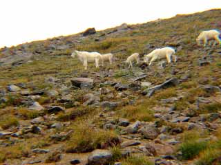
Mountain Goats above the trail
Sept 7, 2002, We travel to Mt Rainier with our son Brian for a hike on Burroughs Mountain. We rarely visit the Sunrise side of the mountain, so it's a special treat to hike here. Sunrise is at 6,300 ft, so we are above tree level. It is cloudy toward the mountain, so we don't see the great views of the Emmons Glacier and Little Tahoma, but we do see Sluskan Chief and Squaw, Echo Rock and other sights to the North and West. The trail climbs past Frozen Lake, then reaches First Burroughs Mtn before climbing to Second Burroughs, our destination. It's an enjoyable hike even without seeing the mountain. The highlight is when Tena spots a herd of Mountain Goats on the ridge above us. As we watch they descend at an angle toward us, dip into a gulley and cross the trail only about 150 feet away. It is quite a sight. There were adults as well as youngsters in the herd. In a short time they are across the valley below and heading up the next ridge.
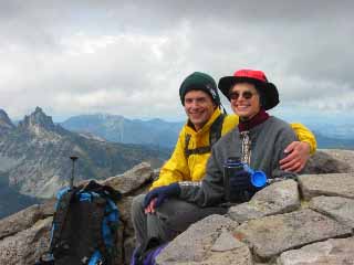
Tena and Brian with Sluskan Chief and Squaw in the background
Pictures of my cool little shop
![]() Get your own Free Home Page
Get your own Free Home Page
