
by: Rick Johnson 
PO Box 40451
Tucson, Az.
85717
RikJohnson@juno.com
Return to the Home Page.
my Edgar Rice Burroughs site.
These maps are the ones that relate to not only my own independent stories but also the ERB Fan-Fic stories that you will find here and at my ERB site.
For more maps of the Burroughs locations, go to my Edgar Rice Burroughs site.
-This is a more cleaned up and readable version of the Greystoke map that was given to Burroughs.

-Here is southern Pal-ul-Don after the Morass dried and the Don expansion from Drying Out in a Humid World.

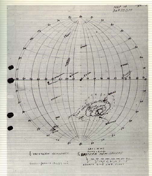
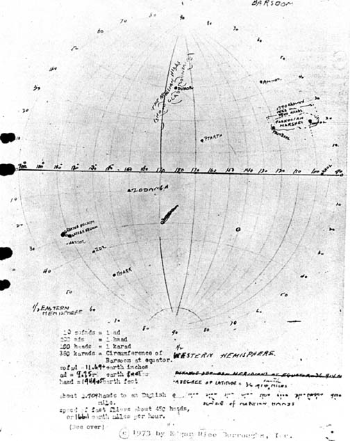
-These are the original maps of Barsoom drawn by Edgar Rice Burroughs taken from notes and descriptions by John Carter.
-This is the route taken by Ayiesha after her advent on Barsoom from A Maiden on Barsoom.
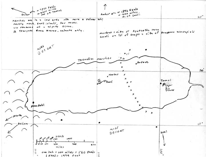
This is the Toonolian Swamp from the Spy stories of Jason Obrien in the 22nd century.
-This is the re-done map drawn by Edgar Rice Burroughs from descriptions and notes received from the Tyler & Billings expedition. I added notes on the side.

-This is the expanded map of Oo-Oh Isl from Weir-Lu of Caspak

-This is the presumed location of Caspak based on description of icebergs and locations of undersea mountain ranges.

-This is the tunnel cut from Caspak to Oo-Oh by Jason & Ayiesha I nWeir-Lu of Caspak.

-This is the first stage of the construction of a Weiroo city.

-This is the second stage of the construction of a Weiroo city.

-This is the third stage of the construction of a Weiroo city.

-This is the fourth stage of the construction of a Weiroo city.

-This is the original map drawn by Edgar Rice Burroughs from descriptions and notes received from Julius.

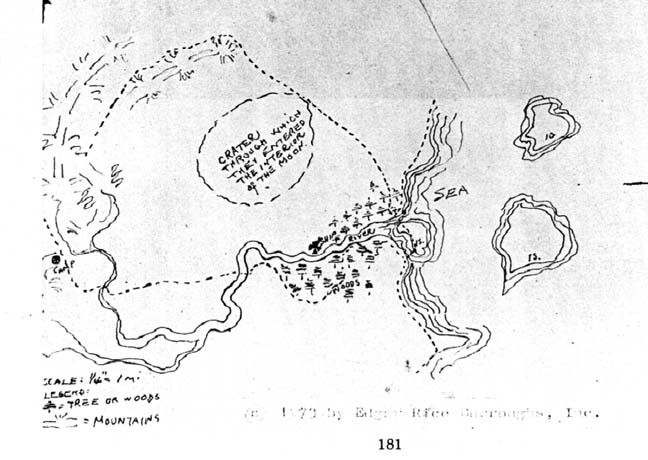
-This is a detail map of the interior of the Moon by Edgar Rice Burroughs.
-These are the original maps of Amtor drawn by Edgar Rice Burroughs taken from notes and descriptions by Carson Napier.

-This is Amtor as corrected by Rick Johnson.

-This is the map of Anlap Isl as drawn by Rick Johnson.

-This is the entire Commonwealth as currently colonized by the Descendents of English settlers abducted by the Demons in the 11th century.

-This is the Barony of Drakonis as it currently exists.

-This is the main Continent on Gaea (Lucifer 2).

-This is the city of Caer Cyprian, capital of Drakonis Barony.

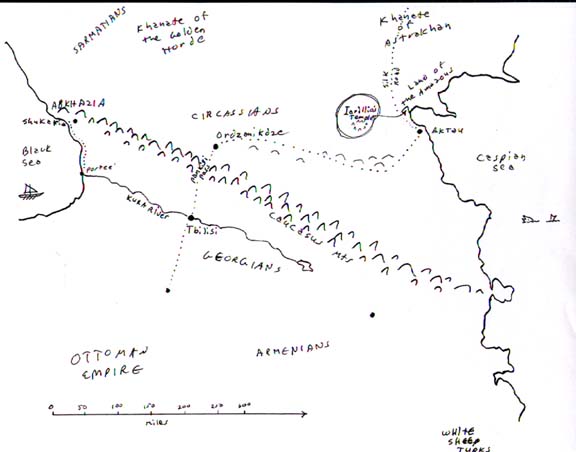
-This is East Europe from Russia to Georgia in Conversion.

-This is Georgia from the Caspian Sea to the Black Sea in Adaption.
-This is the Eastern part of Georgia from Adaption.
-This is the Western part of Georgia from Adaption.

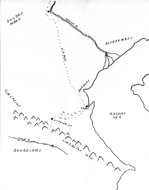
-This is the Amazon region on the Caspian Sea from Adaption.

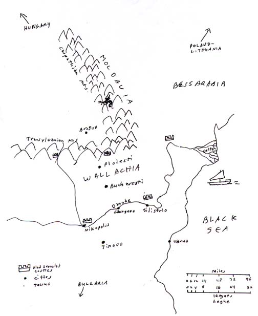
-This is Wallachia (aka Transylvania/Romania) from Adaption.
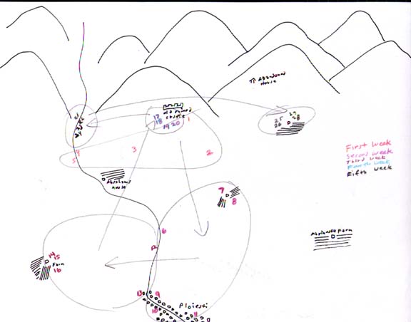
-This is the Ploiesti Village region of Wallachia showing the vampire attacks from Adaption.
-This is the Karalovo village area of Bulgaria showing the Werewolf attacks from Adaption.

-This is the hunting lodge east of Karalovo Village in Bulgaria from Adaption.

-This is the Mid-East from Turkey to the Sinai in Tokaido.

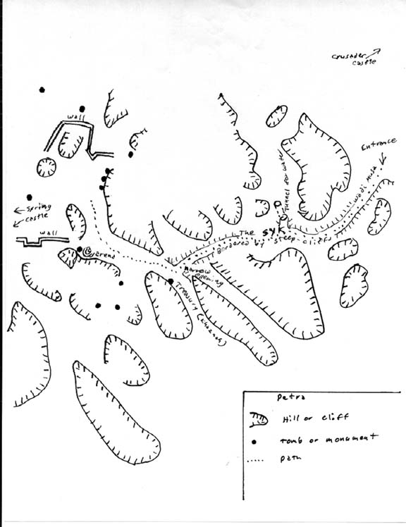
-This is a map of Petra.
-This is the route taken by Janice and Stars to recover their kidnapped daughter in Japan in Recovery.

-This is Africa after the collapse of the mountains that blocked the Congo River from Drying Out in a Humid World.

-Here is the path of the Recovery in the Congo Sea from Drying Out in a Humid World.

-Here is southern Pal-ul-Don after the Morass dried and the Don expansion from Drying Out in a Humid World.
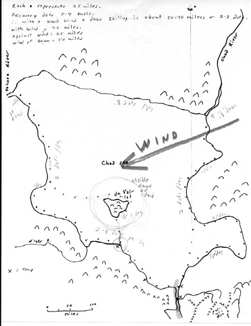
-This is the path of the Recovery in the Chad Sea from Drying Out in a Humid World- 2.
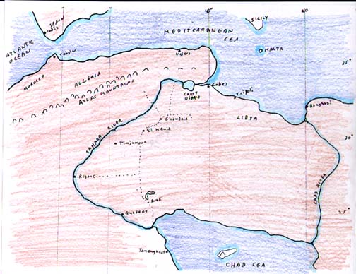
-This is the Sahara River from the Chad Sea to the Mediterranean Sea from Drying Out in a Humid World-2.

To contact me or to request topics to be covered, send to RikJohnson@juno.com
by: Rick Johnson
PO Box 40451
Tucson, Az.
85717
