
Bell's alignment research started at a mound called
the De'il's Plantin (Devil's Plantation) in the middle of a long, straight
stretch of road seven miles south of Glasgow. In a landscape dotted with ancient
sites he was not surprised to find that some of these sites fell into alignment;
what did surprise him was that these alignments seemed to follow a definite
pattern. Sooner or later they linked up with lines of sites leading to Duncolm,
the highest of the Kilpatrick hills on the north side of the Clyde.

Duncolm ... at first glance it looks like a Scots cousin of Ayers Rock,
the sacred site of the Aborigines in Central Australia.
Evening classes at Glasgow University Department of Archaeology threw
no further light on the subject. Though it was only ten miles away, no one had
ever heard of Duncolm. Ley-hunting was purely an English pastime, Bell was told.
Like cricket, it had never quite caught on in Scotland. Its eccentric devotees
were firmly classified as the lunatic fringe of archaeology, just one step removed
from the Flat Earth Society.
'It would be a mistake to presume my alignments did not exist because they
did not fit current archaeological theories. It would also be a mistake to presume
that since they apparently do exist, they must fit one of the wide range of
theories evolved by researchers who had found similar lines in England.
From what I had read in The Ley Hunter magazine and elsewhere, it seemed
that most English researchers now believed their ley-lines followed invisible
'lines of force' across the country. As the only lines I had found were simple
overland alignments of hilltops and ancient man-made features detected without
recourse to dowsing or astronomy, I felt I could hardly call them ley-lines.
They were not the same thing. Some of my alignments were in line of sight between
intervisible points, others were connecting lines linking sites on different
alignments - each line was joined, at an important point along its length, to
another line. For this reason I classified them, in the loosest possible sense,
as prehistoric communication lines. But whether this was a definition or a supposition,
I was by no means certain.
In the first alignment maps I drew, I used the term PCL's - Prehistoric Communication
Lines. The name proved unacceptable in archaeological debate because it implied
that A, my alignments existed, and B, I knew what they had been used for. To
get round this, I changed the name to PSA's - Prehistoric Site Alignments. No-one
could argue with this name, because whether my lines were real or imaginary
they were still prehistoric site alignments. By 'pre-historic' I meant that
sites on the alignment dated to the time before recorded history in that
particular area. This last part was quite important, as it gave me in theory,
a wider range of acceptable dates for the sites on my alignments maps.' (Bell,
Glasgow's Secret Geometry)
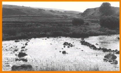
Looking south from Carron Ford, on the possible route of
the Straight Road with No Path
One of the recurring arguments against Bell's PSA's was the fact that as
far as anyone in archaeology knew, there was no record of alignments or anything
of that nature in any of the old books on Glasgow. There is, however, a fairly
believable account of the origins of Glasgow Cathedral. St. Mungo (aka Kentigern)
is said to have led a burial procession down through the Campsie Fells to bury
Fergus the holy man in a cemetery that now lies beneath the flagstones of the
Cathedral crypt. Bell was curious about the route taken to the cemetery and
his next step was to search for the earliest written account of St. Mungo's
journey to Glasgow. He hoped that in the record of this journey there would
be a clue about the nature of early roads or tracks in the Glasgow area.
'Many a tedious old volume I had to read through before I learned that when
Bishop Jocelyn was rebuilding Glasgow Cathedral in the 12th Century, he had
commissioned a hagiographer from Furness Abbey to revise St. Mungo's biography.
Two copies of this book survive, one in the British Museum, the other in Dublin.
To my delight, however, I unearthed a translated and edited version in the Glasgow
Room of the Mitchell Library. In this book, The Life of S. Kentigern,
I finally found what I was looking for - the earliest known reference to a road
or track in the Glasgow area. It appears in the following extract from chapter
nine:
'And in truth, the bulls, in no way being restive,
or in anything disobeying the voice of Kentigern, without any tripping or
fall, came by a straight road, along where there was no path, as far as Cathures,
which is now called Glasgu ...'
I was ecstatic ... In a quiet corner of the reading room, I whispered the
words over and over again to myself like a mantra, 'they came by a straight
road along where there was no path'.
On to the Hypothesis section
Back to the Observation page